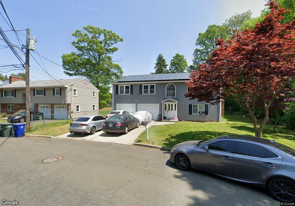
10 Saint Nicholas Dr Bridgeport, CT 06604
North End NeighborhoodEstimated Value: $496,000 - $518,000
3
Beds
2
Baths
1,316
Sq Ft
$383/Sq Ft
Est. Value
About This Home
This home is located at 10 Saint Nicholas Dr, Bridgeport, CT 06604 and is currently estimated at $503,893, approximately $382 per square foot. 10 Saint Nicholas Dr is a home located in Fairfield County with nearby schools including John Winthrop School, Central High School, and St Andrew School.
Ownership History
Date
Name
Owned For
Owner Type
Purchase Details
Closed on
Dec 1, 1999
Sold by
Palmieri Antonio and Palmieri Carmela
Bought by
Seyal Asim S and Seyal Atif S
Current Estimated Value
Home Financials for this Owner
Home Financials are based on the most recent Mortgage that was taken out on this home.
Original Mortgage
$166,600
Interest Rate
7.86%
Create a Home Valuation Report for This Property
The Home Valuation Report is an in-depth analysis detailing your home's value as well as a comparison with similar homes in the area
Home Values in the Area
Average Home Value in this Area
Purchase History
| Date | Buyer | Sale Price | Title Company |
|---|---|---|---|
| Seyal Asim S | $185,000 | -- | |
| Seyal Asim S | $185,000 | -- |
Source: Public Records
Mortgage History
| Date | Status | Borrower | Loan Amount |
|---|---|---|---|
| Open | Seyal Asim S | $161,220 | |
| Closed | Seyal Asim S | $161,310 | |
| Closed | Seyal Asim S | $166,600 |
Source: Public Records
Tax History
| Year | Tax Paid | Tax Assessment Tax Assessment Total Assessment is a certain percentage of the fair market value that is determined by local assessors to be the total taxable value of land and additions on the property. | Land | Improvement |
|---|---|---|---|---|
| 2025 | $9,057 | $208,440 | $85,420 | $123,020 |
| 2024 | $9,057 | $208,440 | $85,420 | $123,020 |
| 2023 | $9,057 | $208,440 | $85,420 | $123,020 |
| 2022 | $9,057 | $208,440 | $85,420 | $123,020 |
| 2021 | $9,057 | $208,440 | $85,420 | $123,020 |
| 2020 | $9,364 | $173,440 | $66,910 | $106,530 |
| 2019 | $9,364 | $173,440 | $66,910 | $106,530 |
| 2018 | $9,430 | $173,440 | $66,910 | $106,530 |
| 2017 | $9,430 | $173,440 | $66,910 | $106,530 |
| 2016 | $9,430 | $173,440 | $66,910 | $106,530 |
| 2015 | $8,403 | $199,120 | $65,800 | $133,320 |
| 2014 | $8,403 | $199,120 | $65,800 | $133,320 |
Source: Public Records
Map
Nearby Homes
- 105 Daniel Dr
- 170 Marilyn Dr
- 8 Raleigh Rd
- 3460 Old Town Rd
- 121 Campbell Rd
- 3432 Old Town Rd
- 69 Seaver Cir
- 18 Ridgebury Dr
- 217 Macon Dr
- 3125 Old Town Rd
- 99 Quinsey Dr
- 3370 Madison Ave Unit 10B
- 5763 Park Ave
- 338 Stevenson Rd
- 2643 Easton Turnpike
- 153 Cherry Hill Dr Unit 2A
- 153 Cherry Hill Dr Unit 2B
- 2768 Madison Ave Unit 2A
- 15 Cherry Hill Dr Unit 2A
- 230 Cherry Hill Dr Unit 2B
- 26 Saint Nicholas Dr
- 5 Saint Nicholas Dr
- 46 Saint Nicholas Dr
- 137 Doreen Dr
- 60 Saxton Dr
- 30 Saxton Dr
- 31 Saint Nicholas Dr
- 56 Saint Nicholas Dr
- 44 Saxton Dr
- 47 Saint Nicholas Dr
- 159 Doreen Dr
- 276 Nancy Dr
- 101 Doreen Dr
- 226 Nancy Dr
- 294 Nancy Dr
- 104 Doreen Dr
- 25 Saxton Dr
- 250 Nancy Dr
- 85 Doreen Dr
- 310 Nancy Dr
Your Personal Tour Guide
Ask me questions while you tour the home.