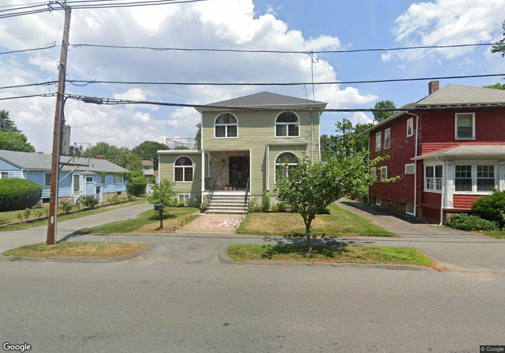
10 Salem St Unit 1 Swampscott, MA 01907
Estimated Value: $1,332,000 - $1,537,961
2
Beds
4
Baths
3,353
Sq Ft
$438/Sq Ft
Est. Value
About This Home
This home is located at 10 Salem St Unit 1, Swampscott, MA 01907 and is currently estimated at $1,469,990, approximately $438 per square foot. 10 Salem St Unit 1 is a home located in Essex County with nearby schools including Swampscott Middle School, Swampscott High School, and Devereux School.
Ownership History
Date
Name
Owned For
Owner Type
Purchase Details
Closed on
May 5, 2022
Sold by
Wolf Barbara S
Bought by
Barbara S Wolf 1998 T
Current Estimated Value
Purchase Details
Closed on
Apr 30, 2014
Sold by
Wolf Bertil F and Wolf Barbara S
Bought by
Wolf Barbara S
Purchase Details
Closed on
May 24, 2004
Sold by
Rosenberg Allan J
Bought by
Allan J Rosenberg Ret
Create a Home Valuation Report for This Property
The Home Valuation Report is an in-depth analysis detailing your home's value as well as a comparison with similar homes in the area
Home Values in the Area
Average Home Value in this Area
Purchase History
| Date | Buyer | Sale Price | Title Company |
|---|---|---|---|
| Barbara S Wolf 1998 T | -- | None Available | |
| Wolf Barbara S | -- | -- | |
| Allan J Rosenberg Ret | -- | -- |
Source: Public Records
Tax History Compared to Growth
Tax History
| Year | Tax Paid | Tax Assessment Tax Assessment Total Assessment is a certain percentage of the fair market value that is determined by local assessors to be the total taxable value of land and additions on the property. | Land | Improvement |
|---|---|---|---|---|
| 2025 | $15,556 | $1,356,200 | $571,600 | $784,600 |
| 2024 | $14,965 | $1,302,400 | $547,400 | $755,000 |
| 2023 | $14,514 | $1,236,300 | $546,000 | $690,300 |
| 2022 | $12,485 | $973,100 | $384,800 | $588,300 |
| 2021 | $11,969 | $867,300 | $299,800 | $567,500 |
| 2020 | $11,224 | $784,900 | $265,800 | $519,100 |
| 2019 | $11,930 | $784,900 | $265,800 | $519,100 |
| 2018 | $12,558 | $784,900 | $265,800 | $519,100 |
| 2017 | $13,215 | $757,300 | $265,800 | $491,500 |
| 2016 | $13,124 | $757,300 | $265,800 | $491,500 |
| 2015 | $13,432 | $783,200 | $265,800 | $517,400 |
| 2014 | $12,409 | $663,600 | $206,300 | $457,300 |
Source: Public Records
Map
Nearby Homes
- 24 Orchard Cir
- 25 Manton Rd
- 37 Stanley Rd
- 48 Bellevue Rd
- 35 Alden Rd
- 179 Beach Bluff Ave
- 71 Walnut Rd
- 212 Humphrey St Unit 205
- 9 Tedesco Pond Place Unit 9
- 5 Elmwood Rd
- 201 Humphrey St Unit 2
- 1006 Paradise Rd Unit 3R
- 1004 Paradise Rd Unit PHJ
- 19 Elmwood Rd
- 8 Ocean View Rd
- 35 Littles Point Rd Unit S201
- 2 Wilfred Terrace
- 309 Paradise Rd
- 21 Bay View Dr
- 75 Bay View Dr
- 18 Salem St Unit 1
- 9 Salem St Unit 1
- 13 Salem St Unit 1
- 13 Salem St Unit 1
- 13 Salem St Unit 1
- 944 Humphrey St
- 948 Humphrey St
- 23 Salem St Unit 1
- 1 One Salem St
- 933 Humphrey St
- 8888 Humphrey St
- 5 Salem St Unit 1
- 956 Humphrey St
- 925 Humphrey St
- 2 Salem St Unit 1
- 40 One Salem St Unit 40
- 40 One Salem St
- 941 Humphrey St
- 958 Humphrey St
- 945 Humphrey St