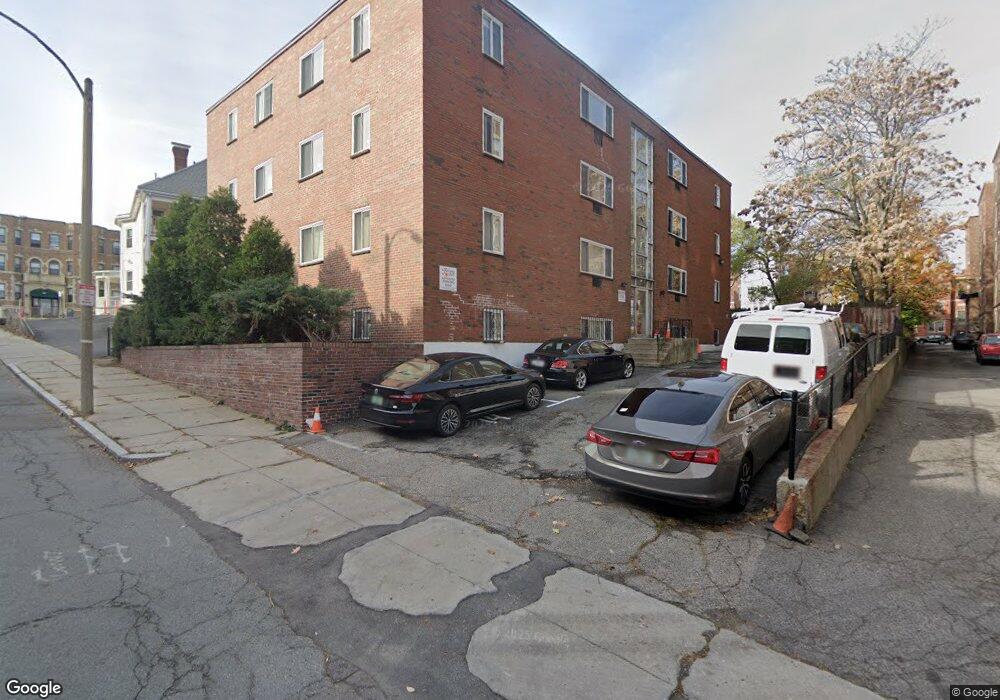
10 Scottsfield Rd Unit 3 Boston, MA 02134
Commonwealth NeighborhoodEstimated Value: $418,000 - $482,000
2
Beds
1
Bath
750
Sq Ft
$596/Sq Ft
Est. Value
About This Home
This home is located at 10 Scottsfield Rd Unit 3, Boston, MA 02134 and is currently estimated at $447,328, approximately $596 per square foot. 10 Scottsfield Rd Unit 3 is a home located in Suffolk County with nearby schools including Boston Green Academy Horace Mann Charter School, Torah Academy, and Mesivta High School of Greater Boston.
Ownership History
Date
Name
Owned For
Owner Type
Purchase Details
Closed on
Jan 24, 2024
Sold by
Thomas Chien Lin Yu Lt and Yu
Bought by
10 Scottfield Rd B3 Rlty
Current Estimated Value
Purchase Details
Closed on
Jan 9, 2024
Sold by
10 Scottfield Rd B3 Rlty
Bought by
Thomas Chein Lin Yu Lt and Yu
Purchase Details
Closed on
Sep 21, 2021
Sold by
Oreilly Terence
Bought by
Oreilly Kerrie L
Home Financials for this Owner
Home Financials are based on the most recent Mortgage that was taken out on this home.
Original Mortgage
$202,425
Interest Rate
2.7%
Mortgage Type
Purchase Money Mortgage
Purchase Details
Closed on
Dec 11, 2014
Sold by
Ronald S Schindler Ret and Fantim
Bought by
Oreilly Terence
Home Financials for this Owner
Home Financials are based on the most recent Mortgage that was taken out on this home.
Original Mortgage
$215,920
Interest Rate
3.98%
Mortgage Type
New Conventional
Create a Home Valuation Report for This Property
The Home Valuation Report is an in-depth analysis detailing your home's value as well as a comparison with similar homes in the area
Home Values in the Area
Average Home Value in this Area
Purchase History
| Date | Buyer | Sale Price | Title Company |
|---|---|---|---|
| 10 Scottfield Rd B3 Rlty | -- | None Available | |
| 10 Scottfield Rd B3 Rlty | -- | None Available | |
| Thomas Chein Lin Yu Lt | -- | None Available | |
| Thomas Chein Lin Yu Lt | -- | None Available | |
| Oreilly Kerrie L | $269,900 | None Available | |
| Oreilly Kerrie L | $269,900 | None Available | |
| Oreilly Terence | $269,900 | -- | |
| Oreilly Terence | $269,900 | -- | |
| Oreilly Terence | $269,900 | -- |
Source: Public Records
Mortgage History
| Date | Status | Borrower | Loan Amount |
|---|---|---|---|
| Previous Owner | Oreilly Kerrie L | $202,425 | |
| Previous Owner | Oreilly Terence | $215,920 |
Source: Public Records
Tax History Compared to Growth
Tax History
| Year | Tax Paid | Tax Assessment Tax Assessment Total Assessment is a certain percentage of the fair market value that is determined by local assessors to be the total taxable value of land and additions on the property. | Land | Improvement |
|---|---|---|---|---|
| 2025 | $4,573 | $394,900 | $0 | $394,900 |
| 2024 | $4,105 | $376,600 | $0 | $376,600 |
| 2023 | $4,045 | $376,600 | $0 | $376,600 |
| 2022 | $2,326 | $213,800 | $0 | $213,800 |
| 2021 | $2,242 | $210,100 | $0 | $210,100 |
| 2020 | $2,807 | $265,800 | $0 | $265,800 |
| 2019 | $2,747 | $260,600 | $0 | $260,600 |
| 2018 | $2,554 | $243,700 | $0 | $243,700 |
| 2017 | $2,389 | $225,600 | $0 | $225,600 |
| 2016 | $2,277 | $207,000 | $0 | $207,000 |
| 2015 | $2,508 | $207,100 | $0 | $207,100 |
| 2014 | $2,368 | $188,200 | $0 | $188,200 |
Source: Public Records
Map
Nearby Homes
- 15 Walbridge St Unit 3
- 239 Kelton St Unit 41
- 245 Kelton St Unit 21
- 159-161 Allston
- 198 Allston St Unit 3
- 85 Brainerd Rd Unit TH7
- 130 Glenville Ave
- 1408 Commonwealth Ave Unit 20
- 86 Glenville Ave Unit 2
- 147 Kelton St Unit 312
- 147 Kelton St Unit 305
- 1304 Commonwealth Ave Unit 5
- 15 Commonwealth Ct Unit 10
- 249 Corey Rd Unit 404
- 249 Corey Rd Unit 306
- 249 Corey Rd Unit 303
- 249 Corey Rd Unit 309
- 249 Corey Rd Unit 308
- 249 Corey Rd Unit 408
- 249 Corey Rd Unit 401
- 208 Kelton St
- 208 Kelton St Unit 3
- 208 Kelton St Unit 240-3
- 208 Kelton St Unit 2
- 208 Kelton St Unit Kelton street
- 208 Kelton St Unit 7
- 208 Kelton St Unit 10
- 208 Kelton St Unit 4
- 208 Kelton St Unit 240 - 7
- 208 Kelton St
- 208 Kelton St Unit 1
- 220 Kelton St Unit 1
- 220 Kelton St Unit 8
- 220 Kelton St Unit 18
- 220 Kelton St Unit 9
- 220 Kelton St Unit B
- 220 Kelton St Unit 14
- 220 Kelton St Unit 4
- 220 Kelton St Unit 2
- 220 Kelton St Unit 3