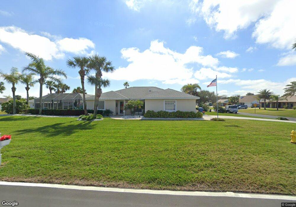
10 Seabridge Dr Ormond Beach, FL 32176
Estimated Value: $448,000 - $503,000
3
Beds
2
Baths
1,514
Sq Ft
$322/Sq Ft
Est. Value
About This Home
This home is located at 10 Seabridge Dr, Ormond Beach, FL 32176 and is currently estimated at $486,945, approximately $321 per square foot. 10 Seabridge Dr is a home located in Volusia County with nearby schools including Ormond Beach Middle School and Seabreeze High School.
Ownership History
Date
Name
Owned For
Owner Type
Purchase Details
Closed on
Feb 10, 2000
Sold by
Brickley Patricia
Bought by
Cvetko Gerald A and Cvetko Barbara L
Current Estimated Value
Home Financials for this Owner
Home Financials are based on the most recent Mortgage that was taken out on this home.
Original Mortgage
$115,000
Outstanding Balance
$36,075
Interest Rate
8.11%
Mortgage Type
Purchase Money Mortgage
Estimated Equity
$450,870
Purchase Details
Closed on
Feb 16, 1999
Sold by
Rossi Renaldo R
Bought by
Brickley Patricia
Purchase Details
Closed on
Oct 30, 1998
Sold by
Fuller Christine and Fuller Christine A
Bought by
Rossi Renaldo R
Purchase Details
Closed on
Feb 12, 1998
Sold by
Rossi Renaldo R
Bought by
Fuller Christine
Purchase Details
Closed on
Dec 15, 1992
Bought by
Cvetko Gerald A and Cvetko Barbara L
Create a Home Valuation Report for This Property
The Home Valuation Report is an in-depth analysis detailing your home's value as well as a comparison with similar homes in the area
Home Values in the Area
Average Home Value in this Area
Purchase History
| Date | Buyer | Sale Price | Title Company |
|---|---|---|---|
| Cvetko Gerald A | $150,000 | -- | |
| Brickley Patricia | $30,000 | -- | |
| Rossi Renaldo R | -- | -- | |
| Fuller Christine | -- | -- | |
| Cvetko Gerald A | $100 | -- |
Source: Public Records
Mortgage History
| Date | Status | Borrower | Loan Amount |
|---|---|---|---|
| Open | Cvetko Gerald A | $115,000 |
Source: Public Records
Tax History
| Year | Tax Paid | Tax Assessment Tax Assessment Total Assessment is a certain percentage of the fair market value that is determined by local assessors to be the total taxable value of land and additions on the property. | Land | Improvement |
|---|---|---|---|---|
| 2026 | $3,458 | $222,034 | -- | -- |
| 2025 | $3,458 | $216,197 | -- | -- |
| 2024 | $3,309 | $210,104 | -- | -- |
| 2023 | $3,309 | $203,985 | $0 | $0 |
| 2022 | $3,227 | $198,044 | $0 | $0 |
| 2021 | $3,307 | $192,276 | $0 | $0 |
| 2020 | $3,247 | $189,621 | $0 | $0 |
| 2019 | $3,212 | $185,358 | $0 | $0 |
| 2018 | $3,179 | $181,902 | $0 | $0 |
| 2017 | $3,169 | $178,161 | $0 | $0 |
| 2016 | $3,171 | $174,497 | $0 | $0 |
| 2015 | $3,250 | $173,284 | $0 | $0 |
| 2014 | $3,181 | $171,909 | $0 | $0 |
Source: Public Records
Map
Nearby Homes
- 5 Seabridge Dr
- 11 Seabridge Dr
- 4 Sea Hawk Dr
- 22 Seabridge Dr
- 3548 John Anderson Dr
- 39 Sea Island Dr N
- 129 Ocean Aire Terrace S
- 103 Peninsula Winds Dr
- 4 Dolphin Ave
- 3580 Ocean Shore Blvd
- 16 Julie Dr
- 130 Heron Dunes Dr
- 44 Capistrano Dr
- 3370 Ocean Shore Blvd Unit 404
- 3370 Ocean Shore Blvd Unit 504
- 3360 Ocean Shore Blvd Unit 103
- 3370 Ocean Shore Blvd Unit 4070
- 3360 Ocean Shore Blvd Unit 4050
- 3370 Ocean Shore Blvd Unit 306
- 3360 Ocean Shore Blvd Unit 306
- 52 Sea Island Dr N
- 50 Sea Island Dr N
- 14 Seabridge Dr
- 9 Seabridge Dr
- 8 Seabridge Dr
- 48 Sea Island Dr N
- 4 Sea Island Dr S
- 2 Sea Harbor Dr W
- 16 Seabridge Dr
- 51 Sea Island Dr N
- 3 Sea Harbor Dr W
- 6 Seabridge Dr
- 49 Sea Island Dr N
- 6 Sea Island Dr S
- 46 Sea Island Dr N
- 47 Sea Island Dr N
- 4 Sea Harbor Dr W
- 5 Sea Harbor Dr W
- 3549 John Anderson Dr
- 8 Sea Island Dr S
Your Personal Tour Guide
Ask me questions while you tour the home.