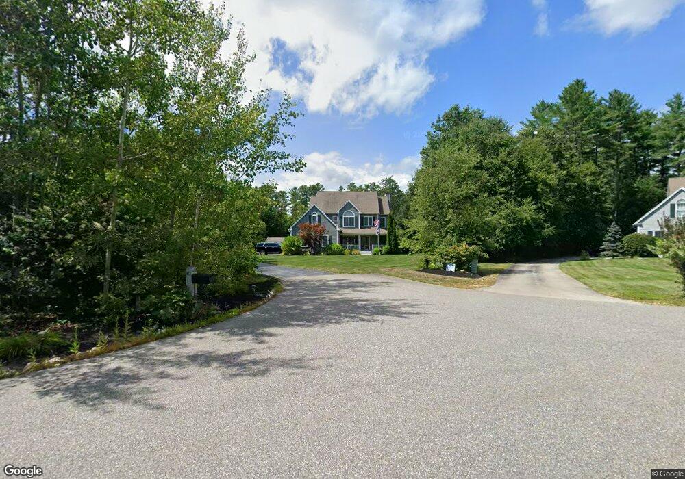
10 Smith Rd Brookline, NH 03033
Estimated Value: $662,000 - $843,000
4
Beds
3
Baths
3,091
Sq Ft
$244/Sq Ft
Est. Value
About This Home
This home is located at 10 Smith Rd, Brookline, NH 03033 and is currently estimated at $754,741, approximately $244 per square foot. 10 Smith Rd is a home with nearby schools including Richard Maghakian Memorial School, Captain Samuel Douglass Academy, and Hollis-Brookline Middle School.
Ownership History
Date
Name
Owned For
Owner Type
Purchase Details
Closed on
Aug 7, 2020
Sold by
Childs Scott J and Childs Kathy J
Bought by
Childs Ft and Childs
Current Estimated Value
Purchase Details
Closed on
Oct 18, 2004
Sold by
Adamyk Homes Inc
Bought by
Childs Scott J
Create a Home Valuation Report for This Property
The Home Valuation Report is an in-depth analysis detailing your home's value as well as a comparison with similar homes in the area
Home Values in the Area
Average Home Value in this Area
Purchase History
| Date | Buyer | Sale Price | Title Company |
|---|---|---|---|
| Childs Ft | -- | None Available | |
| Childs Ft | -- | None Available | |
| Childs Scott J | $389,800 | -- | |
| Childs Scott J | $389,800 | -- |
Source: Public Records
Mortgage History
| Date | Status | Borrower | Loan Amount |
|---|---|---|---|
| Previous Owner | Childs Scott J | $276,900 | |
| Previous Owner | Childs Scott J | $285,500 | |
| Previous Owner | Childs Scott J | $50,000 | |
| Previous Owner | Childs Scott J | $311,300 |
Source: Public Records
Tax History Compared to Growth
Tax History
| Year | Tax Paid | Tax Assessment Tax Assessment Total Assessment is a certain percentage of the fair market value that is determined by local assessors to be the total taxable value of land and additions on the property. | Land | Improvement |
|---|---|---|---|---|
| 2024 | $16,395 | $725,100 | $247,400 | $477,700 |
| 2023 | $15,068 | $725,100 | $247,400 | $477,700 |
| 2022 | $13,228 | $445,100 | $142,500 | $302,600 |
| 2021 | $12,721 | $445,100 | $142,500 | $302,600 |
| 2020 | $12,374 | $445,100 | $142,500 | $302,600 |
| 2019 | $13,295 | $445,100 | $142,500 | $302,600 |
| 2018 | $12,525 | $445,100 | $142,500 | $302,600 |
| 2017 | $12,237 | $371,500 | $115,400 | $256,100 |
| 2016 | $12,096 | $371,500 | $115,400 | $256,100 |
| 2015 | $11,535 | $371,500 | $115,400 | $256,100 |
| 2014 | $12,204 | $371,500 | $115,400 | $256,100 |
| 2013 | $11,751 | $371,500 | $115,400 | $256,100 |
Source: Public Records
Map
Nearby Homes
- 46 Oak Hill Rd
- 6 Flint Meadow Dr
- 22 Hobart Hill Rd
- 55 Oak Hill Rd
- 28A Rocky Pond Rd
- 167 Route 13
- 5 Carons Way
- 6 High Oaks Path
- 7 Winterberry Rd
- 9 Winterberry Rd
- 22 Austin Ln
- 93 Old Milford Rd
- 143 Worcester Rd
- 364 Townsend Hill Rd
- 15 N End Rd
- 21 Cranberry St
- 179 Brookline St
- 10 Boynton St
- 0 Brookline St
- 172 Hayden Rd