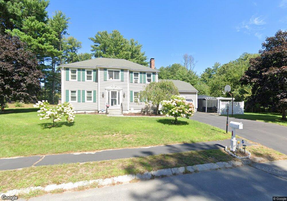
10 Spruce St Blackstone, MA 01504
Estimated Value: $618,826 - $677,000
4
Beds
3
Baths
2,166
Sq Ft
$298/Sq Ft
Est. Value
About This Home
This home is located at 10 Spruce St, Blackstone, MA 01504 and is currently estimated at $644,957, approximately $297 per square foot. 10 Spruce St is a home located in Worcester County with nearby schools including Blackstone-Millville Regional High School and Bethany Christian Academy.
Ownership History
Date
Name
Owned For
Owner Type
Purchase Details
Closed on
Apr 29, 2002
Sold by
Powers Brian E and Powers Judith A
Bought by
Howell Francis X and Howell Dolores
Current Estimated Value
Purchase Details
Closed on
Sep 28, 2001
Sold by
Anp Blackstone Energy
Bought by
Powers Brian E and Powers Judith A
Purchase Details
Closed on
Jun 28, 2001
Sold by
Levesque Richard A and Levesque Denise C
Bought by
Anp Blackstone Energy
Create a Home Valuation Report for This Property
The Home Valuation Report is an in-depth analysis detailing your home's value as well as a comparison with similar homes in the area
Home Values in the Area
Average Home Value in this Area
Purchase History
| Date | Buyer | Sale Price | Title Company |
|---|---|---|---|
| Howell Francis X | $315,000 | -- | |
| Powers Brian E | $291,750 | -- | |
| Anp Blackstone Energy | $449,555 | -- |
Source: Public Records
Mortgage History
| Date | Status | Borrower | Loan Amount |
|---|---|---|---|
| Open | Anp Blackstone Energy | $187,000 | |
| Closed | Anp Blackstone Energy | $117,000 |
Source: Public Records
Tax History
| Year | Tax Paid | Tax Assessment Tax Assessment Total Assessment is a certain percentage of the fair market value that is determined by local assessors to be the total taxable value of land and additions on the property. | Land | Improvement |
|---|---|---|---|---|
| 2025 | $7,943 | $526,000 | $193,400 | $332,600 |
| 2024 | $7,533 | $461,300 | $210,600 | $250,700 |
| 2023 | $6,946 | $429,300 | $210,600 | $218,700 |
| 2022 | $7,006 | $391,400 | $174,000 | $217,400 |
| 2021 | $6,934 | $370,400 | $171,400 | $199,000 |
| 2020 | $6,929 | $367,400 | $170,500 | $196,900 |
| 2019 | $6,721 | $355,400 | $158,500 | $196,900 |
| 2018 | $3,933 | $329,600 | $151,300 | $178,300 |
| 2017 | $6,115 | $317,500 | $151,300 | $166,200 |
| 2016 | $6,061 | $313,400 | $139,600 | $173,800 |
| 2015 | $6,054 | $310,800 | $141,800 | $169,000 |
Source: Public Records
Map
Nearby Homes
- 183 Elm St Unit 185
- 11 Bellingham Rd
- 27 Liberty Hill Dr
- 5 Bernier Ln
- 31 Cemetery St
- 36 Indian Run Rd
- 11 Quail Run Rd
- 111 Providence St
- 1, 3, 5 Old Lincoln St
- 5 Whitman Cir Unit 5
- 3 Whitman Cir Unit 3
- 1 Whitman Cir Unit 1
- 93 Providence St Unit B
- 0 North St Unit 73440626
- 162 Blackstone St
- 50 Hartford Ave E
- 8 Puffer Dr
- 183-183R Mendon St
- 183 Blackstone St
- Lot 3 Pickering Rd
Your Personal Tour Guide
Ask me questions while you tour the home.