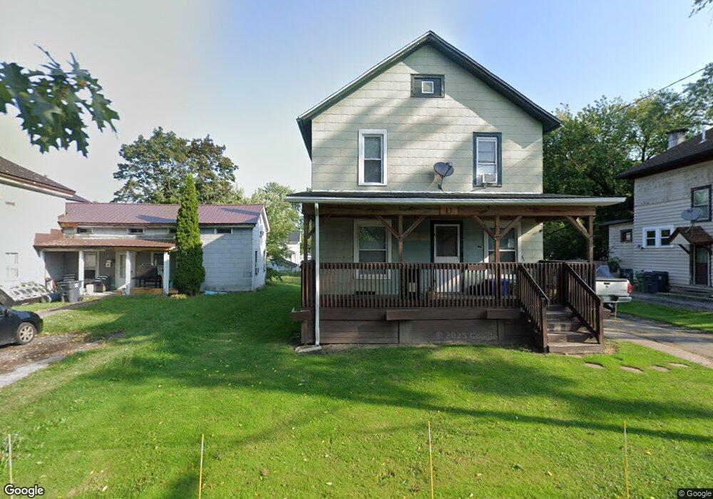
10 Terry St Middleport, NY 14105
Estimated Value: $156,000 - $193,000
3
Beds
2
Baths
1,669
Sq Ft
$104/Sq Ft
Est. Value
About This Home
This home is located at 10 Terry St, Middleport, NY 14105 and is currently estimated at $173,955, approximately $104 per square foot. 10 Terry St is a home located in Niagara County with nearby schools including Royalton-Hartland Elementary School, Royalton-Hartland Middle School, and Royalton-Hartland High School.
Ownership History
Date
Name
Owned For
Owner Type
Purchase Details
Closed on
Sep 26, 2022
Sold by
Sue Chraston-Wolfe Darlyn
Bought by
Chraston Bryan F
Current Estimated Value
Purchase Details
Closed on
Mar 20, 2018
Sold by
Chraston Erik T
Bought by
Chraston Wolfe Darlyn Sue
Purchase Details
Closed on
Dec 29, 2005
Sold by
Eastman Clinton
Bought by
Chraston Erik
Home Financials for this Owner
Home Financials are based on the most recent Mortgage that was taken out on this home.
Original Mortgage
$63,488
Interest Rate
6.39%
Mortgage Type
FHA
Purchase Details
Closed on
May 2, 1996
Sold by
Citicorp Mortgage Inc
Bought by
Eastman Clinton and Eastman Bevely
Purchase Details
Closed on
Sep 1, 1995
Create a Home Valuation Report for This Property
The Home Valuation Report is an in-depth analysis detailing your home's value as well as a comparison with similar homes in the area
Home Values in the Area
Average Home Value in this Area
Purchase History
| Date | Buyer | Sale Price | Title Company |
|---|---|---|---|
| Chraston Bryan F | -- | -- | |
| Chraston Wolfe Darlyn Sue | -- | -- | |
| Chraston Erik | $64,000 | Greg Dale | |
| Eastman Clinton | $43,000 | -- | |
| -- | $40,784 | -- |
Source: Public Records
Mortgage History
| Date | Status | Borrower | Loan Amount |
|---|---|---|---|
| Previous Owner | Chraston Erik | $63,488 |
Source: Public Records
Tax History Compared to Growth
Tax History
| Year | Tax Paid | Tax Assessment Tax Assessment Total Assessment is a certain percentage of the fair market value that is determined by local assessors to be the total taxable value of land and additions on the property. | Land | Improvement |
|---|---|---|---|---|
| 2024 | $3,831 | $74,400 | $7,700 | $66,700 |
| 2023 | $3,719 | $74,400 | $7,700 | $66,700 |
| 2022 | $3,595 | $74,400 | $7,700 | $66,700 |
| 2021 | $3,516 | $74,400 | $7,700 | $66,700 |
| 2020 | $3,450 | $74,400 | $7,700 | $66,700 |
| 2019 | $3,303 | $74,400 | $7,700 | $66,700 |
| 2018 | $3,378 | $74,400 | $7,700 | $66,700 |
| 2017 | $3,303 | $74,400 | $7,700 | $66,700 |
| 2016 | $2,550 | $74,400 | $7,700 | $66,700 |
| 2015 | -- | $74,400 | $7,700 | $66,700 |
| 2014 | -- | $74,400 | $7,700 | $66,700 |
Source: Public Records
Map
Nearby Homes
- 38 N Hartland St
- 38 N Main St
- 23 S Vernon St
- 37 State St
- 25 Vernon St
- 36 Park Ave
- 9753 Watson Ave
- 0 State St Unit B1581360
- 3845 N Hartland St
- 3835 Chase Rd
- 28 Manor Ln
- 10174 Telegraph Rd
- 8976 Telegraph Rd
- 3140 Johnson Creek Rd
- 4491 Royalton Center Rd
- 3102 Johnson Creek Rd
- 4020 Salt Works Rd
- 15 Pebbleridge Dr
- 11084 Maple Ridge Rd
- 519 Davis Ave