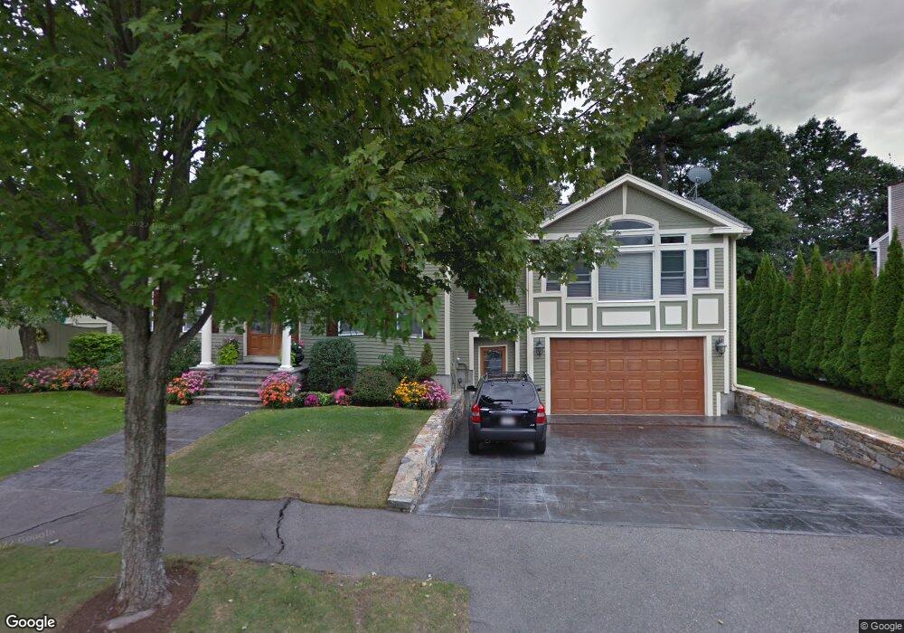
10 Tobey Ln Wakefield, MA 01880
Montrose NeighborhoodEstimated Value: $903,000 - $1,274,466
4
Beds
3
Baths
3,240
Sq Ft
$352/Sq Ft
Est. Value
About This Home
This home is located at 10 Tobey Ln, Wakefield, MA 01880 and is currently estimated at $1,140,117, approximately $351 per square foot. 10 Tobey Ln is a home located in Middlesex County with nearby schools including Wakefield Memorial High School, Odyssey Day School, and St Joseph School.
Ownership History
Date
Name
Owned For
Owner Type
Purchase Details
Closed on
Oct 5, 1990
Sold by
David Development Corp
Bought by
Ronzio James A
Current Estimated Value
Home Financials for this Owner
Home Financials are based on the most recent Mortgage that was taken out on this home.
Original Mortgage
$125,000
Interest Rate
10.21%
Mortgage Type
Purchase Money Mortgage
Create a Home Valuation Report for This Property
The Home Valuation Report is an in-depth analysis detailing your home's value as well as a comparison with similar homes in the area
Home Values in the Area
Average Home Value in this Area
Purchase History
| Date | Buyer | Sale Price | Title Company |
|---|---|---|---|
| Ronzio James A | $265,000 | -- |
Source: Public Records
Mortgage History
| Date | Status | Borrower | Loan Amount |
|---|---|---|---|
| Open | Ronzio James A | $203,000 | |
| Closed | Ronzio James A | $128,000 | |
| Closed | Ronzio James A | $125,000 |
Source: Public Records
Tax History Compared to Growth
Tax History
| Year | Tax Paid | Tax Assessment Tax Assessment Total Assessment is a certain percentage of the fair market value that is determined by local assessors to be the total taxable value of land and additions on the property. | Land | Improvement |
|---|---|---|---|---|
| 2025 | $13,253 | $1,167,700 | $395,500 | $772,200 |
| 2024 | $13,137 | $1,167,700 | $395,500 | $772,200 |
| 2023 | $12,801 | $1,091,300 | $369,600 | $721,700 |
| 2022 | $12,223 | $992,100 | $336,000 | $656,100 |
| 2021 | $11,106 | $872,400 | $276,000 | $596,400 |
| 2020 | $11,141 | $872,400 | $276,000 | $596,400 |
| 2019 | $10,804 | $842,100 | $266,400 | $575,700 |
| 2018 | $10,413 | $804,100 | $254,400 | $549,700 |
| 2017 | $9,885 | $758,600 | $240,000 | $518,600 |
| 2016 | $9,049 | $670,800 | $222,500 | $448,300 |
| 2015 | $8,778 | $651,200 | $216,000 | $435,200 |
| 2014 | $8,322 | $651,200 | $216,000 | $435,200 |
Source: Public Records
Map
Nearby Homes