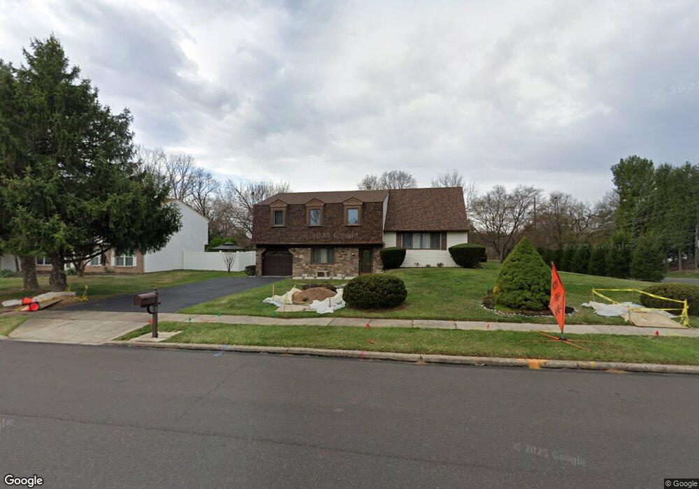
10 Toll Dr Southampton, PA 18966
Estimated Value: $503,000 - $612,000
--
Bed
2
Baths
1,808
Sq Ft
$307/Sq Ft
Est. Value
About This Home
This home is located at 10 Toll Dr, Southampton, PA 18966 and is currently estimated at $554,874, approximately $306 per square foot. 10 Toll Dr is a home located in Bucks County with nearby schools including Davis Elementary School, Klinger Middle School, and William Tennent High School.
Ownership History
Date
Name
Owned For
Owner Type
Purchase Details
Closed on
Nov 1, 2017
Sold by
Provencher Emily
Bought by
Provencher Emily and Revocable Trust Provisions Contained Her
Current Estimated Value
Purchase Details
Closed on
Jun 6, 2009
Sold by
Provencher Albert and Provencher Emily
Bought by
Provencher Emily
Purchase Details
Closed on
Mar 25, 2004
Sold by
Provencher Albert and Provencher Emily
Bought by
Provencher Albert and Provencher Emily
Create a Home Valuation Report for This Property
The Home Valuation Report is an in-depth analysis detailing your home's value as well as a comparison with similar homes in the area
Home Values in the Area
Average Home Value in this Area
Purchase History
| Date | Buyer | Sale Price | Title Company |
|---|---|---|---|
| Provencher Emily | -- | None Available | |
| Provencher Emily | -- | None Available | |
| Provencher Albert | -- | None Available |
Source: Public Records
Tax History Compared to Growth
Tax History
| Year | Tax Paid | Tax Assessment Tax Assessment Total Assessment is a certain percentage of the fair market value that is determined by local assessors to be the total taxable value of land and additions on the property. | Land | Improvement |
|---|---|---|---|---|
| 2025 | $7,529 | $35,200 | $7,160 | $28,040 |
| 2024 | $7,529 | $35,200 | $7,160 | $28,040 |
| 2023 | $7,300 | $35,200 | $7,160 | $28,040 |
| 2022 | $7,146 | $35,200 | $7,160 | $28,040 |
| 2021 | $7,017 | $35,200 | $7,160 | $28,040 |
| 2020 | $6,920 | $35,200 | $7,160 | $28,040 |
| 2019 | $6,665 | $35,200 | $7,160 | $28,040 |
| 2018 | $6,512 | $35,200 | $7,160 | $28,040 |
| 2017 | $6,328 | $35,200 | $7,160 | $28,040 |
| 2016 | $6,328 | $35,200 | $7,160 | $28,040 |
| 2015 | -- | $35,200 | $7,160 | $28,040 |
| 2014 | -- | $35,200 | $7,160 | $28,040 |
Source: Public Records
Map
Nearby Homes
- 185 Toll Dr
- 43 Davisville Rd
- 325 Toll Dr
- 725 E County Line Rd
- 620 Constitutional Dr
- 377 Holly Dr
- 551 Revolutionary Way
- 2325 Pioneer Rd
- 475 Constitutional Dr
- 530 Andrew Dr
- 415 New Rd
- 766 Meadow Dr
- 136 Washington Dr
- 117 Maple Ave
- 4145 Thistlewood Rd
- 665 Whirlaway Dr
- 2015 Butternut Dr
- 206 E Hampton Crossing
- 609 Stewart Rd
- 4108 Centennial Station Unit 410
- 20 Toll Dr
- 233 Davisville Rd
- 30 Toll Dr
- 15 Toll Dr
- 276 Kingsclere Dr
- 218 Davisville Rd
- 200 Davisville Rd
- 230 Davisville Rd
- 219 Davisville Rd
- 290 Kingsclere Dr
- 275 Kingsclere Dr
- 254 Davisville Rd
- 25 Laurel Rd
- 50 Toll Dr
- 15 Laurel Rd
- 285 Kingsclere Dr
- 213 Buttercup Dr
- 300 Kingsclere Dr
- 35 Laurel Rd
- 190 Davisville Rd