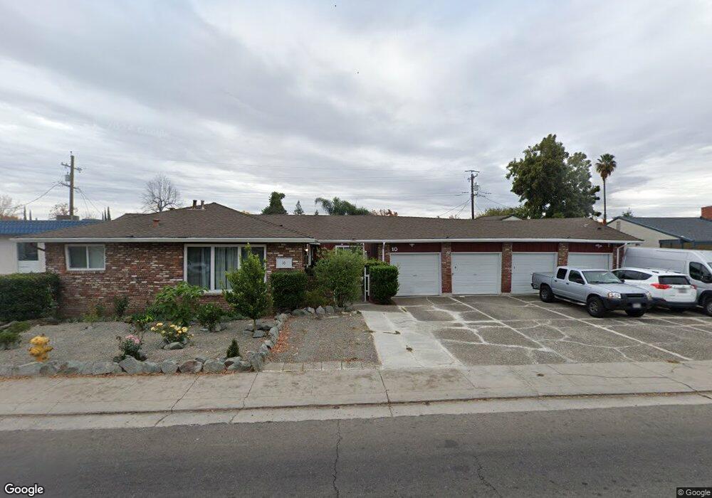
10 W Swain Rd Unit 1 Stockton, CA 95207
Lincoln Village NeighborhoodEstimated Value: $596,000 - $748,000
20
Beds
20
Baths
3,553
Sq Ft
$186/Sq Ft
Est. Value
About This Home
This home is located at 10 W Swain Rd Unit 1, Stockton, CA 95207 and is currently estimated at $660,818, approximately $185 per square foot. 10 W Swain Rd Unit 1 is a home located in San Joaquin County with nearby schools including Maxine Hong Kingston Elementary School, Adams Elementary School, and Pulliam Elementary School.
Ownership History
Date
Name
Owned For
Owner Type
Purchase Details
Closed on
Aug 5, 2020
Sold by
Capristo Martin
Bought by
Capristo Martin and Seng Sophallin
Current Estimated Value
Purchase Details
Closed on
Feb 9, 2017
Sold by
Bowman Gregory B and Bowman Edith J
Bought by
Capristo Martin
Home Financials for this Owner
Home Financials are based on the most recent Mortgage that was taken out on this home.
Original Mortgage
$281,250
Outstanding Balance
$142,112
Interest Rate
4.2%
Mortgage Type
New Conventional
Estimated Equity
$518,706
Purchase Details
Closed on
Jan 27, 2017
Sold by
Seng Sophallin
Bought by
Capristo Martin
Home Financials for this Owner
Home Financials are based on the most recent Mortgage that was taken out on this home.
Original Mortgage
$281,250
Outstanding Balance
$142,112
Interest Rate
4.2%
Mortgage Type
New Conventional
Estimated Equity
$518,706
Purchase Details
Closed on
Aug 27, 2009
Sold by
Bowman Gregory B and Bowman Edith J
Bought by
Bowman Gregory B and Bowman Edith J
Home Financials for this Owner
Home Financials are based on the most recent Mortgage that was taken out on this home.
Original Mortgage
$254,000
Interest Rate
5.19%
Mortgage Type
New Conventional
Purchase Details
Closed on
Mar 31, 2005
Sold by
Bowman Gregory B and Bowman Edith J
Bought by
Bowman Gregory B and Edith J Bowman 2004 R
Purchase Details
Closed on
Jul 3, 2002
Sold by
Wight Lawrence A and Lawrence A Wight Separate Prop
Bought by
Bowman Gregory B and Bowman Edith J
Home Financials for this Owner
Home Financials are based on the most recent Mortgage that was taken out on this home.
Original Mortgage
$217,125
Interest Rate
6.69%
Purchase Details
Closed on
Apr 9, 1999
Sold by
Bianucci Nola M Tr and Bianucci John Allan
Bought by
Wight Lawrence
Home Financials for this Owner
Home Financials are based on the most recent Mortgage that was taken out on this home.
Original Mortgage
$112,000
Interest Rate
7.1%
Create a Home Valuation Report for This Property
The Home Valuation Report is an in-depth analysis detailing your home's value as well as a comparison with similar homes in the area
Home Values in the Area
Average Home Value in this Area
Purchase History
| Date | Buyer | Sale Price | Title Company |
|---|---|---|---|
| Capristo Martin | -- | None Available | |
| Capristo Martin | $375,000 | Old Republic Title Company | |
| Capristo Martin | -- | Old Republic Title Company | |
| Bowman Gregory B | -- | Chicago Title Servicelink Di | |
| Bowman Gregory B | -- | Chicago Title Servicelink Di | |
| Bowman Gregory B | -- | -- | |
| Bowman Gregory B | -- | Alliance Title Company | |
| Wight Lawrence | $140,000 | Alliance Title Company |
Source: Public Records
Mortgage History
| Date | Status | Borrower | Loan Amount |
|---|---|---|---|
| Open | Capristo Martin | $281,250 | |
| Previous Owner | Bowman Gregory B | $254,000 | |
| Previous Owner | Bowman Gregory B | $217,125 | |
| Previous Owner | Wight Lawrence | $112,000 |
Source: Public Records
Tax History Compared to Growth
Tax History
| Year | Tax Paid | Tax Assessment Tax Assessment Total Assessment is a certain percentage of the fair market value that is determined by local assessors to be the total taxable value of land and additions on the property. | Land | Improvement |
|---|---|---|---|---|
| 2025 | $5,364 | $435,213 | $133,464 | $301,749 |
| 2024 | $5,278 | $426,681 | $130,848 | $295,833 |
| 2023 | $5,158 | $418,316 | $128,283 | $290,033 |
| 2022 | $5,054 | $410,115 | $125,768 | $284,347 |
| 2021 | $4,855 | $402,074 | $123,302 | $278,772 |
| 2020 | $5,035 | $397,952 | $122,038 | $275,914 |
| 2019 | $5,016 | $390,150 | $119,646 | $270,504 |
| 2018 | $4,923 | $382,500 | $117,300 | $265,200 |
| 2017 | $3,686 | $295,000 | $120,000 | $175,000 |
| 2016 | $3,826 | $295,000 | $120,000 | $175,000 |
| 2014 | $3,258 | $255,000 | $51,000 | $204,000 |
Source: Public Records
Map
Nearby Homes
- 5806 N El Dorado St
- 20 W Norwich Dr
- 126 Nottingham Dr
- 311 W Norwich Dr
- 6009 Glenbrook Ln
- 5614 Tamworth Way
- 6510 N El Dorado St
- 722 E Swain Rd
- 5662 Kermit Ln
- 7 W Loretta Ave
- 5536 Kermit Ln
- 806 E Longview Ave
- 36 Lynda Ave
- 5511 Audrey Dr
- 813 Cave Ln
- 5416 Ridgeway Ave
- 6703 Kermit Ln
- 6905 N El Dorado St
- 5622 Jeffrey Ct
- 332 Jean Ave
- 10 W Swain Rd
- 10 W Swain Rd
- 12 W Swain Rd
- 9 W Longview Ave
- 7 W Longview Ave
- 11 W Longview Ave
- 14 W Swain Rd
- 5 W Longview Ave
- 15 W Longview Ave
- 16 W Swain Rd
- 3 W Longview Ave
- 17 W Longview Ave
- 6018 Cresenda Ave Unit 3
- 8 W Longview Ave
- 6 W Longview Ave
- 10 W Longview Ave
- 18 W Swain Rd
- 5901 N El Dorado St
- 6026 Cresenda Ave
- 9 W Swain Rd