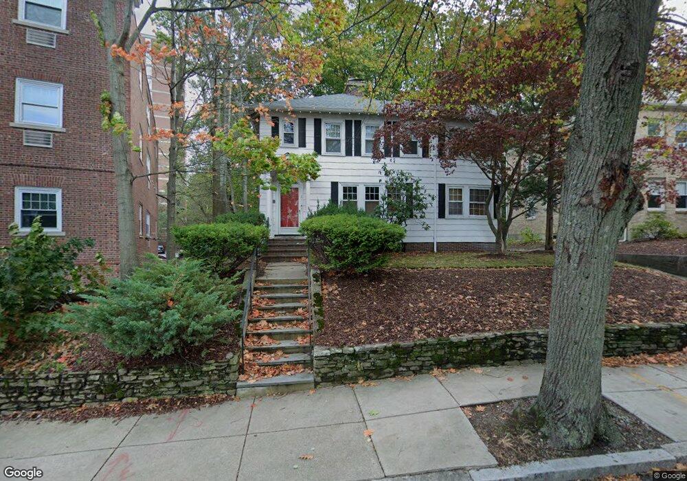
10 Wade St Brighton, MA 02135
Commonwealth NeighborhoodEstimated Value: $1,477,672
5
Beds
3
Baths
2,496
Sq Ft
$592/Sq Ft
Est. Value
About This Home
This home is located at 10 Wade St, Brighton, MA 02135 and is currently estimated at $1,477,672, approximately $592 per square foot. 10 Wade St is a home located in Suffolk County with nearby schools including Shaloh House Jewish Day School, St Columbkille Partnership School, and Bais Yaakov Of Boston High School.
Ownership History
Date
Name
Owned For
Owner Type
Purchase Details
Closed on
Nov 20, 2008
Sold by
Cohen Rhoda and Cohen Stanley
Bought by
Boston College
Current Estimated Value
Create a Home Valuation Report for This Property
The Home Valuation Report is an in-depth analysis detailing your home's value as well as a comparison with similar homes in the area
Home Values in the Area
Average Home Value in this Area
Purchase History
| Date | Buyer | Sale Price | Title Company |
|---|---|---|---|
| Boston College | $660,000 | -- |
Source: Public Records
Tax History Compared to Growth
Tax History
| Year | Tax Paid | Tax Assessment Tax Assessment Total Assessment is a certain percentage of the fair market value that is determined by local assessors to be the total taxable value of land and additions on the property. | Land | Improvement |
|---|---|---|---|---|
| 2025 | $0 | $1,474,900 | $648,100 | $826,800 |
| 2024 | $0 | $1,406,600 | $472,000 | $934,600 |
| 2023 | $0 | $1,338,900 | $449,300 | $889,600 |
| 2022 | $0 | $1,326,000 | $445,000 | $881,000 |
| 2021 | $0 | $1,299,900 | $436,200 | $863,700 |
| 2020 | $13,301 | $1,259,600 | $375,800 | $883,800 |
| 2019 | $12,401 | $1,176,600 | $297,500 | $879,100 |
| 2018 | $10,094 | $963,200 | $273,900 | $689,300 |
| 2017 | $9,900 | $934,800 | $273,900 | $660,900 |
| 2016 | -- | $834,600 | $273,900 | $560,700 |
| 2015 | -- | $675,100 | $246,800 | $428,300 |
| 2014 | -- | $586,300 | $246,800 | $339,500 |
Source: Public Records
Map
Nearby Homes
- 2021 Commonwealth Ave Unit B
- 39 South St Unit B
- 25 South St Unit B1
- 24 Sidlaw Rd Unit 12
- 129 Chiswick Rd Unit 6
- 114 Strathmore Rd Unit 102
- 108 Lake Shore Rd Unit 4
- 1789 Commonwealth Ave
- 26 Chiswick Rd Unit 6
- 2400 Beacon St Unit 112
- 97 Strathmore Rd Unit 4
- 6 Sutherland Rd Unit 41
- 21 Glenmont Rd
- 88 Strathmore Rd Unit 7
- 56-58 Selkirk Rd
- 44 Orkney Rd Unit 3
- 12 Mina Way
- 10 Mina Way
- 41 Orkney Rd
- 8 Kinross Rd Unit 2
- 16 Wade St
- 16 Wade St Unit 1
- 16 Wade St Unit 2
- 2018 Commonwealth Ave Unit 48
- 2018 Commonwealth Ave Unit 28
- 2018 Commonwealth Ave Unit 32
- 2018 Commonwealth Ave Unit 31
- 2018 Commonwealth Ave Unit 46
- 2018 Commonwealth Ave Unit 22
- 2018 Commonwealth Ave Unit 1
- 2018 Commonwealth Ave Unit 27
- 2018 Commonwealth Ave Unit 7
- 2018 Commonwealth Ave Unit 44
- 2018 Commonwealth Ave Unit 42
- 2018 Commonwealth Ave Unit 9
- 2018 Commonwealth Ave Unit 45
- 2018 Commonwealth Ave Unit 36
- 2018 Commonwealth Ave Unit 33
- 2018 Commonwealth Ave Unit 8
- 18 Wade St