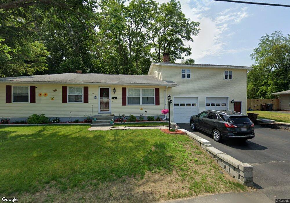
10 Westwood Dr Auburn, MA 01501
Stoneville NeighborhoodEstimated Value: $491,000 - $540,000
3
Beds
2
Baths
1,666
Sq Ft
$311/Sq Ft
Est. Value
About This Home
This home is located at 10 Westwood Dr, Auburn, MA 01501 and is currently estimated at $518,644, approximately $311 per square foot. 10 Westwood Dr is a home located in Worcester County with nearby schools including Auburn Senior High School and Shrewsbury Montessori School - Auburn Campus.
Ownership History
Date
Name
Owned For
Owner Type
Purchase Details
Closed on
Nov 2, 2023
Sold by
Rodgers Susan E
Bought by
Rodgers Susan E and Rodgers Amanda M
Current Estimated Value
Purchase Details
Closed on
Jun 5, 1992
Sold by
Vinton Richard A and Vinton Barbara
Bought by
Rodgers Thomas J and Rodgers Susan
Home Financials for this Owner
Home Financials are based on the most recent Mortgage that was taken out on this home.
Original Mortgage
$70,500
Interest Rate
8.8%
Mortgage Type
Purchase Money Mortgage
Create a Home Valuation Report for This Property
The Home Valuation Report is an in-depth analysis detailing your home's value as well as a comparison with similar homes in the area
Home Values in the Area
Average Home Value in this Area
Purchase History
| Date | Buyer | Sale Price | Title Company |
|---|---|---|---|
| Rodgers Susan E | -- | None Available | |
| Rodgers Thomas J | $115,500 | -- |
Source: Public Records
Mortgage History
| Date | Status | Borrower | Loan Amount |
|---|---|---|---|
| Previous Owner | Rodgers Thomas J | $118,942 | |
| Previous Owner | Rodgers Thomas J | $92,000 | |
| Previous Owner | Rodgers Thomas J | $30,000 | |
| Previous Owner | Rodgers Thomas J | $70,500 |
Source: Public Records
Tax History Compared to Growth
Tax History
| Year | Tax Paid | Tax Assessment Tax Assessment Total Assessment is a certain percentage of the fair market value that is determined by local assessors to be the total taxable value of land and additions on the property. | Land | Improvement |
|---|---|---|---|---|
| 2025 | $65 | $451,400 | $125,600 | $325,800 |
| 2024 | $6,566 | $439,800 | $119,400 | $320,400 |
| 2023 | $6,531 | $411,300 | $108,500 | $302,800 |
| 2022 | $6,109 | $363,200 | $108,500 | $254,700 |
| 2021 | $5,905 | $325,500 | $95,700 | $229,800 |
| 2020 | $5,869 | $312,200 | $95,700 | $216,500 |
| 2019 | $5,452 | $296,000 | $94,700 | $201,300 |
| 2018 | $3,410 | $287,300 | $88,600 | $198,700 |
| 2017 | $5,117 | $279,000 | $80,300 | $198,700 |
| 2016 | $4,877 | $269,600 | $84,500 | $185,100 |
| 2015 | $4,469 | $258,900 | $84,500 | $174,400 |
| 2014 | $4,336 | $250,800 | $80,400 | $170,400 |
Source: Public Records
Map
Nearby Homes
- 2 Keen St
- 27 Havana Rd
- 315 Stafford St
- 53 James St
- 176 Boyce St
- 177 Boyce St
- 5 Commonwealth Ave
- 35 Genessee St Unit I
- 4 S Edlin St
- 40 Ludlow St
- 25 Vinal St Unit 26
- 25 Vinal St Unit 29
- 25 Vinal St Unit 30
- 177 Oxford St N
- 24 Ludlow St
- 8 Shirley St
- 170 Stafford St
- 114 Henshaw St
- 21 Healy Rd
- 24 Meena Dr