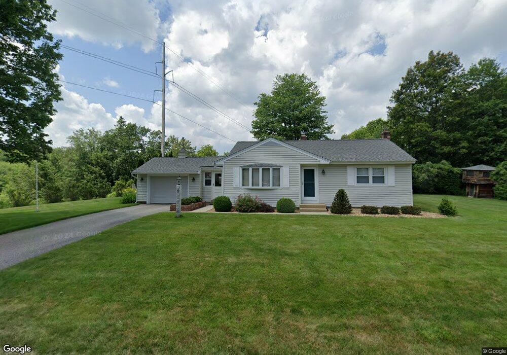
10 Westwood Dr Goffstown, NH 03045
Estimated Value: $394,000 - $448,000
2
Beds
3
Baths
966
Sq Ft
$437/Sq Ft
Est. Value
About This Home
This home is located at 10 Westwood Dr, Goffstown, NH 03045 and is currently estimated at $421,796, approximately $436 per square foot. 10 Westwood Dr is a home with nearby schools including Mountain View Middle School and Goffstown High School.
Create a Home Valuation Report for This Property
The Home Valuation Report is an in-depth analysis detailing your home's value as well as a comparison with similar homes in the area
Home Values in the Area
Average Home Value in this Area
Tax History Compared to Growth
Tax History
| Year | Tax Paid | Tax Assessment Tax Assessment Total Assessment is a certain percentage of the fair market value that is determined by local assessors to be the total taxable value of land and additions on the property. | Land | Improvement |
|---|---|---|---|---|
| 2024 | $6,931 | $339,100 | $172,500 | $166,600 |
| 2023 | $6,395 | $339,100 | $172,500 | $166,600 |
| 2022 | $5,659 | $215,100 | $106,400 | $108,700 |
| 2021 | $5,339 | $215,100 | $106,400 | $108,700 |
| 2020 | $7,275 | $215,100 | $106,400 | $108,700 |
| 2019 | $5,287 | $215,100 | $106,400 | $108,700 |
| 2018 | $4,001 | $215,100 | $106,400 | $108,700 |
| 2017 | $6,685 | $182,600 | $88,200 | $94,400 |
| 2016 | $4,826 | $182,600 | $88,200 | $94,400 |
| 2015 | $4,948 | $175,700 | $79,600 | $96,100 |
| 2014 | $4,744 | $175,700 | $79,600 | $96,100 |
Source: Public Records
Map
Nearby Homes
- 5 W Side Ave
- 32 Westwood Dr
- 31 Westwood Dr
- 6 Westwood Dr
- 14 Westwood Dr
- 30 Westwood Dr
- 29 Westwood Dr
- 11 Bog Rd
- 5 Bog Rd
- 16 Westwood Dr
- 63 Pleasant St
- 61 Pleasant St
- 26 Westwood Dr
- 55 Pleasant St
- 24 Westwood Dr
- 4-53-2 New Boston Rd
- 0 New Boston Rd Unit 33-17-1A 4984819
- 0 New Boston Rd Unit 33-17 4979272
- 0 New Boston Rd Unit 33-17-1 4979266
- 0 New Boston Rd Unit 33-18 4976861