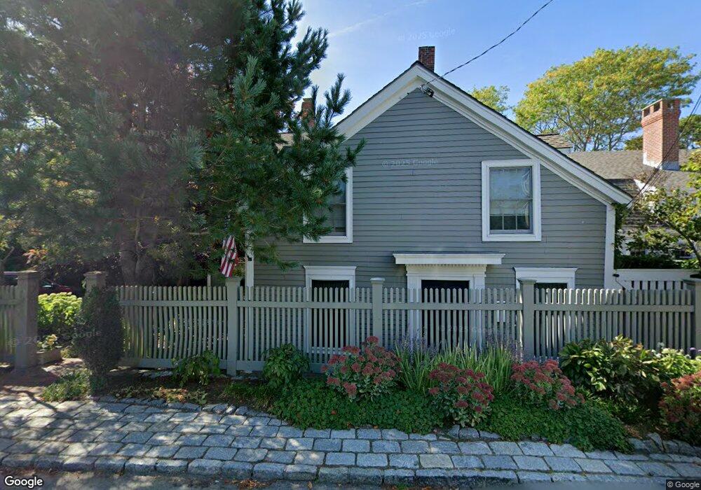
10 Wonson St Gloucester, MA 01930
East Gloucester NeighborhoodEstimated Value: $1,536,000 - $3,401,432
6
Beds
5
Baths
3,224
Sq Ft
$839/Sq Ft
Est. Value
About This Home
This home is located at 10 Wonson St, Gloucester, MA 01930 and is currently estimated at $2,705,477, approximately $839 per square foot. 10 Wonson St is a home located in Essex County with nearby schools including East Gloucester Elementary School, Ralph B O'maley Middle School, and Gloucester High School.
Ownership History
Date
Name
Owned For
Owner Type
Purchase Details
Closed on
Jul 9, 2010
Sold by
Berson Frank G and Berson Jill
Bought by
Helzberg Barnett C and Helzberg Jennifer S
Current Estimated Value
Purchase Details
Closed on
May 20, 2005
Sold by
Maramarco Anthony M and Maramarco Margaret F
Bought by
Berson Frank G
Purchase Details
Closed on
Sep 5, 1996
Sold by
Stjohn Dennis R and Stjohn Carol E
Bought by
Maramarco Anthony M and Maramarco Margaret
Purchase Details
Closed on
Oct 5, 1990
Sold by
Lawrence Richard F
Bought by
Stjohn Dennis R
Create a Home Valuation Report for This Property
The Home Valuation Report is an in-depth analysis detailing your home's value as well as a comparison with similar homes in the area
Home Values in the Area
Average Home Value in this Area
Purchase History
| Date | Buyer | Sale Price | Title Company |
|---|---|---|---|
| Helzberg Barnett C | $1,690,000 | -- | |
| Berson Frank G | $1,570,000 | -- | |
| Maramarco Anthony M | $550,000 | -- | |
| Stjohn Dennis R | $260,000 | -- |
Source: Public Records
Mortgage History
| Date | Status | Borrower | Loan Amount |
|---|---|---|---|
| Previous Owner | Stjohn Dennis R | $532,800 | |
| Previous Owner | Stjohn Dennis R | $200,000 |
Source: Public Records
Tax History
| Year | Tax Paid | Tax Assessment Tax Assessment Total Assessment is a certain percentage of the fair market value that is determined by local assessors to be the total taxable value of land and additions on the property. | Land | Improvement |
|---|---|---|---|---|
| 2025 | $28,508 | $2,932,900 | $1,779,700 | $1,153,200 |
| 2024 | $27,710 | $2,847,900 | $1,694,700 | $1,153,200 |
| 2023 | $25,624 | $2,419,600 | $1,446,000 | $973,600 |
| 2022 | $24,763 | $2,111,100 | $1,257,500 | $853,600 |
| 2021 | $23,895 | $1,920,800 | $1,143,200 | $777,600 |
| 2020 | $23,859 | $1,935,000 | $1,143,200 | $791,800 |
| 2019 | $22,992 | $1,811,800 | $1,090,100 | $721,700 |
| 2018 | $22,780 | $1,761,800 | $1,063,500 | $698,300 |
| 2017 | $22,100 | $1,675,500 | $1,013,100 | $662,400 |
| 2016 | $21,385 | $1,571,300 | $969,100 | $602,200 |
| 2015 | $20,523 | $1,503,500 | $947,100 | $556,400 |
Source: Public Records
Map
Nearby Homes
- 1 Wonson St
- 73 Rocky Neck Ave Unit 2
- 60 Rocky Neck Ave Unit 202
- 15 Raven Ln Unit 15
- 197 E Main St Unit 1
- 191 Main St Unit 3
- 191 Main St Unit 2A
- 33 Middle St
- 35 Middle St Unit 4
- 10 Seaview Rd
- 139A Prospect St
- 11 Ocean View Dr
- 20 Beacon St
- 20 Beacon St Unit 2
- 20 Beacon St Unit 1
- 113 Pleasant St
- 33 Maplewood Ave Unit 310
- 120 Washington St
- 50 Warner St
- 13 Leslie o Johnson Rd
- 1 Rackliffe St
- 12 Wonson St
- 3 Rackliffe St
- 14 Wonson St
- 17 Wonson St
- 13 Wonson St
- 8 Wonson St
- 4 Rackliffe St
- 9 Wonson St
- 19 Wonson St
- 34 Rocky Neck Ave
- 21 Wonson St
- 6 Rackliffe St
- 36R Rocky Neck Ave
- 36 Rocky Neck Ave
- 38 Rocky Neck Ave
- 36 Rocky Neck Ave
- 5 Rackliffe St Unit WINTER
- 5 Rackliffe St
- 5 Rackliffe St
Your Personal Tour Guide
Ask me questions while you tour the home.