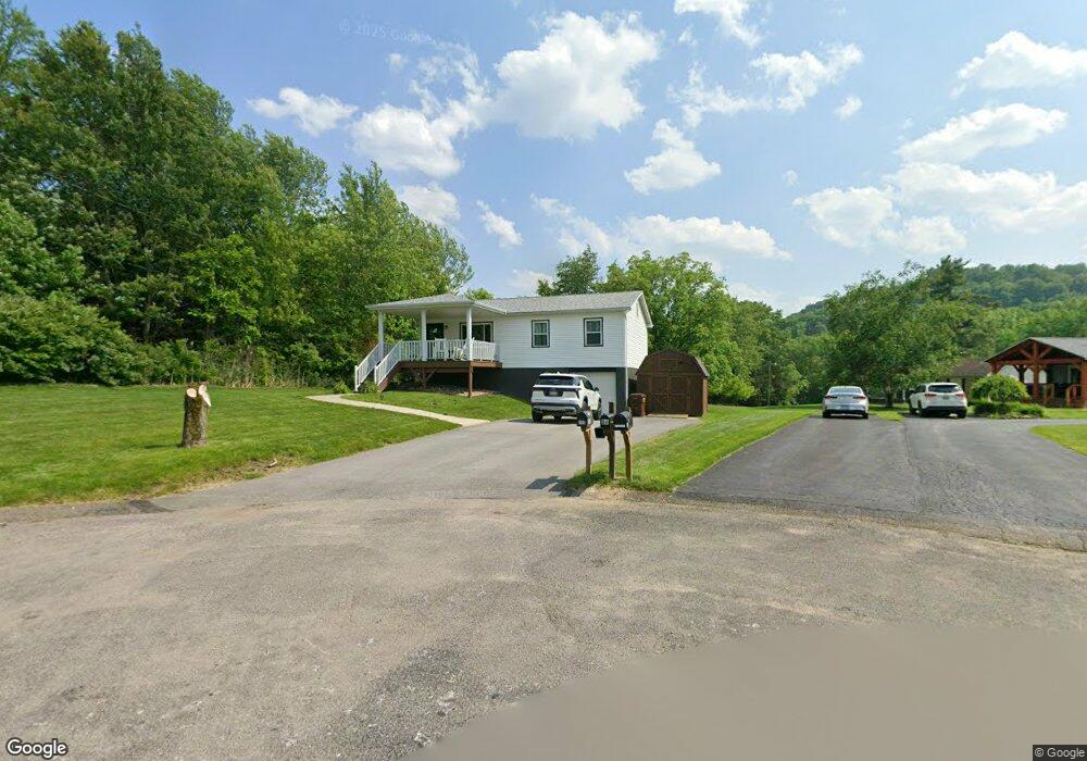
100 Ashland Way Vandergrift, PA 15690
Allegheny Township NeighborhoodEstimated Value: $75,055 - $212,000
--
Bed
--
Bath
988
Sq Ft
$162/Sq Ft
Est. Value
About This Home
This home is located at 100 Ashland Way, Vandergrift, PA 15690 and is currently estimated at $160,264, approximately $162 per square foot. 100 Ashland Way is a home located in Westmoreland County with nearby schools including Kiski Area High School.
Ownership History
Date
Name
Owned For
Owner Type
Purchase Details
Closed on
Oct 13, 2005
Sold by
Lehosky Scott E and Lehosky Stacy M
Bought by
Lehosky Scott E and Lehosky Stacy M
Current Estimated Value
Home Financials for this Owner
Home Financials are based on the most recent Mortgage that was taken out on this home.
Original Mortgage
$90,000
Outstanding Balance
$48,051
Interest Rate
5.72%
Mortgage Type
New Conventional
Estimated Equity
$112,213
Purchase Details
Closed on
May 17, 2002
Sold by
Stewart John R and Stewart Karla J
Bought by
Lehosky Scott E and Long Stacy M
Home Financials for this Owner
Home Financials are based on the most recent Mortgage that was taken out on this home.
Original Mortgage
$79,700
Interest Rate
7.01%
Mortgage Type
FHA
Create a Home Valuation Report for This Property
The Home Valuation Report is an in-depth analysis detailing your home's value as well as a comparison with similar homes in the area
Home Values in the Area
Average Home Value in this Area
Purchase History
| Date | Buyer | Sale Price | Title Company |
|---|---|---|---|
| Lehosky Scott E | -- | -- | |
| Lehosky Scott E | $81,000 | -- |
Source: Public Records
Mortgage History
| Date | Status | Borrower | Loan Amount |
|---|---|---|---|
| Open | Lehosky Scott E | $90,000 | |
| Closed | Lehosky Scott E | $79,700 |
Source: Public Records
Tax History Compared to Growth
Tax History
| Year | Tax Paid | Tax Assessment Tax Assessment Total Assessment is a certain percentage of the fair market value that is determined by local assessors to be the total taxable value of land and additions on the property. | Land | Improvement |
|---|---|---|---|---|
| 2025 | $2,798 | $18,450 | $1,480 | $16,970 |
| 2024 | $2,655 | $18,450 | $1,480 | $16,970 |
| 2023 | $2,427 | $18,450 | $1,480 | $16,970 |
| 2022 | $2,372 | $18,450 | $1,480 | $16,970 |
| 2021 | $2,373 | $18,450 | $1,480 | $16,970 |
| 2020 | $2,255 | $17,580 | $1,480 | $16,100 |
| 2019 | $2,246 | $17,580 | $1,480 | $16,100 |
| 2018 | $2,211 | $17,580 | $1,480 | $16,100 |
| 2017 | $2,158 | $17,580 | $1,480 | $16,100 |
| 2016 | $2,126 | $17,580 | $1,480 | $16,100 |
| 2015 | $2,126 | $17,580 | $1,480 | $16,100 |
| 2014 | $2,115 | $17,580 | $1,480 | $16,100 |
Source: Public Records
Map
Nearby Homes
- 894 State Route 356
- 844 Hawk Valley Dr
- 620 Cedar Ridge Dr
- 1179 School Rd
- 519 Dogwood Ct
- 501 State Route 356
- 2632 River Rd
- 704-706 Holland St
- 716 Pennsylvania 356
- 512 Watson St
- 528 Longfellow St
- 533A Walnut St
- 439 Longfellow St
- 154 Lillian Rd
- 46 Alice Ln
- 517 Sycamore St
- 314 1/2 Lowell St
- 311 Lowell St
- 410 Longfellow St
- 314 Lowell St Unit 1/2
- 82 Ashland Way
- 86 Ashland Way
- 78 Ashland Way
- 786 State Route 356
- 68 Ashland Way
- 67 Ashland Way
- 40 La Belle Vue Rd
- 54 La Belle Vue Rd
- 56 Ashland Way
- 33 Ashland Way
- 20 Stacy Way
- 42 Ashland Way
- 774 Rt 356
- 11 Locust Ln
- 200 La Belle Vue Rd
- 772 State Route 356
- 22 Locust Ln
- 260 La Belle Vue Rd
- 190 Pine View Dr
- 2 Labellevue Rd