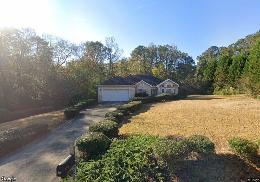
100 Brookwood Dr Lagrange, GA 30240
Estimated Value: $270,369 - $338,000
3
Beds
2
Baths
2,036
Sq Ft
$151/Sq Ft
Est. Value
About This Home
This home is located at 100 Brookwood Dr, Lagrange, GA 30240 and is currently estimated at $308,092, approximately $151 per square foot. 100 Brookwood Dr is a home located in Troup County with nearby schools including Ethel W. Kight Elementary School, Hollis Hand Elementary School, and Franklin Forest Elementary School.
Ownership History
Date
Name
Owned For
Owner Type
Purchase Details
Closed on
Feb 11, 2004
Sold by
Johnny B Watkins
Bought by
Shaddix Shane and Shaddix Vicki
Current Estimated Value
Purchase Details
Closed on
Nov 25, 2002
Sold by
Tanner Wilma
Bought by
Johnny B Watkins
Purchase Details
Closed on
Mar 29, 1999
Sold by
Hutchinson Wm
Bought by
Tanner Wilma
Create a Home Valuation Report for This Property
The Home Valuation Report is an in-depth analysis detailing your home's value as well as a comparison with similar homes in the area
Home Values in the Area
Average Home Value in this Area
Purchase History
| Date | Buyer | Sale Price | Title Company |
|---|---|---|---|
| Shaddix Shane | $200,000 | -- | |
| Johnny B Watkins | $177,000 | -- | |
| Tanner Wilma | $9,000 | -- |
Source: Public Records
Tax History Compared to Growth
Tax History
| Year | Tax Paid | Tax Assessment Tax Assessment Total Assessment is a certain percentage of the fair market value that is determined by local assessors to be the total taxable value of land and additions on the property. | Land | Improvement |
|---|---|---|---|---|
| 2024 | $2,221 | $83,440 | $10,000 | $73,440 |
| 2023 | $2,277 | $85,480 | $10,000 | $75,480 |
| 2022 | $2,247 | $82,480 | $10,000 | $72,480 |
| 2021 | $2,393 | $81,320 | $10,000 | $71,320 |
| 2020 | $2,332 | $79,320 | $8,000 | $71,320 |
| 2019 | $2,124 | $72,400 | $6,000 | $66,400 |
| 2018 | $2,124 | $72,400 | $6,000 | $66,400 |
| 2017 | $2,003 | $68,400 | $6,000 | $62,400 |
| 2016 | $1,968 | $67,226 | $6,000 | $61,226 |
| 2015 | $1,971 | $67,226 | $6,000 | $61,226 |
| 2014 | $1,877 | $64,003 | $6,000 | $58,003 |
| 2013 | -- | $66,982 | $6,000 | $60,982 |
Source: Public Records
Map
Nearby Homes
- 104 Spring Valley Dr
- 117 Brookwood Dr
- 108 Spring Valley Dr
- 223 Pinehaven Dr
- 200 Cheyenne Dr
- 641 Whitaker Rd
- 146 Whitaker Rd
- 208 Highland Trail
- E Angela Dr
- LOT 4 Angela Dr
- 102 Willowcrest Way
- 243 Oak Dr
- 3 Reed Dr
- 141 Avery Dr
- 509 Connie Dr
- 0 Unit 10514554
- 610 Ginger Cir
- 0 Cameron Mill Rd Unit 10640133
- 654 Cameron Mill Rd
- 190 Hill Rd
- 402 Whitaker Rd
- 102 Brookwood Dr
- 101 Brookwood Dr
- 393 Whitaker Rd
- 104 Brookwood Dr
- 106 Brookwood Dr
- 364 Whitaker Rd
- 104 Highland Pointe Dr
- 108 Brookwood Dr
- 108 Brookwood Dr Unit 14
- 102 Spring Valley Dr
- 101 Highland Pointe Dr
- 100 Spring Valley Dr Unit 14
- 100 Spring Valley Dr
- 453 Whitaker Rd
- 107 Brookwood Dr
- 110 Brookwood Dr
- 0 Highland Pointe Dr Unit TR 1 7283337
- 0 Highland Pointe Dr Unit TR 2 7283334
- 103 Highland Pointe Dr