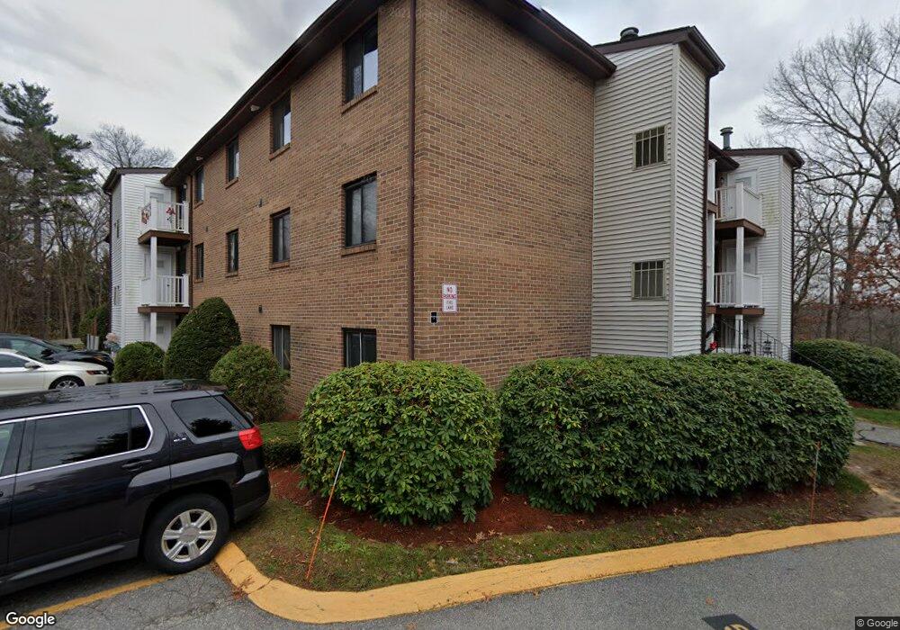
100 Cass Ave Unit B19 Dracut, MA 01826
Estimated Value: $292,000 - $315,665
2
Beds
1
Bath
970
Sq Ft
$313/Sq Ft
Est. Value
About This Home
This home is located at 100 Cass Ave Unit B19, Dracut, MA 01826 and is currently estimated at $303,916, approximately $313 per square foot. 100 Cass Ave Unit B19 is a home located in Middlesex County with nearby schools including George H. Englesby Elementary School, Richardson Middle School, and Dracut Senior High School.
Ownership History
Date
Name
Owned For
Owner Type
Purchase Details
Closed on
Dec 2, 1994
Sold by
Department Of Housing & Urban Dev
Bought by
Letendre Jean L
Current Estimated Value
Home Financials for this Owner
Home Financials are based on the most recent Mortgage that was taken out on this home.
Original Mortgage
$34,200
Interest Rate
8.81%
Mortgage Type
Purchase Money Mortgage
Purchase Details
Closed on
May 12, 1993
Sold by
Clancy John and Silverman Carin
Bought by
Citicorp Mtg Inc
Create a Home Valuation Report for This Property
The Home Valuation Report is an in-depth analysis detailing your home's value as well as a comparison with similar homes in the area
Home Values in the Area
Average Home Value in this Area
Purchase History
| Date | Buyer | Sale Price | Title Company |
|---|---|---|---|
| Letendre Jean L | $36,000 | -- | |
| Citicorp Mtg Inc | $82,000 | -- |
Source: Public Records
Mortgage History
| Date | Status | Borrower | Loan Amount |
|---|---|---|---|
| Closed | Citicorp Mtg Inc | $34,200 |
Source: Public Records
Tax History Compared to Growth
Tax History
| Year | Tax Paid | Tax Assessment Tax Assessment Total Assessment is a certain percentage of the fair market value that is determined by local assessors to be the total taxable value of land and additions on the property. | Land | Improvement |
|---|---|---|---|---|
| 2025 | $2,790 | $275,700 | $0 | $275,700 |
| 2024 | $2,449 | $234,400 | $0 | $234,400 |
| 2023 | $2,548 | $220,000 | $0 | $220,000 |
| 2022 | $2,213 | $180,100 | $0 | $180,100 |
| 2021 | $2,018 | $155,100 | $0 | $155,100 |
| 2020 | $2,043 | $153,000 | $0 | $153,000 |
| 2019 | $1,785 | $129,800 | $0 | $129,800 |
| 2018 | $1,799 | $127,200 | $0 | $127,200 |
| 2017 | $1,724 | $127,200 | $0 | $127,200 |
| 2016 | $1,459 | $98,300 | $0 | $98,300 |
| 2015 | $1,451 | $97,200 | $0 | $97,200 |
| 2014 | $1,569 | $108,300 | $0 | $108,300 |
Source: Public Records
Map
Nearby Homes
- 100 Cass Ave Unit A13
- 14 Louis Farm Rd Unit 14
- 157 Old Rd
- 174 Old Rd
- 11 Mountain View Dr
- 190 Old Rd
- 15 Louis Farm Rd Unit 15
- 20 Dean Ave
- 94 Hampson St
- 101 Donohue Rd Unit 19
- 101 Donohue Rd Unit 3
- 148 Flower Ln Unit 14
- 161 Flower Ln Unit 5
- 37 Beaudry St
- 49 Sparks St
- 45 Hoover St
- 81 Spring Park Ave
- 363 Hildreth St Unit 11
- 999 Hildreth St
- 349 Hildreth St Unit 16
- 100 Cass Ave Unit 14 B
- 100 Cass Ave Unit B24
- 100 Cass Ave Unit B23
- 100 Cass Ave Unit B22
- 100 Cass Ave Unit B21
- 100 Cass Ave Unit B17
- 100 Cass Ave Unit B15
- 100 Cass Ave Unit B14
- 100 Cass Ave Unit B13
- 100 Cass Ave Unit B12
- 100 Cass Ave Unit B11
- 100 Cass Ave Unit B10
- 100 Cass Ave Unit B9
- 100 Cass Ave Unit B8
- 100 Cass Ave Unit B7
- 100 Cass Ave Unit B6
- 100 Cass Ave Unit B5
- 100 Cass Ave Unit B4
- 100 Cass Ave Unit B3
- 100 Cass Ave Unit B2