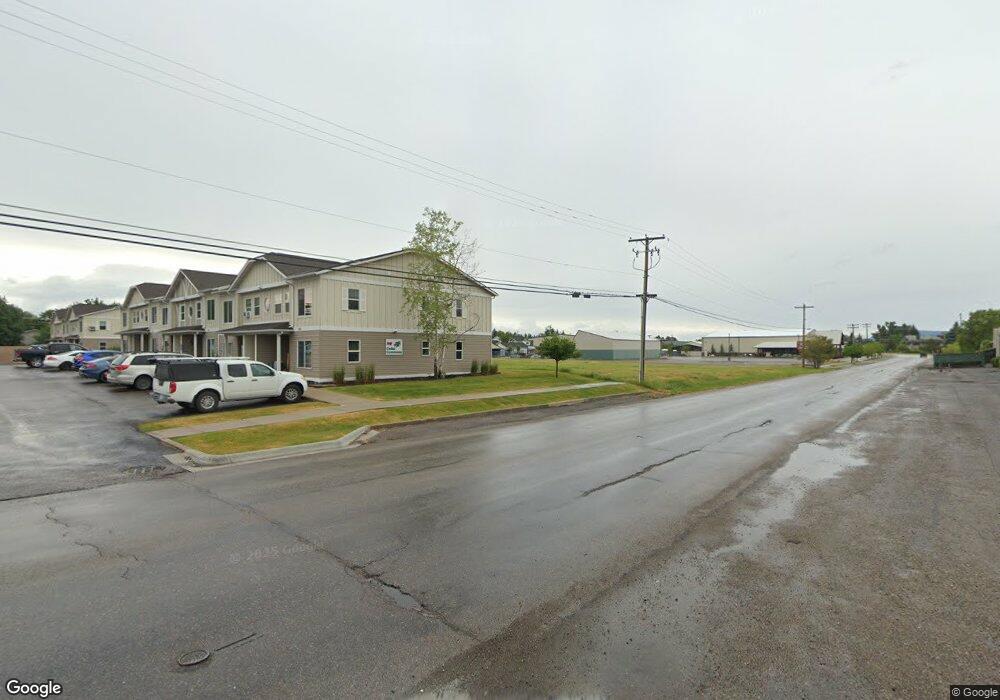
100 Cedar Commons Ln Unit 120 & 130 Kalispell, MT 59901
Estimated Value: $926,000 - $930,000
8
Beds
12
Baths
3,688
Sq Ft
$252/Sq Ft
Est. Value
About This Home
This home is located at 100 Cedar Commons Ln Unit 120 & 130, Kalispell, MT 59901 and is currently estimated at $928,000, approximately $251 per square foot. 100 Cedar Commons Ln Unit 120 & 130 is a home located in Flathead County with nearby schools including Cornelius Hedges School, Flathead High School, and St. Matthew's School.
Ownership History
Date
Name
Owned For
Owner Type
Purchase Details
Closed on
Sep 27, 2012
Sold by
Montana Rentals Llc
Bought by
Wild Rose Properties Llc
Current Estimated Value
Home Financials for this Owner
Home Financials are based on the most recent Mortgage that was taken out on this home.
Original Mortgage
$704,000
Outstanding Balance
$489,331
Interest Rate
3.59%
Mortgage Type
Purchase Money Mortgage
Estimated Equity
$438,669
Purchase Details
Closed on
Oct 15, 2008
Sold by
Blend Michael K and Blend Diana O
Bought by
Montana Rentals Llc
Purchase Details
Closed on
Aug 9, 2007
Sold by
Beargrass Holdings Llp and Schoottelkorb William R
Bought by
Blend Michael K and Blend Diana O
Home Financials for this Owner
Home Financials are based on the most recent Mortgage that was taken out on this home.
Original Mortgage
$335,640
Interest Rate
7.75%
Mortgage Type
Future Advance Clause Open End Mortgage
Create a Home Valuation Report for This Property
The Home Valuation Report is an in-depth analysis detailing your home's value as well as a comparison with similar homes in the area
Home Values in the Area
Average Home Value in this Area
Purchase History
| Date | Buyer | Sale Price | Title Company |
|---|---|---|---|
| Wild Rose Properties Llc | -- | Atec | |
| Montana Rentals Llc | -- | None Available | |
| Blend Michael K | -- | Sts |
Source: Public Records
Mortgage History
| Date | Status | Borrower | Loan Amount |
|---|---|---|---|
| Open | Wild Rose Properties Llc | $704,000 | |
| Previous Owner | Blend Michael K | $335,640 |
Source: Public Records
Tax History Compared to Growth
Tax History
| Year | Tax Paid | Tax Assessment Tax Assessment Total Assessment is a certain percentage of the fair market value that is determined by local assessors to be the total taxable value of land and additions on the property. | Land | Improvement |
|---|---|---|---|---|
| 2025 | $5,859 | $964,900 | $0 | $0 |
| 2024 | $7,831 | $1,005,600 | $0 | $0 |
| 2023 | $8,750 | $1,005,600 | $0 | $0 |
| 2022 | $3,945 | $392,700 | $0 | $0 |
| 2021 | $4,226 | $392,700 | $0 | $0 |
| 2020 | $4,752 | $350,100 | $0 | $0 |
| 2019 | $4,757 | $350,100 | $0 | $0 |
| 2018 | $4,624 | $324,000 | $0 | $0 |
| 2017 | $4,634 | $324,000 | $0 | $0 |
| 2016 | $4,086 | $305,800 | $0 | $0 |
| 2015 | $4,085 | $305,800 | $0 | $0 |
| 2014 | $3,986 | $178,716 | $0 | $0 |
Source: Public Records
Map
Nearby Homes
- 1312 2nd Ave E
- 1225 2nd Ave E
- 330 12th St E
- 1046 3rd Ave E
- 1221 7th Ave E
- 1687 Bull Run
- 205 12th St W
- 209 12th St W
- 1692 Bull Run
- 826 11th St E
- 815 3rd Ave E
- 1028 2nd Ave W
- 1024 Woodland Ave
- 835 7th Ave E
- 723 5th Ave E Unit 212C
- 1717 S Woodland Dr Unit SPC -21
- 1517 5th Ave W
- 51 Selders Ln
- 1971 Bluestone Dr
- 529 1st Ave E
- 100 Cedar Commons Ln Unit s 100, 120, 130
- 110 Cedar Commons Ln
- 120 Cedar Commons Ln
- 130 Cedar Commons Ln
- 125 Cedar Commons Ln
- 140 Cedar Commons Ln
- 150 Cedar Commons Ln
- 1430 3rd Ave E Unit 2
- 1430 3rd Ave E Unit 12
- 1430 3rd Ave E Unit 1
- 1430 3rd Ave E Unit 9
- 1430 3rd Ave E Unit 4
- 1430 3rd Ave E Unit 3
- 1430 3rd Ave E Unit 10
- 1430 3rd Ave E Unit 8
- 1430 3rd Ave E Unit 1430 3rd Avenue East
- 1430 3rd Ave E
- 1428 4th Ave E
- 1437 4th Ave E