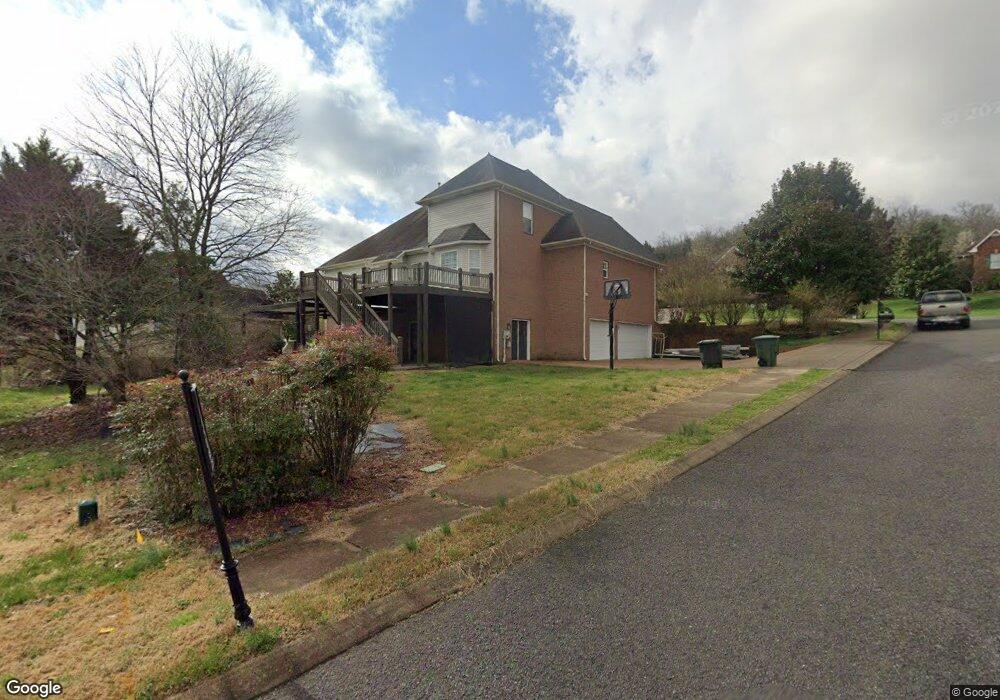
100 Cedar Ridge Way Hendersonville, TN 37075
Estimated Value: $631,290 - $772,000
--
Bed
3
Baths
3,273
Sq Ft
$209/Sq Ft
Est. Value
About This Home
This home is located at 100 Cedar Ridge Way, Hendersonville, TN 37075 and is currently estimated at $684,823, approximately $209 per square foot. 100 Cedar Ridge Way is a home located in Sumner County with nearby schools including Station Camp Elementary School, Station Camp Middle School, and Station Camp High School.
Ownership History
Date
Name
Owned For
Owner Type
Purchase Details
Closed on
Jul 20, 2001
Sold by
Southeastern Building Corp
Bought by
Kolp Timothy J and Kolp Bernadette M
Current Estimated Value
Home Financials for this Owner
Home Financials are based on the most recent Mortgage that was taken out on this home.
Original Mortgage
$232,005
Outstanding Balance
$89,539
Interest Rate
7.16%
Estimated Equity
$595,284
Create a Home Valuation Report for This Property
The Home Valuation Report is an in-depth analysis detailing your home's value as well as a comparison with similar homes in the area
Home Values in the Area
Average Home Value in this Area
Purchase History
| Date | Buyer | Sale Price | Title Company |
|---|---|---|---|
| Kolp Timothy J | $290,172 | Hallmark Title Company |
Source: Public Records
Mortgage History
| Date | Status | Borrower | Loan Amount |
|---|---|---|---|
| Open | Kolp Timothy J | $232,005 |
Source: Public Records
Tax History Compared to Growth
Tax History
| Year | Tax Paid | Tax Assessment Tax Assessment Total Assessment is a certain percentage of the fair market value that is determined by local assessors to be the total taxable value of land and additions on the property. | Land | Improvement |
|---|---|---|---|---|
| 2024 | $2,406 | $169,325 | $32,500 | $136,825 |
| 2023 | $3,354 | $103,525 | $20,700 | $82,825 |
| 2022 | $3,365 | $103,525 | $20,700 | $82,825 |
| 2021 | $3,365 | $103,525 | $20,700 | $82,825 |
| 2020 | $3,365 | $103,525 | $20,700 | $82,825 |
| 2019 | $3,365 | $0 | $0 | $0 |
| 2018 | $2,679 | $0 | $0 | $0 |
| 2017 | $2,679 | $0 | $0 | $0 |
| 2016 | $2,679 | $0 | $0 | $0 |
| 2015 | $2,942 | $0 | $0 | $0 |
| 2014 | $2,512 | $0 | $0 | $0 |
Source: Public Records
Map
Nearby Homes
- 129 Wynbrooke Trace
- 215 Crooked Creek Ln
- 229 Crooked Creek Ln
- 140 Settlers Way
- 1457 Arbor Park Ln
- 1461 Arbor Park Ln
- 1453 Arbor Park Ln
- 101 Settlers Way
- 1449 Arbor Park Ln
- 105 Cedar Ridge Ln
- 1441 Arbor Park Ln
- 1433 Arbor Park Ln
- 101 Country Hills Dr
- 1429 Arbor Park Ln
- 1464 Arbor Park Ln
- 1425 Arbor Park Ln
- 1421 Arbor Park Ln
- 1420 Arbor Park Ln
- Waterford Plan at Campbell Crossing
- Bridgeport Plan at Campbell Crossing
- 111 Crooked Creek Ct
- 102 Cedar Ridge Way
- 101 Cedar Ridge Way
- 112 Crooked Creek Ct
- 114 Crooked Creek Ct
- 113 Crooked Creek Ct
- 110 Crooked Creek Ct
- 103 Cedar Ridge Way
- 116 Crooked Creek Ct
- 108 Crooked Creek Ct
- 105 Crooked Creek Ct
- 105 Cedar Ridge Way
- 104 Cedar Ridge Way
- 115 Crooked Creek Ct
- 106 Cedar Ridge Way
- 106 Crooked Creek Ct
- 117 Crooked Creek Ct
- 118 Crooked Creek Ct
- 107 Cedar Ridge Way
- 103 Crooked Creek Ct