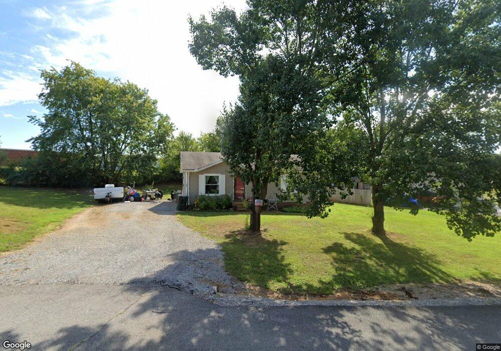
100 Cofer Dr Springfield, TN 37172
Estimated Value: $203,731 - $239,000
Studio
1
Bath
912
Sq Ft
$239/Sq Ft
Est. Value
About This Home
This home is located at 100 Cofer Dr, Springfield, TN 37172 and is currently estimated at $217,683, approximately $238 per square foot. 100 Cofer Dr is a home located in Robertson County with nearby schools including Westside Elementary School, Cheatham Park Elementary School, and Jo Byrns High School.
Ownership History
Date
Name
Owned For
Owner Type
Purchase Details
Closed on
Jul 30, 2018
Sold by
Jones David Keith
Bought by
Jones David Keith and Jones Tina Marie
Current Estimated Value
Purchase Details
Closed on
Feb 23, 2012
Sold by
Jones David Keith
Bought by
Jones David Keith
Purchase Details
Closed on
Jun 21, 1999
Sold by
Hester Vincent L
Bought by
Jones David K and Jones Tracy M
Home Financials for this Owner
Home Financials are based on the most recent Mortgage that was taken out on this home.
Original Mortgage
$69,500
Interest Rate
7.27%
Purchase Details
Closed on
Dec 1, 1997
Sold by
Grayson Applin Melissa
Bought by
Hester Vincent L
Home Financials for this Owner
Home Financials are based on the most recent Mortgage that was taken out on this home.
Original Mortgage
$60,941
Interest Rate
7.19%
Purchase Details
Closed on
Jan 23, 1995
Sold by
Mann Warren S
Bought by
Grayson Applin Melissa
Purchase Details
Closed on
Aug 8, 1988
Bought by
Mann Warren S
Create a Home Valuation Report for This Property
The Home Valuation Report is an in-depth analysis detailing your home's value as well as a comparison with similar homes in the area
Home Values in the Area
Average Home Value in this Area
Purchase History
| Date | Buyer | Sale Price | Title Company |
|---|---|---|---|
| Jones David Keith | -- | None Available | |
| Jones David Keith | -- | -- | |
| Jones David Keith | -- | -- | |
| Jones David K | $69,500 | -- | |
| Hester Vincent L | $61,000 | -- | |
| Grayson Applin Melissa | $50,000 | -- | |
| Mann Warren S | -- | -- |
Source: Public Records
Mortgage History
| Date | Status | Borrower | Loan Amount |
|---|---|---|---|
| Previous Owner | Mann Warren S | $69,500 | |
| Previous Owner | Mann Warren S | $60,941 |
Source: Public Records
Tax History
| Year | Tax Paid | Tax Assessment Tax Assessment Total Assessment is a certain percentage of the fair market value that is determined by local assessors to be the total taxable value of land and additions on the property. | Land | Improvement |
|---|---|---|---|---|
| 2025 | -- | $47,675 | $22,500 | $25,175 |
| 2024 | -- | $47,675 | $22,500 | $25,175 |
| 2023 | $1,194 | $47,675 | $22,500 | $25,175 |
| 2022 | $880 | $24,125 | $4,825 | $19,300 |
| 2021 | $880 | $24,125 | $4,825 | $19,300 |
| 2020 | $880 | $24,125 | $4,825 | $19,300 |
| 2019 | $26,521 | $24,125 | $4,825 | $19,300 |
| 2018 | $880 | $24,125 | $4,825 | $19,300 |
| 2017 | $719 | $16,775 | $4,075 | $12,700 |
| 2016 | $719 | $16,775 | $4,075 | $12,700 |
| 2015 | $698 | $16,775 | $4,075 | $12,700 |
| 2014 | $757 | $18,200 | $4,075 | $14,125 |
Source: Public Records
Map
Nearby Homes
- 244 Green Hills Dr
- 7373 New Chapel Rd
- 5148 Highway 49 W
- 1421 Lawrence Ln
- 610 5th Ave W
- 409 7th Ave W
- 702 Richard St
- 2130 Bessie St
- 1 Bessie St
- 0 Bessie St
- 509 3rd Ave W
- 325 N Walnut St
- 2067 Bessie St
- 113 11th Ave W
- 409 N Oak St
- 311 Walnut St
- 307 Walnut St
- 588 19th Ave W
- 1205 S Main St
- 1112 Batts Blvd
Your Personal Tour Guide
Ask me questions while you tour the home.