Estimated Value: $351,698 - $382,000
3
Beds
3
Baths
2,330
Sq Ft
$156/Sq Ft
Est. Value
About This Home
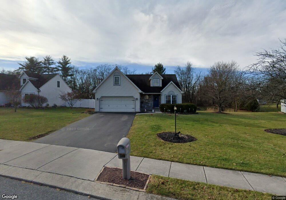
This home is located at 100 Cranbrook Dr, Dover, PA 17315 and is currently estimated at $363,925, approximately $156 per square foot. 100 Cranbrook Dr is a home located in York County with nearby schools including Dover Area High School and Lighthouse Christian School.
Ownership History
Date
Name
Owned For
Owner Type
Purchase Details
Closed on
Feb 9, 2001
Sold by
Nadu Construction Inc
Bought by
Anstadt Peter B and Anstadt Ursula A
Current Estimated Value
Home Financials for this Owner
Home Financials are based on the most recent Mortgage that was taken out on this home.
Original Mortgage
$147,050
Interest Rate
6.96%
Create a Home Valuation Report for This Property
The Home Valuation Report is an in-depth analysis detailing your home's value as well as a comparison with similar homes in the area
Home Values in the Area
Average Home Value in this Area
Purchase History
| Date | Buyer | Sale Price | Title Company |
|---|---|---|---|
| Anstadt Peter B | $151,605 | -- |
Source: Public Records
Mortgage History
| Date | Status | Borrower | Loan Amount |
|---|---|---|---|
| Previous Owner | Anstadt Peter B | $147,050 |
Source: Public Records
Tax History
| Year | Tax Paid | Tax Assessment Tax Assessment Total Assessment is a certain percentage of the fair market value that is determined by local assessors to be the total taxable value of land and additions on the property. | Land | Improvement |
|---|---|---|---|---|
| 2025 | $6,433 | $183,040 | $36,720 | $146,320 |
| 2024 | $6,433 | $183,040 | $36,720 | $146,320 |
| 2023 | $6,433 | $183,040 | $36,720 | $146,320 |
| 2022 | $6,325 | $183,040 | $36,720 | $146,320 |
| 2021 | $5,995 | $183,040 | $36,720 | $146,320 |
| 2020 | $5,946 | $183,040 | $36,720 | $146,320 |
| 2019 | $5,832 | $183,040 | $36,720 | $146,320 |
| 2018 | $5,752 | $183,040 | $36,720 | $146,320 |
| 2017 | $5,752 | $183,040 | $36,720 | $146,320 |
| 2016 | $0 | $183,040 | $36,720 | $146,320 |
| 2015 | -- | $183,040 | $36,720 | $146,320 |
| 2014 | -- | $183,040 | $36,720 | $146,320 |
Source: Public Records
Map
Nearby Homes
- 119 Cedar Dr
- 129 Maplewood Dr
- 70 N Main St
- 84 Charles Ln
- 1841 Wyatt Cir
- 0 W Canal Rd
- 4008 Country Dr
- 46 Chipawa Ave
- 86 Cherokee Ave
- 143 Pawnee Ave
- 74 Chipawa Ave
- 140 Pawnee Ave
- 3847 Country Dr
- 3895 Craig Ave
- 2640 Tamela Ave
- 3836 Country Dr
- 3832 Country Dr
- 2856 W Canal Rd
- 2677 Victorian Dr
- 2657 Victorian Dr
- 102 Cranbrook Dr
- 135 Cedar Dr
- 104 Cedar Dr
- 102 Cedar Dr
- 104 Cranbrook Dr
- 100 Cedar Dr
- 106 Cedar Dr
- 101 Cranbrook Dr
- 105 Cranbrook Dr
- 103 Cranbrook Dr
- 160 Cedar Dr
- 108 Cedar Dr
- 106 Cranbrook Dr
- 98 Cedar Dr
- 112 Cedar Dr
- 0 Meadow Rd Unit 1000289336
- 0 Meadow Rd Unit 1004590789
- 0 Meadow Rd Unit 1004575365
- 0 Meadow Rd Unit 1004525189
- 0 Meadow Rd Unit 1004519427
Your Personal Tour Guide
Ask me questions while you tour the home.