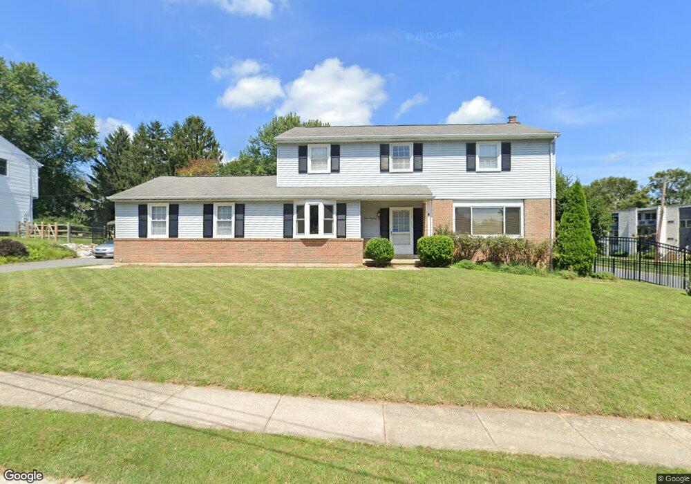
100 Locust Dr Newark, DE 19711
Estimated Value: $492,000 - $550,000
4
Beds
3
Baths
2,154
Sq Ft
$238/Sq Ft
Est. Value
About This Home
This home is located at 100 Locust Dr, Newark, DE 19711 and is currently estimated at $513,584, approximately $238 per square foot. 100 Locust Dr is a home located in New Castle County with nearby schools including Downes (John R.) Elementary School, Shue-Medill Middle School, and Newark High School.
Ownership History
Date
Name
Owned For
Owner Type
Purchase Details
Closed on
Dec 30, 2021
Sold by
Robert Hackney Nathaniel
Bought by
Hackney Nathaniel Robert
Current Estimated Value
Purchase Details
Closed on
Aug 1, 2011
Sold by
English Robert H and English Teresa R
Bought by
Hackney Nathaniel Robert and Hackney Stacey N
Purchase Details
Closed on
Jun 17, 2008
Sold by
English Robert H
Bought by
English Robert H and Robert H English Jr Revocable
Create a Home Valuation Report for This Property
The Home Valuation Report is an in-depth analysis detailing your home's value as well as a comparison with similar homes in the area
Home Values in the Area
Average Home Value in this Area
Purchase History
| Date | Buyer | Sale Price | Title Company |
|---|---|---|---|
| Hackney Nathaniel Robert | -- | Longo & Associates Llp | |
| Hackney Nathaniel Robert | -- | None Available | |
| English Robert H | -- | None Available | |
| English Robert H | -- | None Available | |
| English Robert H | -- | None Available | |
| English Robert H | -- | None Available |
Source: Public Records
Tax History Compared to Growth
Tax History
| Year | Tax Paid | Tax Assessment Tax Assessment Total Assessment is a certain percentage of the fair market value that is determined by local assessors to be the total taxable value of land and additions on the property. | Land | Improvement |
|---|---|---|---|---|
| 2024 | $1,030 | $97,600 | $12,500 | $85,100 |
| 2023 | $3,529 | $97,600 | $12,500 | $85,100 |
| 2022 | $3,492 | $97,600 | $12,500 | $85,100 |
| 2021 | $3,395 | $97,600 | $12,500 | $85,100 |
| 2020 | $3,304 | $97,600 | $12,500 | $85,100 |
| 2019 | $2,867 | $96,600 | $12,500 | $84,100 |
| 2018 | $2,800 | $96,600 | $12,500 | $84,100 |
| 2017 | $2,717 | $96,600 | $12,500 | $84,100 |
| 2016 | $2,710 | $96,600 | $12,500 | $84,100 |
| 2015 | $2,429 | $96,600 | $12,500 | $84,100 |
| 2014 | $2,428 | $96,600 | $12,500 | $84,100 |
Source: Public Records
Map
Nearby Homes
- 506 Cambridge Dr
- 311 Stamford Dr
- 41 Fremont Rd
- 25 Brentwood Ln
- 914 Quail Ln
- 47 Covered Bridge Ln
- 322 Wallace Dr
- 65 Jackson Hall School Rd
- 34 Ethan Allen Ct
- 137 Madison Dr
- 104 Leahy Dr
- 102 Leahy Dr
- 100 Leahy Dr
- 181 Madison Dr
- 03a Leahy Dr
- 01a Leahy Dr
- The Reid Plan at Briarcreek North
- The Vincent Plan at Briarcreek North
- The Murray Plan at Briarcreek North
- The Wyeth Plan at Briarcreek North