Estimated Value: $211,000 - $479,000
Studio
--
Bath
--
Sq Ft
24,829
Sq Ft Lot
About This Home
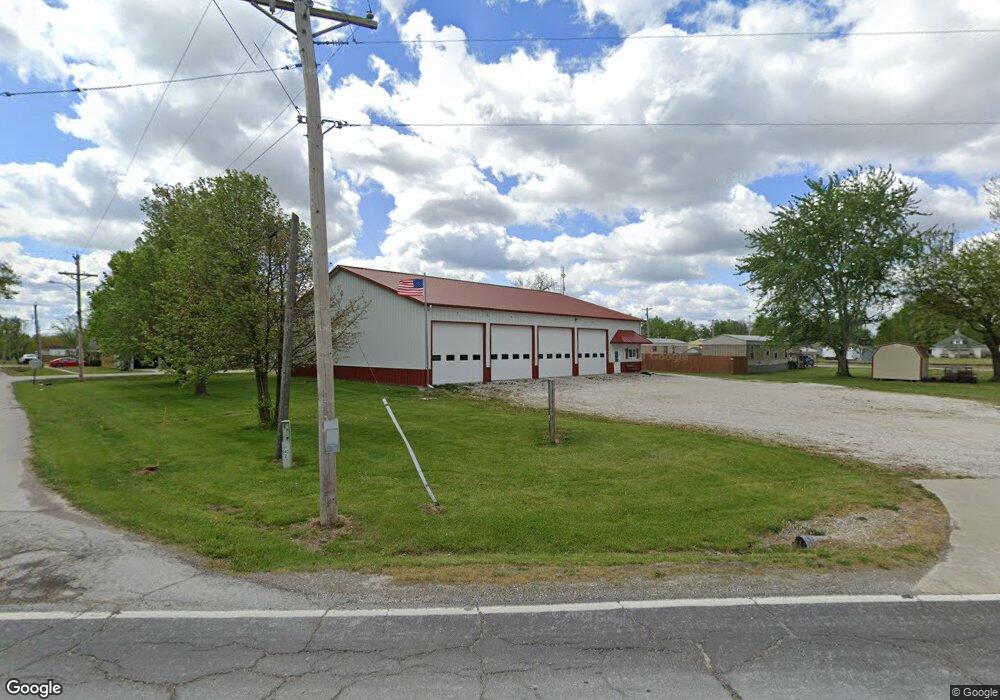
This home is located at 100 Middle St, Clark, MO 65243 and is currently estimated at $345,000. 100 Middle St is a home with nearby schools including Renick Elementary School and Terrill Road Christian Academy.
Ownership History
Date
Name
Owned For
Owner Type
Purchase Details
Closed on
Mar 28, 2023
Sold by
Barker Phyllis A
Bought by
Phyllis Ann Barker Legacy Trust
Current Estimated Value
Purchase Details
Closed on
Nov 1, 2022
Sold by
Beauchamp Steven W
Bought by
Beauchamp Steven W and Steven And Terry Beauchamp Legacy Trust
Purchase Details
Closed on
Jul 30, 2012
Sold by
Hart Mike and Hart Rhonda
Bought by
Southeastern Randolph Fire Protection Di
Purchase Details
Closed on
Oct 13, 2009
Sold by
Hart Mike and Hart Rhonda
Bought by
Hart Shirley J and Shirley J Hart Trust
Create a Home Valuation Report for This Property
The Home Valuation Report is an in-depth analysis detailing your home's value as well as a comparison with similar homes in the area
Purchase History
| Date | Buyer | Sale Price | Title Company |
|---|---|---|---|
| Phyllis Ann Barker Legacy Trust | -- | -- | |
| Beauchamp Steven W | -- | None Listed On Document | |
| Schumann Michael A | -- | None Listed On Document | |
| Southeastern Randolph Fire Protection Di | -- | -- | |
| Hart Shirley J | -- | -- |
Source: Public Records
Tax History
| Year | Tax Paid | Tax Assessment Tax Assessment Total Assessment is a certain percentage of the fair market value that is determined by local assessors to be the total taxable value of land and additions on the property. | Land | Improvement |
|---|---|---|---|---|
| 2025 | -- | $0 | $0 | $0 |
| 2024 | -- | $0 | $0 | $0 |
| 2023 | -- | $0 | $0 | $0 |
| 2022 | -- | $0 | $0 | $0 |
| 2020 | $0 | $0 | $0 | $0 |
| 2019 | $0 | $0 | $0 | $0 |
| 2018 | $0 | $0 | $0 | $0 |
| 2017 | $0 | $0 | $0 | $0 |
| 2016 | -- | $0 | $0 | $0 |
| 2014 | -- | $0 | $0 | $0 |
| 2013 | -- | $0 | $0 | $0 |
| 2012 | -- | $380 | $0 | $0 |
Source: Public Records
Map
Nearby Homes
- 1040 Private Road 2628
- 1473 County Road 2645
- 1006 County Road 2640
- 10 AC +/- County Road 2633
- TBD County Road 2633
- 0 County Road 2633
- Lot 2 County Road 2605
- Tract 4 County Road 2605
- 2428 County Road 2760
- 0 S Ridge Subdivision Unit 413906
- 0 S Ridge Subdivision Unit 18-417
- 0 S Ridge Subdivision Unit 413910
- 0 S Ridge Subdivision Unit 413908
- 0 S Ridge Subdivision Unit 413909
- 0 S Ridge Subdivision Unit 18-416
- 0 S Ridge Subdivision Unit 18-418
- 0 S Ridge Subdivision Unit 22-6
- 912 Destinee Dr
- 913 Destinee Dr
- 900 Destinee Dr
Your Personal Tour Guide
Ask me questions while you tour the home.