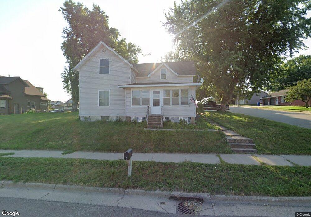
100 N Main St Altura, MN 55910
Estimated Value: $201,972 - $256,000
3
Beds
1
Bath
1,496
Sq Ft
$149/Sq Ft
Est. Value
About This Home
This home is located at 100 N Main St, Altura, MN 55910 and is currently estimated at $222,493, approximately $148 per square foot. 100 N Main St is a home located in Winona County with nearby schools including Lewiston-Altura Secondary School.
Ownership History
Date
Name
Owned For
Owner Type
Purchase Details
Closed on
Dec 18, 2020
Sold by
Walkes Melaney E
Bought by
Maker Ashlee A
Current Estimated Value
Home Financials for this Owner
Home Financials are based on the most recent Mortgage that was taken out on this home.
Original Mortgage
$139,583
Outstanding Balance
$124,271
Interest Rate
2.7%
Mortgage Type
New Conventional
Estimated Equity
$98,223
Purchase Details
Closed on
Mar 14, 2016
Sold by
Horvat Daniel Daniel
Bought by
Walkes Melaney Melaney
Home Financials for this Owner
Home Financials are based on the most recent Mortgage that was taken out on this home.
Original Mortgage
$121,754
Interest Rate
3.68%
Create a Home Valuation Report for This Property
The Home Valuation Report is an in-depth analysis detailing your home's value as well as a comparison with similar homes in the area
Home Values in the Area
Average Home Value in this Area
Purchase History
| Date | Buyer | Sale Price | Title Company |
|---|---|---|---|
| Maker Ashlee A | $143,900 | Town N Country Title Llc | |
| Walkes Melaney Melaney | $124,000 | -- | |
| Maker Ashlee Ashlee | $143,900 | -- |
Source: Public Records
Mortgage History
| Date | Status | Borrower | Loan Amount |
|---|---|---|---|
| Open | Maker Ashlee A | $139,583 | |
| Previous Owner | Walkes Melaney Melaney | $121,754 | |
| Closed | Maker Ashlee Ashlee | $139,583 |
Source: Public Records
Tax History Compared to Growth
Tax History
| Year | Tax Paid | Tax Assessment Tax Assessment Total Assessment is a certain percentage of the fair market value that is determined by local assessors to be the total taxable value of land and additions on the property. | Land | Improvement |
|---|---|---|---|---|
| 2025 | $1,810 | $182,700 | $23,700 | $159,000 |
| 2024 | $1,810 | $169,900 | $23,200 | $146,700 |
| 2023 | $1,326 | $170,800 | $23,200 | $147,600 |
| 2022 | $1,174 | $154,100 | $21,600 | $132,500 |
| 2021 | $1,098 | $128,500 | $18,700 | $109,800 |
| 2020 | $1,084 | $117,700 | $17,200 | $100,500 |
| 2019 | $1,062 | $117,700 | $17,200 | $100,500 |
| 2018 | $1,022 | $115,200 | $16,500 | $98,700 |
| 2017 | $1,052 | $0 | $0 | $0 |
| 2016 | $966 | $0 | $0 | $0 |
| 2015 | $966 | $0 | $0 | $0 |
| 2014 | $986 | $0 | $0 | $0 |
Source: Public Records
Map
Nearby Homes
- 16 2nd St SE
- TBD County Road 27
- 1260 N Main St
- 1185 Fairwater Dr
- 275 Pheasant Run
- 265 Pheasant Run
- 245 Pheasant Run
- 235 Pheasant Run
- 220 Pheasant Run
- 230 Pheasant Run
- 225 Pheasant Run
- 215 Pheasant Run
- 210 Pheasant Run
- 210 Sweetwater Dr
- 205 Sweetwater Dr
- 215 Sweetwater Dr
- 17 Williams St
- 140 W Main St
- 390 E Main St
- 570 Harrison St