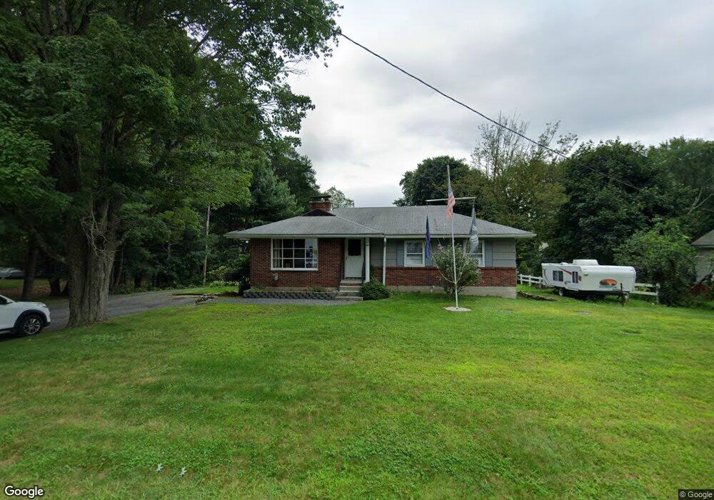
100 Nicholas Ave Boylston, MA 01505
Estimated Value: $471,487 - $593,000
4
Beds
3
Baths
1,826
Sq Ft
$279/Sq Ft
Est. Value
About This Home
This home is located at 100 Nicholas Ave, Boylston, MA 01505 and is currently estimated at $508,872, approximately $278 per square foot. 100 Nicholas Ave is a home located in Worcester County with nearby schools including Tahanto Regional High School, Gateways Academy, and Central New England Christian Academy.
Ownership History
Date
Name
Owned For
Owner Type
Purchase Details
Closed on
Sep 19, 2018
Sold by
Blais Robert J Sr Est and Tivnan
Bought by
Tivnan Maryann L and Tivnan William V
Current Estimated Value
Home Financials for this Owner
Home Financials are based on the most recent Mortgage that was taken out on this home.
Original Mortgage
$178,500
Outstanding Balance
$154,047
Interest Rate
4.5%
Mortgage Type
VA
Estimated Equity
$354,825
Create a Home Valuation Report for This Property
The Home Valuation Report is an in-depth analysis detailing your home's value as well as a comparison with similar homes in the area
Home Values in the Area
Average Home Value in this Area
Purchase History
| Date | Buyer | Sale Price | Title Company |
|---|---|---|---|
| Tivnan Maryann L | $210,000 | -- |
Source: Public Records
Mortgage History
| Date | Status | Borrower | Loan Amount |
|---|---|---|---|
| Open | Tivnan Maryann L | $178,500 |
Source: Public Records
Tax History
| Year | Tax Paid | Tax Assessment Tax Assessment Total Assessment is a certain percentage of the fair market value that is determined by local assessors to be the total taxable value of land and additions on the property. | Land | Improvement |
|---|---|---|---|---|
| 2025 | $5,391 | $389,800 | $145,200 | $244,600 |
| 2024 | $4,966 | $359,600 | $145,200 | $214,400 |
| 2023 | $4,882 | $339,000 | $137,300 | $201,700 |
| 2022 | $4,391 | $277,200 | $137,300 | $139,900 |
| 2021 | $4,491 | $264,500 | $137,300 | $127,200 |
| 2020 | $3,718 | $224,800 | $109,400 | $115,400 |
| 2019 | $3,494 | $217,800 | $107,300 | $110,500 |
| 2018 | $3,558 | $212,700 | $107,300 | $105,400 |
| 2017 | $3,429 | $212,700 | $107,300 | $105,400 |
| 2016 | $3,482 | $212,700 | $101,900 | $110,800 |
| 2015 | $3,703 | $212,700 | $101,900 | $110,800 |
| 2014 | $3,424 | $196,900 | $91,200 | $105,700 |
Source: Public Records
Map
Nearby Homes
- 291 Sewall St Unit 291
- 289 Sewall St Unit 289
- 4 Poe Ave Unit 1
- 281 Sewall St Unit 281
- 2 Poe Ave Unit 1
- 279 Sewall St Unit 279
- 313 Gulf St
- 5 Ridge Rd
- 230A Gulf St
- 7 Conifer Cir Unit 7
- 2 Clover Glen Cir
- 156 Hillside Village Dr
- 71 Hillside Village Dr
- 13 Fatima Ln
- 69 Santoro Rd
- 22 Huron Ave
- 655 Plantation St Unit 20B
- 740 Burncoat St Unit B
- 58 Osceola Ave
- 35 Arbutus Rd
- 98 Nicholas Ave
- 106 Nicholas Ave
- 94 Nicholas Ave
- 102 Nicholas Ave
- 103 Nicholas Ave
- 99 Nicholas Ave
- 110 Nicholas Ave
- . Nicholas Ave
- 93 Nicholas Ave
- 108 Nicholas Ave
- 109 Nicholas Ave
- 25 Coderre Rd
- 114 Nicholas Ave
- 87 Nicholas Ave
- 115 Nicholas Ave
- 111 Nicholas Ave
- 82 Nicholas Ave
- 120 Nicholas Ave
- 119 Nicholas Ave
- 81 Nicholas Ave
Your Personal Tour Guide
Ask me questions while you tour the home.