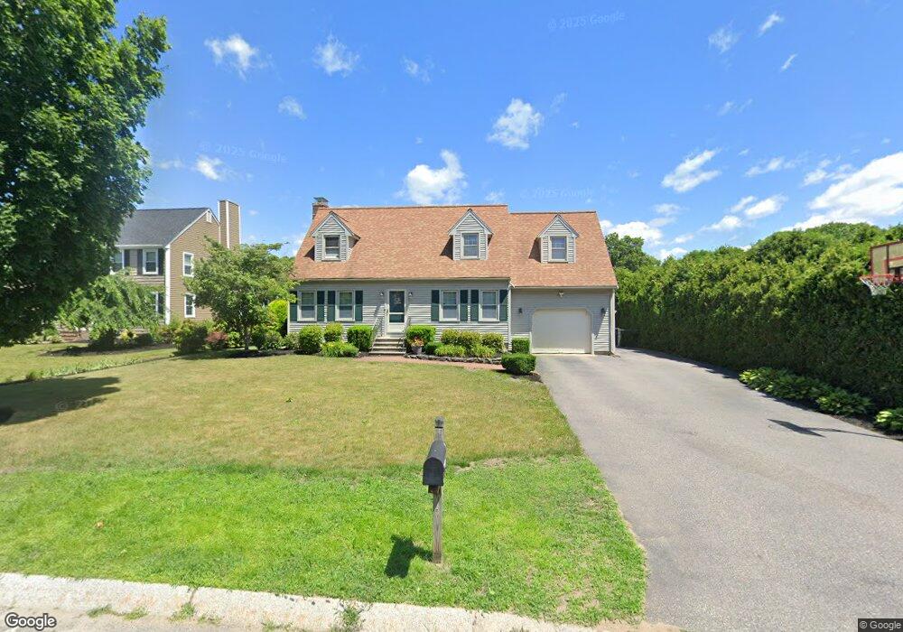
100 Pheasant Ln Bridgewater, MA 02324
Estimated Value: $636,000 - $743,000
3
Beds
3
Baths
2,331
Sq Ft
$302/Sq Ft
Est. Value
About This Home
This home is located at 100 Pheasant Ln, Bridgewater, MA 02324 and is currently estimated at $704,757, approximately $302 per square foot. 100 Pheasant Ln is a home located in Plymouth County with nearby schools including Mitchell Elementary School, Williams Intermediate School, and Bridgewater Middle School.
Ownership History
Date
Name
Owned For
Owner Type
Purchase Details
Closed on
May 27, 2011
Sold by
Fielding Jonathan and Fielding Mary
Bought by
Fielding Mary F
Current Estimated Value
Home Financials for this Owner
Home Financials are based on the most recent Mortgage that was taken out on this home.
Original Mortgage
$200,000
Outstanding Balance
$139,865
Interest Rate
4.94%
Mortgage Type
Purchase Money Mortgage
Estimated Equity
$564,892
Purchase Details
Closed on
Nov 26, 2002
Sold by
Taylor Michael S and Taylor Maureen
Bought by
Fielding Jonathan and Fielding Mary
Home Financials for this Owner
Home Financials are based on the most recent Mortgage that was taken out on this home.
Original Mortgage
$220,000
Interest Rate
6.07%
Mortgage Type
Purchase Money Mortgage
Purchase Details
Closed on
May 27, 1994
Sold by
Genoa Inc
Bought by
Taylor Michael S and Taylor Maureen E
Create a Home Valuation Report for This Property
The Home Valuation Report is an in-depth analysis detailing your home's value as well as a comparison with similar homes in the area
Home Values in the Area
Average Home Value in this Area
Purchase History
| Date | Buyer | Sale Price | Title Company |
|---|---|---|---|
| Fielding Mary F | -- | -- | |
| Fielding Jonathan | $367,500 | -- | |
| Taylor Michael S | $150,600 | -- |
Source: Public Records
Mortgage History
| Date | Status | Borrower | Loan Amount |
|---|---|---|---|
| Open | Fielding Mary F | $200,000 | |
| Previous Owner | Taylor Michael S | $75,000 | |
| Previous Owner | Taylor Michael S | $220,000 | |
| Previous Owner | Taylor Michael S | $10,000 | |
| Previous Owner | Taylor Michael S | $143,000 |
Source: Public Records
Tax History Compared to Growth
Tax History
| Year | Tax Paid | Tax Assessment Tax Assessment Total Assessment is a certain percentage of the fair market value that is determined by local assessors to be the total taxable value of land and additions on the property. | Land | Improvement |
|---|---|---|---|---|
| 2025 | $6,923 | $585,200 | $193,400 | $391,800 |
| 2024 | $6,787 | $559,100 | $184,200 | $374,900 |
| 2023 | $6,715 | $523,000 | $172,100 | $350,900 |
| 2022 | $6,580 | $459,500 | $151,000 | $308,500 |
| 2021 | $5,996 | $414,100 | $134,800 | $279,300 |
| 2020 | $5,920 | $401,900 | $129,600 | $272,300 |
| 2019 | $5,773 | $389,300 | $129,600 | $259,700 |
| 2018 | $5,563 | $366,200 | $119,900 | $246,300 |
| 2017 | $5,312 | $340,300 | $119,900 | $220,400 |
| 2016 | $5,074 | $326,500 | $117,600 | $208,900 |
| 2015 | $5,099 | $314,000 | $114,100 | $199,900 |
| 2014 | $4,995 | $307,400 | $110,700 | $196,700 |
Source: Public Records
Map
Nearby Homes
- 81 Arrowhead Dr
- 20 Prattown Ln
- 0 Three Rivers Dr
- 12 Bridge St
- 865 Plymouth St Unit 865
- 398 Plymouth St
- 45 Edge Hill Dr Unit 47
- 827 High St
- 49 Orange St
- 55 Edge Hill Dr
- 1141 Plymouth St
- 125 Walnut St
- 114 Plain St
- 317 Water St
- 167 Spring St
- 23 Stone Meadow Dr
- 49 Country Dr
- 121 South St
- 67 Country Dr
- 36 Michael Rd
- 90 Pheasant Ln
- 110 Pheasant Ln
- 80 Pheasant Ln
- 95 Pheasant Ln
- 85 Pheasant Ln
- 105 Pheasant Ln
- 120 Pheasant Ln
- 70 Pheasant Ln
- 60 Pheasant Ln
- 135 Pheasant Ln
- 75 Pheasant Ln
- 115 Pheasant Ln
- 50 Pheasant Ln
- 125 Pheasant Ln
- 65 Pheasant Ln
- 55 Pheasant Ln
- 40 Pheasant Ln
- 235 Whitman St
- 30 Pheasant Ln
- 165 Hayward St