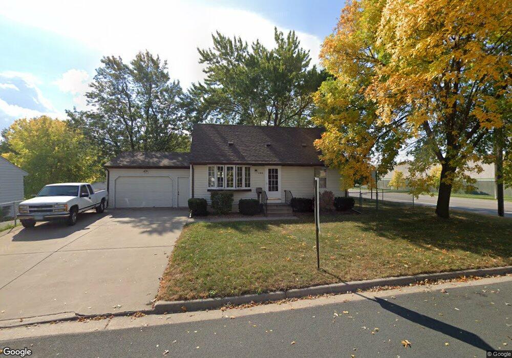
100 Pilot Ave Minneapolis, MN 55421
Estimated Value: $260,000 - $317,000
4
Beds
1
Bath
960
Sq Ft
$305/Sq Ft
Est. Value
About This Home
This home is located at 100 Pilot Ave, Minneapolis, MN 55421 and is currently estimated at $293,273, approximately $305 per square foot. 100 Pilot Ave is a home located in Anoka County with nearby schools including North Park Elementary School, Prodeo Academy, and Immaculate Conception Catholic School.
Ownership History
Date
Name
Owned For
Owner Type
Purchase Details
Closed on
Jan 12, 2017
Bought by
Bernhardt Brett
Current Estimated Value
Home Financials for this Owner
Home Financials are based on the most recent Mortgage that was taken out on this home.
Original Mortgage
$163,856
Outstanding Balance
$134,878
Interest Rate
4.08%
Estimated Equity
$158,395
Create a Home Valuation Report for This Property
The Home Valuation Report is an in-depth analysis detailing your home's value as well as a comparison with similar homes in the area
Home Values in the Area
Average Home Value in this Area
Purchase History
| Date | Buyer | Sale Price | Title Company |
|---|---|---|---|
| Bernhardt Brett | $165,000 | -- |
Source: Public Records
Mortgage History
| Date | Status | Borrower | Loan Amount |
|---|---|---|---|
| Open | Bernhardt Brett | $163,856 |
Source: Public Records
Tax History Compared to Growth
Tax History
| Year | Tax Paid | Tax Assessment Tax Assessment Total Assessment is a certain percentage of the fair market value that is determined by local assessors to be the total taxable value of land and additions on the property. | Land | Improvement |
|---|---|---|---|---|
| 2025 | $2,826 | $257,400 | $69,900 | $187,500 |
| 2024 | $2,742 | $255,700 | $66,900 | $188,800 |
| 2023 | $2,649 | $251,800 | $53,000 | $198,800 |
| 2022 | $2,333 | $270,000 | $63,500 | $206,500 |
| 2021 | $5,550 | $213,800 | $55,900 | $157,900 |
| 2020 | $2,289 | $209,600 | $54,000 | $155,600 |
| 2019 | $2,127 | $201,700 | $50,100 | $151,600 |
| 2018 | $1,821 | $186,500 | $0 | $0 |
| 2017 | $1,694 | $153,700 | $0 | $0 |
| 2016 | $1,542 | $132,100 | $0 | $0 |
| 2015 | $1,473 | $132,100 | $35,700 | $96,400 |
| 2014 | -- | $105,600 | $23,200 | $82,400 |
Source: Public Records
Map
Nearby Homes
- 4928 4th St NE
- 4849 5th St NE
- 5006 6th St NE
- 4532 2nd St NE
- 4717 6th St NE
- 5000 Washington St NE
- 5207 7th St NE
- 613 Sullivan Dr NE
- 4507 5th St NE
- 4408 2nd St NE
- 625 47th Ave NE
- 4559 Washington St NE
- 4438 6th St NE
- 685 49th Ave NE
- 719 49th Ave NE
- 4316 4th St NE
- 4213 Main St NE
- 5337 Lyndale Ave N
- 4228 5th St NE
- 4415 Madison St NE
- 112 Pilot Ave
- 112 Pilot Ave NE
- 124 Pilot Ave
- 101 Pilot Ave
- 113 Pilot Ave
- 101 49th Ave NE
- 113 49th Ave NE
- 125 Pilot Ave
- 125 49th Ave NE
- 136 Pilot Ave
- 137 49th Ave NE
- 137 Pilot Ave
- 148 Pilot Ave
- 112 Gibraltar Rd
- 124 Gibraltar Rd
- 149 Pilot Ave
- 4881 Main St NE
- 149 49th Ave NE
- 100 Gibraltar Rd
- 160 Pilot Ave