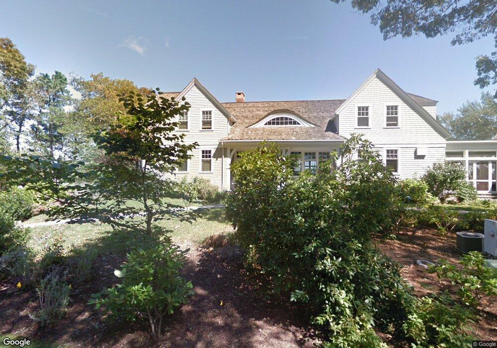
100 Point Isabella Rd Cotuit, MA 02635
Cotuit NeighborhoodEstimated Value: $1,244,000 - $6,188,000
4
Beds
3
Baths
2,701
Sq Ft
$1,588/Sq Ft
Est. Value
About This Home
This home is located at 100 Point Isabella Rd, Cotuit, MA 02635 and is currently estimated at $4,288,159, approximately $1,587 per square foot. 100 Point Isabella Rd is a home located in Barnstable County with nearby schools including West Villages Elementary School, Barnstable United Elementary School, and Barnstable Intermediate School.
Ownership History
Date
Name
Owned For
Owner Type
Purchase Details
Closed on
Nov 24, 2021
Sold by
Maher Kevin D and Maher Michelle M
Bought by
100 Pt Isabella Road Rt
Current Estimated Value
Purchase Details
Closed on
Jun 1, 2009
Sold by
Maher Michelle M
Bought by
Maher Michelle M
Purchase Details
Closed on
May 2, 2000
Sold by
Gikas Evangelos
Bought by
Maher Kevin
Create a Home Valuation Report for This Property
The Home Valuation Report is an in-depth analysis detailing your home's value as well as a comparison with similar homes in the area
Home Values in the Area
Average Home Value in this Area
Purchase History
| Date | Buyer | Sale Price | Title Company |
|---|---|---|---|
| 100 Pt Isabella Road Rt | -- | None Available | |
| Maher Michelle M | -- | -- | |
| Maher Michelle M | -- | -- | |
| Maher Kevin | $2,300,000 | -- |
Source: Public Records
Mortgage History
| Date | Status | Borrower | Loan Amount |
|---|---|---|---|
| Previous Owner | Maher Kevin | $100,000 | |
| Previous Owner | Maher Kevin | $410,000 | |
| Previous Owner | Maher Kevin | $750,000 |
Source: Public Records
Tax History Compared to Growth
Tax History
| Year | Tax Paid | Tax Assessment Tax Assessment Total Assessment is a certain percentage of the fair market value that is determined by local assessors to be the total taxable value of land and additions on the property. | Land | Improvement |
|---|---|---|---|---|
| 2025 | $39,546 | $4,736,100 | $2,175,700 | $2,560,400 |
| 2024 | $35,832 | $4,547,200 | $2,175,700 | $2,371,500 |
| 2023 | $32,123 | $3,837,900 | $1,740,500 | $2,097,400 |
| 2022 | $38,723 | $3,745,000 | $1,992,500 | $1,752,500 |
| 2021 | $34,706 | $3,143,400 | $1,640,900 | $1,502,500 |
| 2020 | $35,886 | $3,064,600 | $1,523,700 | $1,540,900 |
| 2019 | $35,443 | $2,983,400 | $1,611,600 | $1,371,800 |
| 2018 | $34,362 | $2,892,400 | $1,696,400 | $1,196,000 |
| 2017 | $32,837 | $2,782,800 | $1,696,400 | $1,086,400 |
| 2016 | $31,733 | $2,757,000 | $1,670,600 | $1,086,400 |
| 2015 | $27,460 | $2,383,700 | $1,681,100 | $702,600 |
Source: Public Records
Map
Nearby Homes
- 835 Old Post Rd
- 564 Cotuit Bay Dr
- 564 Cotuit Bay Dr
- 71 Sand Point
- 24 Bay Rd
- 359 Baxter Neck Rd
- 431 Baxters Neck Rd
- 25 Oyster Way
- 405 Bridge St
- 98 Bunker Hill Rd
- 426 Old Post Rd
- 64 Bay St
- 135 Putnam Ave
- 920 Main St Unit 1 Building 2
- 920 Main St Unit 2-1
- 440 Grand Island Dr
- Lot 289 Seapuit River B Rd
- Lot 288 Seapuit River A Rd
- 15 Geraldine Rd
- 40 Waterfield Rd
- 120 Point Isabella Rd
- 91 Point Isabella Rd
- 77 Point Isabella Rd
- 82 Point Isabella Rd
- 20 Leeward Way
- 135 Point Isabella Rd
- 62 Point Isabella Rd
- 59 Point Isabella Rd
- 150 Point Isabella Rd
- 54 Point Isabella Rd
- 88 Point Isabella Rd
- 43 Point Isabella Rd
- 40 Point Isabella Rd
- 23 Point Isabella Rd
- 979 Old Post Rd
- 30 Point Isabella Rd
- 851 Old Post Rd
- 28 Point Isabella Rd
- 12 Point Isabella Rd
- 835 & 821 Old Post Rd