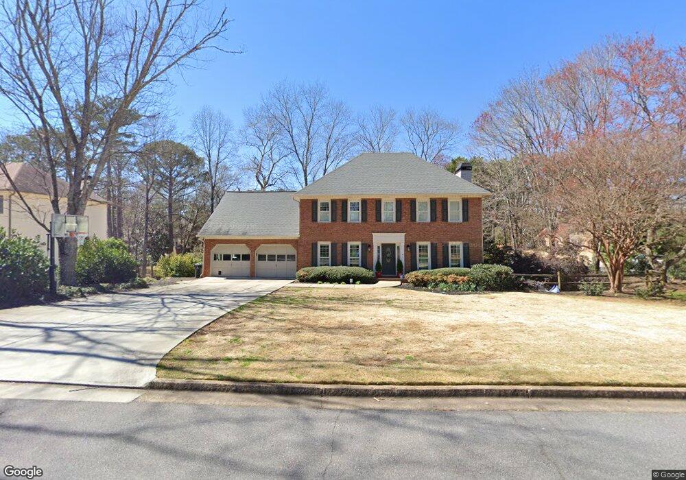
100 Pullman Trail Roswell, GA 30075
Estimated Value: $692,413 - $819,000
4
Beds
3
Baths
2,716
Sq Ft
$280/Sq Ft
Est. Value
About This Home
This home is located at 100 Pullman Trail, Roswell, GA 30075 and is currently estimated at $760,853, approximately $280 per square foot. 100 Pullman Trail is a home located in Fulton County with nearby schools including Roswell North Elementary School, Crabapple Middle School, and Roswell High School.
Ownership History
Date
Name
Owned For
Owner Type
Purchase Details
Closed on
Jul 8, 2016
Sold by
Andrew F
Bought by
Campen Michael B and Campen Katie M
Current Estimated Value
Home Financials for this Owner
Home Financials are based on the most recent Mortgage that was taken out on this home.
Original Mortgage
$413,250
Outstanding Balance
$330,111
Interest Rate
3.6%
Estimated Equity
$430,742
Create a Home Valuation Report for This Property
The Home Valuation Report is an in-depth analysis detailing your home's value as well as a comparison with similar homes in the area
Home Values in the Area
Average Home Value in this Area
Purchase History
| Date | Buyer | Sale Price | Title Company |
|---|---|---|---|
| Campen Michael B | $435,000 | -- |
Source: Public Records
Mortgage History
| Date | Status | Borrower | Loan Amount |
|---|---|---|---|
| Open | Campen Michael B | $413,250 |
Source: Public Records
Tax History
| Year | Tax Paid | Tax Assessment Tax Assessment Total Assessment is a certain percentage of the fair market value that is determined by local assessors to be the total taxable value of land and additions on the property. | Land | Improvement |
|---|---|---|---|---|
| 2025 | $756 | $233,520 | $66,680 | $166,840 |
| 2023 | $5,512 | $195,280 | $34,360 | $160,920 |
| 2022 | $3,123 | $195,280 | $34,360 | $160,920 |
| 2021 | $3,698 | $142,920 | $34,560 | $108,360 |
| 2020 | $3,748 | $134,080 | $34,840 | $99,240 |
| 2019 | $607 | $131,720 | $34,240 | $97,480 |
| 2018 | $3,197 | $128,640 | $33,440 | $95,200 |
| 2017 | $3,067 | $117,080 | $21,880 | $95,200 |
| 2016 | $3,056 | $117,080 | $21,880 | $95,200 |
| 2015 | $3,700 | $117,080 | $21,880 | $95,200 |
| 2014 | $2,907 | $107,920 | $20,160 | $87,760 |
Source: Public Records
Map
Nearby Homes
- 510 Brickleberry Ln
- 1030 Sasha Ln
- 105 Weatherford Place
- 180 Kendemere Pointe
- 240 Park Bridge Ln
- 300 Shelli Ln
- 1010 Crossvine Rd
- 307 Canton Way
- 301 Canton Way
- 335 Alpine Dr
- 7015 Gaineswood Dr
- 80 Fowler Ave
- 1256 Coleman St
- 403 Mill Pond Rd
- 52 Woodstock Rd
- 86 Woodstock Rd
- 604 Mill Pond Rd Unit 604
- 910 Windsor Trail
- 1144 Canton St Unit 205
- 1843 Liberty Ln Unit 311
- 110 Pullman Trail
- 385 Junction Track
- 400 Junction Track Unit 2
- 375 Junction Track
- 120 Pullman Trail
- 425 Junction Track
- 410 Junction Track
- 390 Junction Track
- 115 Pullman Trail
- 435 Junction Track
- 435 Junction Track Unit 2
- 125 Pullman Trail
- 380 Junction Track
- 130 Pullman Trail Unit 2
- 365 Junction Track Unit 1
- 430 Junction Track
- 155 Pullman Trail
- 155 Pullman Trail Unit 409-429
- 355 Junction Track
- 370 Junction Track
Your Personal Tour Guide
Ask me questions while you tour the home.