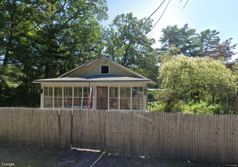
100 Riverside Dr Ashland, NH 03217
Estimated Value: $299,000 - $333,000
2
Beds
1
Bath
898
Sq Ft
$348/Sq Ft
Est. Value
About This Home
This home is located at 100 Riverside Dr, Ashland, NH 03217 and is currently estimated at $312,569, approximately $348 per square foot. 100 Riverside Dr is a home located in Grafton County with nearby schools including Ashland Elementary School and Plymouth Regional High School.
Ownership History
Date
Name
Owned For
Owner Type
Purchase Details
Closed on
Sep 28, 2021
Sold by
Keller Barbara A
Bought by
Barbara A Keller Ret and Keller
Current Estimated Value
Purchase Details
Closed on
Jul 2, 2007
Sold by
Hsbc Mortgage Svcs Inc
Bought by
Keller Barbara
Home Financials for this Owner
Home Financials are based on the most recent Mortgage that was taken out on this home.
Original Mortgage
$132,050
Interest Rate
6.24%
Mortgage Type
Purchase Money Mortgage
Purchase Details
Closed on
Mar 7, 2007
Sold by
Berry Scott A
Bought by
Hsbc Mtg Svcs
Purchase Details
Closed on
Oct 14, 2004
Sold by
Lyford Jamie and Lyford Jennifer
Bought by
Leblanc Daniel J
Home Financials for this Owner
Home Financials are based on the most recent Mortgage that was taken out on this home.
Original Mortgage
$106,250
Interest Rate
5.8%
Mortgage Type
Purchase Money Mortgage
Create a Home Valuation Report for This Property
The Home Valuation Report is an in-depth analysis detailing your home's value as well as a comparison with similar homes in the area
Home Values in the Area
Average Home Value in this Area
Purchase History
| Date | Buyer | Sale Price | Title Company |
|---|---|---|---|
| Barbara A Keller Ret | -- | None Available | |
| Keller Barbara | $139,000 | -- | |
| Hsbc Mtg Svcs | $127,300 | -- | |
| Leblanc Daniel J | $125,000 | -- |
Source: Public Records
Mortgage History
| Date | Status | Borrower | Loan Amount |
|---|---|---|---|
| Previous Owner | Leblanc Daniel J | $132,050 | |
| Previous Owner | Leblanc Daniel J | $106,250 |
Source: Public Records
Tax History Compared to Growth
Tax History
| Year | Tax Paid | Tax Assessment Tax Assessment Total Assessment is a certain percentage of the fair market value that is determined by local assessors to be the total taxable value of land and additions on the property. | Land | Improvement |
|---|---|---|---|---|
| 2024 | $3,817 | $207,550 | $110,100 | $97,450 |
| 2023 | $3,591 | $207,550 | $110,100 | $97,450 |
| 2022 | $3,300 | $118,420 | $48,000 | $70,420 |
| 2021 | $3,253 | $118,420 | $48,000 | $70,420 |
| 2020 | $3,367 | $118,420 | $48,000 | $70,420 |
| 2019 | $3,310 | $118,420 | $48,000 | $70,420 |
| 2018 | $2,875 | $118,420 | $48,000 | $70,420 |
| 2016 | $2,784 | $114,250 | $43,650 | $70,600 |
| 2015 | $2,853 | $114,250 | $43,650 | $70,600 |
| 2013 | $2,870 | $114,250 | $43,650 | $70,600 |
Source: Public Records
Map
Nearby Homes
- 6 Townhouse Way Unit 3
- 202 Thompson St
- 21 Hillside Ave
- 12 Peaked Hill Rd
- 283 River St
- 977 Dana Hill Rd
- 10 Rocky Top Ln
- 00 Hicks Hill Rd
- 479 River Rd
- 37 Old Ledge Rd
- 11 Sebec Rd
- 14 Overlook Rd
- 47 Overlook Rd
- 7 Hollows Rd
- 3A N Ashland Rd
- 1482 River Rd
- 18 Circle Dr Unit 51
- 265 High Country Way
- 206 High Country Way Unit (aka Unit 100)
- 73 Maple Ridge Rd
- 96 Riverside Dr
- 101 Riverside Dr
- 105 Riverside Dr
- 111 Riverside Dr
- 116 Riverside Dr
- 73 Riverside Dr
- 113 Riverside Dr
- 130 Riverside Dr
- 70 Riverside Dr
- 5 Morrell Dr
- 6 Morrell Dr
- 121 Riverside Dr
- 9A Riverside Dr
- Lot#14 Riverside Dr
- 58 Riverside Dr
- 65 Riverside Dr
- 121 Thompson St
- 109 Thompson St
- 59 Riverside Dr
- 21 Summer St