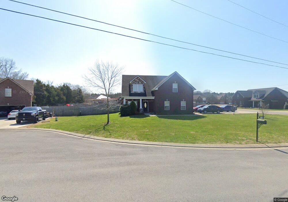
100 Ron Ct Smyrna, TN 37167
Estimated Value: $505,748 - $549,000
4
Beds
3
Baths
2,453
Sq Ft
$215/Sq Ft
Est. Value
About This Home
This home is located at 100 Ron Ct, Smyrna, TN 37167 and is currently estimated at $526,437, approximately $214 per square foot. 100 Ron Ct is a home located in Rutherford County with nearby schools including Smyrna Primary School, Smyrna Middle School, and Smyrna High School.
Ownership History
Date
Name
Owned For
Owner Type
Purchase Details
Closed on
Oct 31, 2017
Sold by
Rhb Llc
Bought by
Leveque Wayne Martin and Leveque Shalaunda
Current Estimated Value
Home Financials for this Owner
Home Financials are based on the most recent Mortgage that was taken out on this home.
Original Mortgage
$234,130
Outstanding Balance
$195,826
Interest Rate
3.78%
Mortgage Type
FHA
Estimated Equity
$330,611
Purchase Details
Closed on
Oct 6, 2017
Sold by
Hollingshead Rental Co Llc
Bought by
Rhb Llc
Home Financials for this Owner
Home Financials are based on the most recent Mortgage that was taken out on this home.
Original Mortgage
$234,130
Outstanding Balance
$195,826
Interest Rate
3.78%
Mortgage Type
FHA
Estimated Equity
$330,611
Purchase Details
Closed on
Oct 31, 2016
Sold by
Rhb Llc
Bought by
Hollingshead Development Llc
Create a Home Valuation Report for This Property
The Home Valuation Report is an in-depth analysis detailing your home's value as well as a comparison with similar homes in the area
Home Values in the Area
Average Home Value in this Area
Purchase History
| Date | Buyer | Sale Price | Title Company |
|---|---|---|---|
| Leveque Wayne Martin | $238,450 | Premier Land Itle & Escrow L | |
| Rhb Llc | -- | Premier Land Title & Escfow | |
| Hollingshead Development Llc | -- | None Available |
Source: Public Records
Mortgage History
| Date | Status | Borrower | Loan Amount |
|---|---|---|---|
| Open | Leveque Wayne Martin | $234,130 |
Source: Public Records
Tax History
| Year | Tax Paid | Tax Assessment Tax Assessment Total Assessment is a certain percentage of the fair market value that is determined by local assessors to be the total taxable value of land and additions on the property. | Land | Improvement |
|---|---|---|---|---|
| 2025 | $2,531 | $99,950 | $13,750 | $86,200 |
| 2024 | $2,400 | $99,950 | $13,750 | $86,200 |
| 2023 | $2,400 | $99,950 | $13,750 | $86,200 |
| 2022 | $2,140 | $99,950 | $13,750 | $86,200 |
| 2021 | $2,075 | $71,075 | $12,500 | $58,575 |
| 2020 | $2,075 | $71,075 | $12,500 | $58,575 |
| 2019 | $2,075 | $71,075 | $12,500 | $58,575 |
Source: Public Records
Map
Nearby Homes
- 300 Patsy Place
- 7672 Knobdate Rd
- 7909 Corey Dr
- 7649 Knobdate Rd
- 5482 Rooker Rd
- 5496 Rooker Rd
- 5572 Rooker Rd
- 5620 Rooker Rd
- 7901 W Buckeye Bottom Rd
- 7018 Mudshark Place
- 8210 Minehead Dr
- 8005 Valencia Dr
- 9001 Lomond Dr
- 10000 Syracuse Dr
- 7005 Clara Ct
- 0 Buckeye Bottom Rd Unit RTC2653088
- 9800 Florence Rd
- 0 W Buckeye Bottom Rd Unit RTC3131217
- 415 Lawson Rd
- 112 Lakewood Cir
Your Personal Tour Guide
Ask me questions while you tour the home.