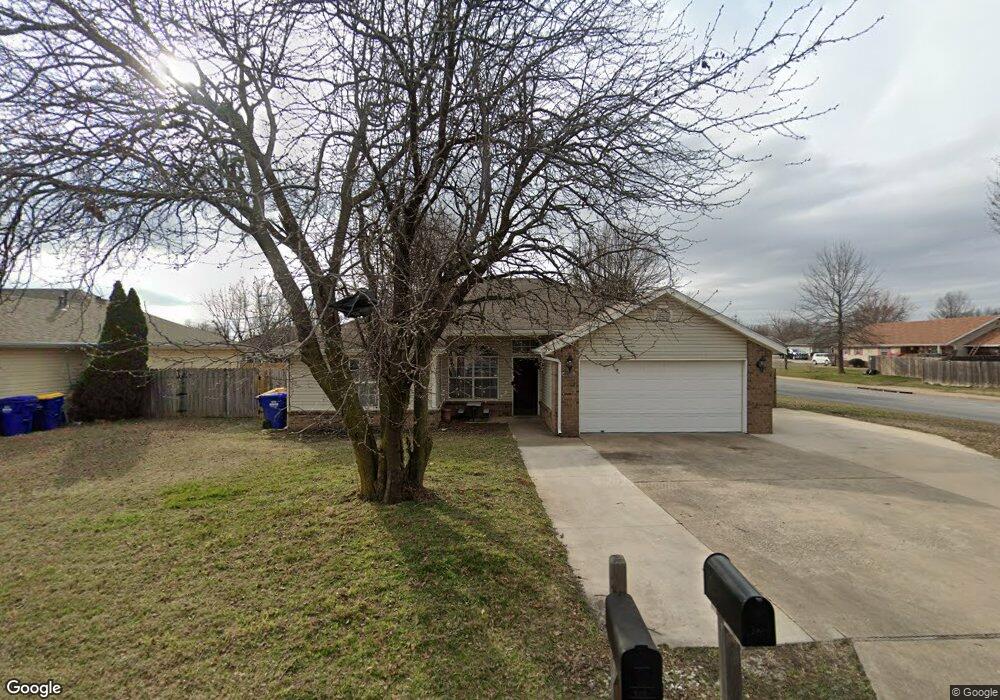
100 S Michael St Lowell, AR 72745
Estimated Value: $266,990 - $291,000
3
Beds
2
Baths
1,375
Sq Ft
$201/Sq Ft
Est. Value
About This Home
This home is located at 100 S Michael St, Lowell, AR 72745 and is currently estimated at $276,748, approximately $201 per square foot. 100 S Michael St is a home located in Benton County with nearby schools including Lowell Elementary School, Kirksey Middle School, and Rogers High School.
Ownership History
Date
Name
Owned For
Owner Type
Purchase Details
Closed on
Feb 16, 2010
Sold by
Hernandez Ana Maritza and Hernandez Julio Cesar
Bought by
Hernandez Ana Maritza
Current Estimated Value
Home Financials for this Owner
Home Financials are based on the most recent Mortgage that was taken out on this home.
Original Mortgage
$73,744
Interest Rate
4.98%
Mortgage Type
FHA
Purchase Details
Closed on
Mar 29, 2004
Bought by
Umana
Purchase Details
Closed on
Jul 2, 2002
Bought by
Zimmerman
Purchase Details
Closed on
Sep 24, 1997
Bought by
Stewart
Purchase Details
Closed on
Feb 28, 1997
Bought by
Easterling 5Lts
Create a Home Valuation Report for This Property
The Home Valuation Report is an in-depth analysis detailing your home's value as well as a comparison with similar homes in the area
Home Values in the Area
Average Home Value in this Area
Purchase History
We collect this data history from publicly available records. To have your information removed, we recommend requesting removal directly through your county’s website.
| Date | Buyer | Sale Price | Title Company |
|---|---|---|---|
| Hernandez Ana Maritza | -- | Service Link | |
| Umana | $100,000 | -- | |
| Umana | $100,000 | -- | |
| Zimmerman | $90,000 | -- | |
| Stewart | $74,000 | -- | |
| Easterling 5Lts | $75,000 | -- |
Source: Public Records
Mortgage History
We collect this data history from publicly available records. To have your information removed, we recommend requesting removal directly through your county’s website.
| Date | Status | Borrower | Loan Amount |
|---|---|---|---|
| Closed | Hernandez Ana Maritza | $73,744 |
Source: Public Records
Tax History
| Year | Tax Paid | Tax Assessment Tax Assessment Total Assessment is a certain percentage of the fair market value that is determined by local assessors to be the total taxable value of land and additions on the property. | Land | Improvement |
|---|---|---|---|---|
| 2025 | $1,660 | $49,736 | $15,200 | $34,536 |
| 2024 | $1,468 | $49,736 | $15,200 | $34,536 |
| 2023 | $1,398 | $31,660 | $7,200 | $24,460 |
| 2022 | $1,091 | $31,660 | $7,200 | $24,460 |
| 2021 | $1,019 | $31,660 | $7,200 | $24,460 |
| 2020 | $955 | $22,860 | $4,000 | $18,860 |
| 2019 | $921 | $22,860 | $4,000 | $18,860 |
| 2018 | $946 | $22,860 | $4,000 | $18,860 |
| 2017 | $850 | $22,860 | $4,000 | $18,860 |
| 2016 | $850 | $22,860 | $4,000 | $18,860 |
| 2015 | $1,143 | $21,490 | $4,400 | $17,090 |
| 2014 | $793 | $21,490 | $4,400 | $17,090 |
Source: Public Records
Map
Nearby Homes
- 806 Henrietta Place
- 303 Poppy St
- 206 N Old Wire Rd
- 444 Beaunoir Ave
- 432 Beaunoir Ave
- 428 Beaunoir Ave
- 433 Beaunoir Ave
- 456 Beaunoir Ave
- 460 Beaunoir Ave
- 1005 Marquis Ave
- 464 Beaunoir Ave
- 0 Presidential Dr Unit 1317772
- 468 Beaunoir Ave
- 617 Albarossa Ave
- 472 Beaunoir Ave
- 605 Albarossa Ave
- 609 Albarossa Ave
- 601 Albarossa Ave
- 613 Albarossa Ave
- 1013 Marquis Ave
- 104 S Michael St
- 101 S Bailey St
- 105 S Bailey St
- 100 N Michael St
- 101 S Michael St
- 108 S Michael St
- 101 N Bailey St
- 105 S Michael St
- 109 S Bailey St
- 0 S Bailey St
- 101 N Michael St
- 104 N Michael St
- 109 S Michael St
- 112 S Michael St
- 105 N Bailey St
- 100 S Bailey St
- 113 S Bailey St
- 100 S Oak St
- 103 N Michael St
- 104 S Bailey St
Your Personal Tour Guide
Ask me questions while you tour the home.