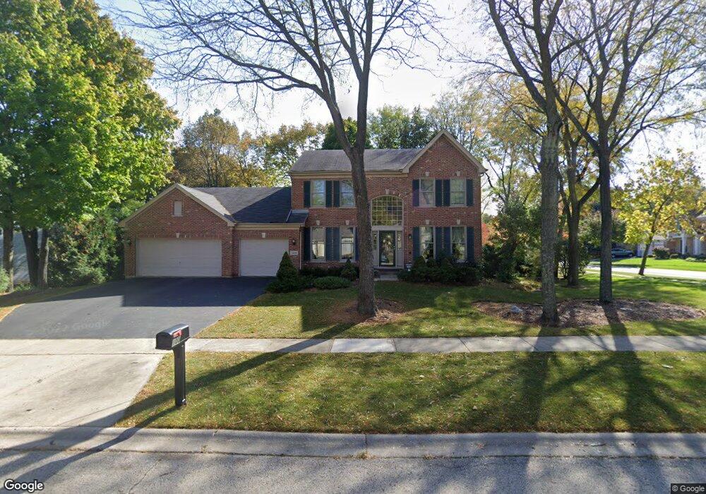
100 S Oakleaf Rd Algonquin, IL 60102
Estimated Value: $453,347 - $588,000
4
Beds
3
Baths
2,540
Sq Ft
$202/Sq Ft
Est. Value
About This Home
This home is located at 100 S Oakleaf Rd, Algonquin, IL 60102 and is currently estimated at $513,837, approximately $202 per square foot. 100 S Oakleaf Rd is a home located in McHenry County with nearby schools including Westfield Community School, Lincoln Prairie Elementary School, and Harry D Jacobs High School.
Ownership History
Date
Name
Owned For
Owner Type
Purchase Details
Closed on
Sep 10, 2007
Sold by
Strand Gunnel E
Bought by
Strand Gunnel E and Gunnel E Strand Trust
Current Estimated Value
Purchase Details
Closed on
Nov 30, 1998
Sold by
Boston Carol
Bought by
Strand Gunnel E
Home Financials for this Owner
Home Financials are based on the most recent Mortgage that was taken out on this home.
Original Mortgage
$100,000
Outstanding Balance
$23,167
Interest Rate
7.01%
Estimated Equity
$490,670
Purchase Details
Closed on
Aug 2, 1995
Sold by
Kennedy Group Ltd Partnership
Bought by
Boston Carol A
Home Financials for this Owner
Home Financials are based on the most recent Mortgage that was taken out on this home.
Original Mortgage
$250,000
Interest Rate
8.37%
Create a Home Valuation Report for This Property
The Home Valuation Report is an in-depth analysis detailing your home's value as well as a comparison with similar homes in the area
Purchase History
| Date | Buyer | Sale Price | Title Company |
|---|---|---|---|
| Strand Gunnel E | -- | None Available | |
| Strand Gunnel E | $300,000 | -- | |
| Boston Carol A | $290,500 | -- |
Source: Public Records
Mortgage History
| Date | Status | Borrower | Loan Amount |
|---|---|---|---|
| Open | Strand Gunnel E | $100,000 | |
| Previous Owner | Boston Carol A | $250,000 |
Source: Public Records
Tax History
| Year | Tax Paid | Tax Assessment Tax Assessment Total Assessment is a certain percentage of the fair market value that is determined by local assessors to be the total taxable value of land and additions on the property. | Land | Improvement |
|---|---|---|---|---|
| 2024 | $10,132 | $145,522 | $27,717 | $117,805 |
| 2023 | $9,556 | $130,151 | $24,789 | $105,362 |
| 2022 | $9,439 | $121,060 | $27,831 | $93,229 |
| 2021 | $9,031 | $112,782 | $25,928 | $86,854 |
| 2020 | $8,781 | $108,789 | $25,010 | $83,779 |
| 2019 | $8,551 | $104,125 | $23,938 | $80,187 |
| 2018 | $8,705 | $102,330 | $23,526 | $78,804 |
| 2017 | $8,504 | $96,401 | $22,163 | $74,238 |
| 2016 | $8,351 | $90,416 | $20,787 | $69,629 |
| 2013 | -- | $85,599 | $19,391 | $66,208 |
Source: Public Records
Map
Nearby Homes
- 145 S Oakleaf Rd
- 7 Falcon Ridge Ct
- 14 Wander Way
- 101 Oakleaf Rd
- 113 Pheasant Trail
- 1920 Jester Ln
- 135 Arquilla Dr
- 681 Majestic Dr
- 1431 Essex St
- 2380 Dawson Ln Unit 165
- 700 Fairfield Ln
- 1354 Essex St Unit 2
- LOT 3 Blackhawk Dr
- 760 Regal Ln
- 1820 Crofton Dr
- 13 Brian Ct
- 521 Pawnee Dr
- 74 Harvest Gate
- 338 Hiawatha Dr
- 1157 Sawmill Ln
- 155 Salford Dr
- 110 S Oakleaf Rd
- 85 S Oakleaf Rd
- 140 Salford Dr
- 165 Salford Dr
- 95 S Oakleaf Rd
- 120 S Oakleaf Rd
- 10 Portsmith Ct
- 150 Salford Dr
- 2 Salford Ct
- 3 Salford Ct
- 105 S Oakleaf Rd
- 160 Salford Dr
- 8 Portsmith Ct
- 130 S Oakleaf Rd Unit 4
- 175 Salford Dr
- 80 S Oakleaf Rd
- 4 Salford Ct Unit 2
- 7 Portsmith Ct
- 115 S Oakleaf Rd
Your Personal Tour Guide
Ask me questions while you tour the home.