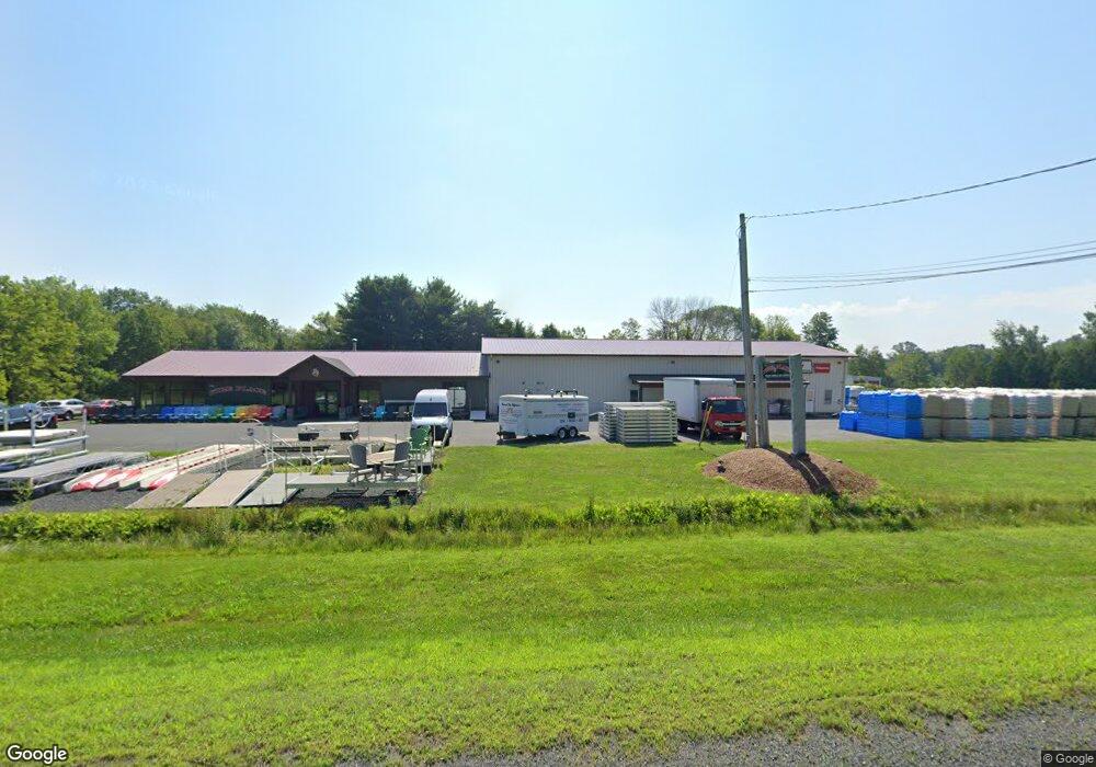
100 State Rd South Deerfield, MA 01373
Estimated Value: $1,193,622
--
Bed
--
Bath
6,174
Sq Ft
$193/Sq Ft
Est. Value
About This Home
This home is located at 100 State Rd, South Deerfield, MA 01373 and is currently estimated at $1,193,622, approximately $193 per square foot. 100 State Rd is a home located in Franklin County with nearby schools including Whately Elementary School and Frontier Regional School.
Ownership History
Date
Name
Owned For
Owner Type
Purchase Details
Closed on
Dec 29, 2017
Sold by
Aldt Realty Llc
Bought by
P & M Hldg Llc
Current Estimated Value
Purchase Details
Closed on
Sep 5, 2014
Sold by
Equipm Northwood Power
Bought by
Aldt Realty Llc
Home Financials for this Owner
Home Financials are based on the most recent Mortgage that was taken out on this home.
Original Mortgage
$208,600
Interest Rate
4.12%
Mortgage Type
Commercial
Purchase Details
Closed on
Jan 13, 2011
Sold by
Bennett Raymond and Bennett Ruth
Bought by
Northwood Power Equip
Home Financials for this Owner
Home Financials are based on the most recent Mortgage that was taken out on this home.
Original Mortgage
$510,000
Interest Rate
4.46%
Mortgage Type
Commercial
Create a Home Valuation Report for This Property
The Home Valuation Report is an in-depth analysis detailing your home's value as well as a comparison with similar homes in the area
Home Values in the Area
Average Home Value in this Area
Purchase History
| Date | Buyer | Sale Price | Title Company |
|---|---|---|---|
| P & M Hldg Llc | $700,000 | -- | |
| Aldt Realty Llc | $675,000 | -- | |
| Equipm Northwood Power | -- | -- | |
| Northwood Power Equip | $650,000 | -- |
Source: Public Records
Mortgage History
| Date | Status | Borrower | Loan Amount |
|---|---|---|---|
| Previous Owner | Aldt Realty Llc | $208,600 | |
| Previous Owner | Northwood Power Equip | $510,000 |
Source: Public Records
Tax History Compared to Growth
Tax History
| Year | Tax Paid | Tax Assessment Tax Assessment Total Assessment is a certain percentage of the fair market value that is determined by local assessors to be the total taxable value of land and additions on the property. | Land | Improvement |
|---|---|---|---|---|
| 2025 | $11,574 | $867,600 | $165,500 | $702,100 |
| 2024 | $11,071 | $808,700 | $165,500 | $643,200 |
| 2023 | $10,940 | $770,400 | $157,700 | $612,700 |
| 2022 | $10,562 | $770,400 | $157,700 | $612,700 |
| 2021 | $10,229 | $685,600 | $157,700 | $527,900 |
| 2020 | $10,770 | $687,300 | $154,200 | $533,100 |
| 2019 | $10,585 | $682,000 | $154,200 | $527,800 |
| 2018 | $9,867 | $643,200 | $154,200 | $489,000 |
| 2017 | $10,034 | $643,200 | $154,200 | $489,000 |
| 2016 | $10,041 | $671,200 | $154,200 | $517,000 |
| 2015 | $10,755 | $665,100 | $148,100 | $517,000 |
| 2014 | $10,489 | $665,100 | $148,100 | $517,000 |
Source: Public Records
Map
Nearby Homes
- 0 North St Unit 73407299
- 320 West St
- 32 Swamp Rd
- 151 Pantry Rd
- 147 Pantry Rd
- 3 Depot Rd
- LOT D Mountain Rd
- 0 Pantry Rd Unit 73430264
- 0 Straits Rd
- 121 West St
- 110 Old Amherst Rd
- 146 Old Amherst Rd
- Lot C Mountain Rd
- Lot A Mountain Rd
- Lot B Mountain Rd
- 15 Crestview Dr
- 24 Elm St
- 24 Graves St
- 15 S Plain Rd
- 33 Eastern Ave