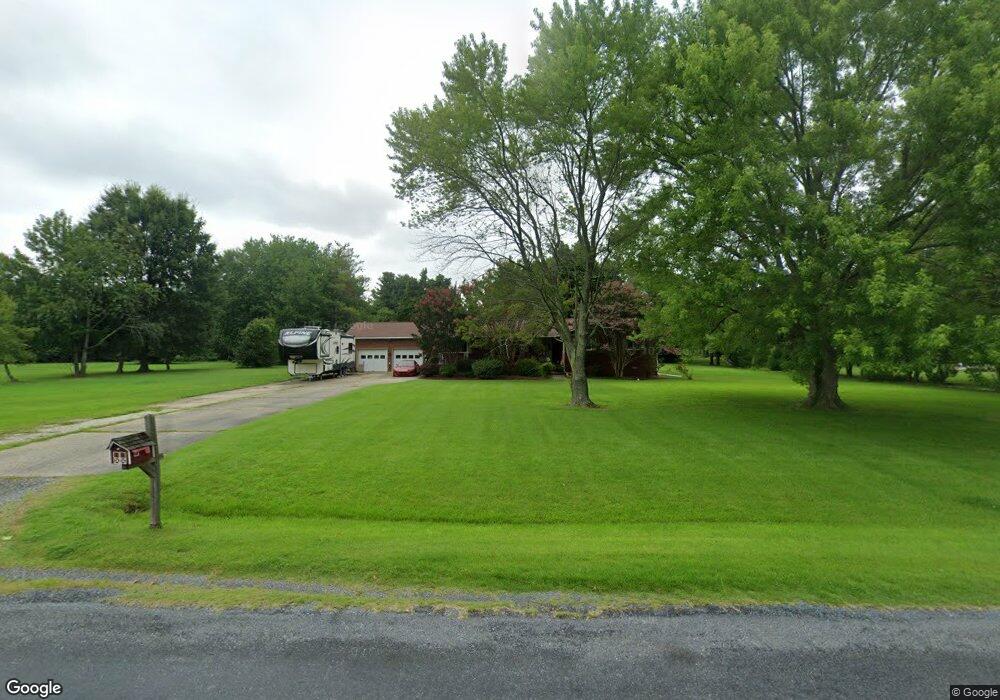
100 Tower Dr Stevensville, MD 21666
Estimated Value: $633,657 - $745,000
--
Bed
3
Baths
2,084
Sq Ft
$322/Sq Ft
Est. Value
About This Home
This home is located at 100 Tower Dr, Stevensville, MD 21666 and is currently estimated at $671,164, approximately $322 per square foot. 100 Tower Dr is a home located in Queen Anne's County with nearby schools including Matapeake Elementary School, Matapeake Middle School, and Kent Island High School.
Ownership History
Date
Name
Owned For
Owner Type
Purchase Details
Closed on
Sep 14, 2004
Sold by
Romeo S
Bought by
Size Victor H and Size Laurie S
Current Estimated Value
Purchase Details
Closed on
Aug 27, 2004
Sold by
Romeo S
Bought by
Size Victor H and Size Laurie S
Purchase Details
Closed on
May 1, 2000
Sold by
Romeo Anis J
Bought by
Romeo Sandra K
Purchase Details
Closed on
Feb 1, 1999
Sold by
Romeo Sandra K
Bought by
Romeo Anis J
Purchase Details
Closed on
Jun 22, 1998
Sold by
Romeo Samuel T and Romeo Anis J
Bought by
Romeo Sandra K
Create a Home Valuation Report for This Property
The Home Valuation Report is an in-depth analysis detailing your home's value as well as a comparison with similar homes in the area
Home Values in the Area
Average Home Value in this Area
Purchase History
| Date | Buyer | Sale Price | Title Company |
|---|---|---|---|
| Size Victor H | $400,500 | -- | |
| Size Victor H | $400,500 | -- | |
| Romeo Sandra K | -- | -- | |
| Romeo Anis J | -- | -- | |
| Romeo Sandra K | -- | -- |
Source: Public Records
Mortgage History
| Date | Status | Borrower | Loan Amount |
|---|---|---|---|
| Closed | Size Victor H | -- |
Source: Public Records
Tax History Compared to Growth
Tax History
| Year | Tax Paid | Tax Assessment Tax Assessment Total Assessment is a certain percentage of the fair market value that is determined by local assessors to be the total taxable value of land and additions on the property. | Land | Improvement |
|---|---|---|---|---|
| 2025 | $4,506 | $478,333 | $0 | $0 |
| 2024 | $4,173 | $442,967 | $0 | $0 |
| 2023 | $3,900 | $407,600 | $165,700 | $241,900 |
| 2022 | $3,841 | $401,367 | $0 | $0 |
| 2021 | $3,790 | $395,133 | $0 | $0 |
| 2020 | $3,790 | $388,900 | $160,700 | $228,200 |
| 2019 | $3,738 | $383,467 | $0 | $0 |
| 2018 | $3,686 | $378,033 | $0 | $0 |
| 2017 | $3,634 | $372,600 | $0 | $0 |
| 2016 | -- | $372,600 | $0 | $0 |
| 2015 | $3,688 | $372,600 | $0 | $0 |
| 2014 | $3,688 | $387,100 | $0 | $0 |
Source: Public Records
Map
Nearby Homes
- 114 N Lake Dr
- 118 N Lake Dr
- 145 N Lake Dr
- 208 Tower Dr
- Lot 1 - E/Kent Point Romancoke
- Lot 8 Ackerman Dr
- 0 Ackerman Dr
- 101 Beachside Dr
- 201 Beachside Dr
- 8905 Romancoke Rd
- 203 Olive Branch Rd
- 312 S Lake Dr
- 210 Pennick Dr
- 214 Pennick Dr
- 213 Pennick Dr
- 102 Golf Ct
- 306 N Lake Rd
- 9401 Romancoke Rd
- 208 Long Point Rd
- 224 Long Point Rd