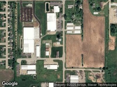
100 Tower Rd Winneconne, WI 54986
--
Bed
--
Bath
--
Sq Ft
1.41
Acres
About This Home
This home is located at 100 Tower Rd, Winneconne, WI 54986. 100 Tower Rd is a home located in Winnebago County with nearby schools including Winneconne Elementary School, Winneconne Middle School, and Winneconne High School.
Ownership History
Date
Name
Owned For
Owner Type
Purchase Details
Closed on
Aug 27, 2020
Sold by
Haak Robert A
Bought by
Haak Tower Road Llc
Purchase Details
Closed on
Apr 13, 2018
Sold by
Haak Robert A
Bought by
Haak Enterprises Llc
Purchase Details
Closed on
May 27, 2016
Sold by
Dietzel Timothy and Dietzel Terri
Bought by
Haak Robert A
Home Financials for this Owner
Home Financials are based on the most recent Mortgage that was taken out on this home.
Original Mortgage
$64,000
Interest Rate
3.59%
Mortgage Type
Commercial
Purchase Details
Closed on
Dec 17, 2013
Sold by
Cranky Pat S Properties Llc
Bought by
Dietzel Timothy and Dietzel Terri L
Home Financials for this Owner
Home Financials are based on the most recent Mortgage that was taken out on this home.
Original Mortgage
$62,000
Interest Rate
4.17%
Mortgage Type
Commercial
Create a Home Valuation Report for This Property
The Home Valuation Report is an in-depth analysis detailing your home's value as well as a comparison with similar homes in the area
Home Values in the Area
Average Home Value in this Area
Purchase History
| Date | Buyer | Sale Price | Title Company |
|---|---|---|---|
| Haak Enterprises Llc | -- | None Available | |
| Haak Robert A | $80,000 | None Available | |
| Dietzel Timothy | $77,500 | None Available |
Source: Public Records
Mortgage History
| Date | Status | Borrower | Loan Amount |
|---|---|---|---|
| Previous Owner | Haak Robert A | $64,000 | |
| Previous Owner | Dietzel Timothy | $62,000 | |
| Previous Owner | Co Earle Enterprises Inc | $70,000 | |
| Previous Owner | Co Earle Enterprises Inc | $69,300 | |
| Previous Owner | Co Cranky Pats Properties Llc | $0 | |
| Previous Owner | Thomas | $95,000 |
Source: Public Records
Tax History Compared to Growth
Tax History
| Year | Tax Paid | Tax Assessment Tax Assessment Total Assessment is a certain percentage of the fair market value that is determined by local assessors to be the total taxable value of land and additions on the property. | Land | Improvement |
|---|---|---|---|---|
| 2023 | $3,223 | $142,400 | $12,000 | $130,400 |
| 2022 | $3,013 | $142,400 | $12,000 | $130,400 |
| 2021 | $2,507 | $142,400 | $12,000 | $130,400 |
| 2020 | $3,203 | $130,200 | $6,000 | $124,200 |
| 2019 | $3,119 | $130,200 | $6,000 | $124,200 |
| 2018 | $3,061 | $130,200 | $6,000 | $124,200 |
| 2017 | $3,033 | $130,200 | $6,000 | $124,200 |
| 2016 | $2,972 | $130,200 | $6,000 | $124,200 |
| 2015 | $3,023 | $130,200 | $6,000 | $124,200 |
| 2014 | -- | $130,200 | $6,000 | $124,200 |
| 2013 | -- | $130,200 | $6,000 | $124,200 |
Source: Public Records
Map
Nearby Homes
- 1119 Poppy Ln
- 1128 Poppy Ln
- 0 Dowling Rd
- 27 S 3rd St
- 919 Elm St
- 169 S 1st St Unit 15
- 169 S 1st St Unit 7
- 620 Oak St
- 311 Captains Ct
- 810 N 9th St
- 104 N 3rd Ave
- 503 E Main St
- 218 N 9th Ave
- 0 Quigley Rd
- 0 Shoreline Dr
- 5429 Broderick Rd
- 6671 Lasley Shore Dr
- 6776 Sunset Trail
- 7108 Clark Point Rd
- 5927 Oak Lane Dr
- 100 Tower Rd
- 0 Tower Rd
- 140 Tower Rd
- 200 W Enterprise Rd
- 95 Tower Rd
- 200 Tower Rd
- 0 Enterprise Rd Unit 50172139
- 917 Grant St
- 903 Grant St
- 1036 Calypso Dr
- 1032 Calypso Dr
- 1040 Calypso Dr
- 1028 Calypso Dr
- 1044 Calypso Dr
- 1024 Calypso Dr
- 1048 Calypso Dr
- 1020 Calypso Dr
- 883 Grant St
- 1016 Calypso Dr
- 1056 Calypso Dr
