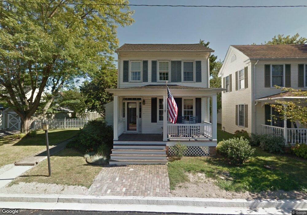
100 W Chew Ave Saint Michaels, MD 21663
Estimated Value: $754,954 - $900,000
--
Bed
2
Baths
2,061
Sq Ft
$406/Sq Ft
Est. Value
About This Home
This home is located at 100 W Chew Ave, Saint Michaels, MD 21663 and is currently estimated at $837,739, approximately $406 per square foot. 100 W Chew Ave is a home located in Talbot County with nearby schools including St. Michaels Elementary School, St. Michaels Middle/High School, and Easton High School.
Ownership History
Date
Name
Owned For
Owner Type
Purchase Details
Closed on
Sep 12, 2002
Sold by
Vannevel Kari A
Bought by
Buckard Kari A and Buckard Matthew H
Current Estimated Value
Purchase Details
Closed on
Jul 12, 1999
Sold by
Kelly Daniel C
Bought by
Vannevel Kari A
Purchase Details
Closed on
Oct 5, 1995
Sold by
Jeffcoat Carlton E and Jeffcoat Nora E
Bought by
Kelly Daniel C
Create a Home Valuation Report for This Property
The Home Valuation Report is an in-depth analysis detailing your home's value as well as a comparison with similar homes in the area
Home Values in the Area
Average Home Value in this Area
Purchase History
| Date | Buyer | Sale Price | Title Company |
|---|---|---|---|
| Buckard Kari A | -- | -- | |
| Vannevel Kari A | $249,000 | -- | |
| Kelly Daniel C | $179,000 | -- |
Source: Public Records
Mortgage History
| Date | Status | Borrower | Loan Amount |
|---|---|---|---|
| Closed | Kelly Daniel C | -- |
Source: Public Records
Tax History Compared to Growth
Tax History
| Year | Tax Paid | Tax Assessment Tax Assessment Total Assessment is a certain percentage of the fair market value that is determined by local assessors to be the total taxable value of land and additions on the property. | Land | Improvement |
|---|---|---|---|---|
| 2025 | $3,756 | $545,800 | $287,800 | $258,000 |
| 2024 | $3,756 | $511,400 | $0 | $0 |
| 2023 | $3,584 | $477,000 | $0 | $0 |
| 2022 | $3,429 | $442,600 | $244,600 | $198,000 |
| 2021 | $3,379 | $433,633 | $0 | $0 |
| 2020 | $3,379 | $424,667 | $0 | $0 |
| 2019 | $3,369 | $415,700 | $213,500 | $202,200 |
| 2018 | $3,279 | $388,500 | $0 | $0 |
| 2017 | $3,149 | $361,300 | $0 | $0 |
| 2016 | $2,785 | $334,100 | $0 | $0 |
| 2015 | $3,013 | $334,100 | $0 | $0 |
| 2014 | $3,013 | $334,100 | $0 | $0 |
Source: Public Records
Map
Nearby Homes
- 107 E Chestnut St
- 100 Grace St
- 105 Seymour Ave
- 0 Grace St Unit MDTA2012346
- 704 Meadow St
- Lot 16A Meadow St
- 222 E Chestnut St
- 216 E Chew Ave
- 807 Radcliff Ave
- 25500 Chance Farm Rd
- 207 Dodson Ave
- 408 Spinnaker Ln
- 300 Perry St
- 912 Calvert Ave
- 216 Brooks Ln
- 228 Tyler Ave
- 24390 Oakwood Park Rd
- 24318 Oakwood Park Rd
- 24912 Back Creek Dr
- 108 Miles
- 600 S Talbot St
- 102 W Chew Ave
- 101 W Marengo St
- 604 N Talbot St
- 604 N Talbot St
- 506 N Talbot St
- 702 S Talbot St
- 604 S Talbot St
- 103 W Chew Ave
- 105 W Chew Ave
- 0 Talbot St Unit 1006870258
- 0 Talbot St Unit 1006870248
- 0 Talbot St Unit 1006760410
- 0 Talbot St Unit 1006728850
- 0 Talbot St Unit 1006728844
- 0 Talbot St Unit 1006502538
- 0 Talbot St Unit 1006350456
- 0 Talbot St Unit TA7394258
- 0 Talbot St Unit TA7696897
- 606 S Talbot St