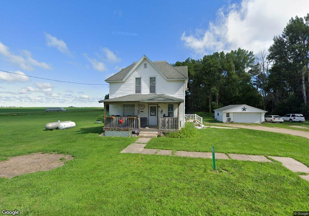
100 Walnut St W Dougherty, IA 50433
Estimated Value: $92,000 - $119,490
4
Beds
1
Bath
1,520
Sq Ft
$68/Sq Ft
Est. Value
About This Home
This home is located at 100 Walnut St W, Dougherty, IA 50433 and is currently estimated at $103,830, approximately $68 per square foot. 100 Walnut St W is a home with nearby schools including West Fork High School.
Ownership History
Date
Name
Owned For
Owner Type
Purchase Details
Closed on
Sep 19, 2014
Sold by
Nagel Lynn R and Nagel Mary B
Bought by
Nagel Ben L and Nagel Nicolette J
Current Estimated Value
Home Financials for this Owner
Home Financials are based on the most recent Mortgage that was taken out on this home.
Original Mortgage
$35,862
Interest Rate
4.15%
Mortgage Type
Purchase Money Mortgage
Purchase Details
Closed on
May 7, 2013
Sold by
Nagel Lynn R and Nagel Mary B
Bought by
Nagel Ben L and Nagel Nicolette J
Purchase Details
Closed on
Sep 28, 2012
Sold by
Weber Mary Eileen
Bought by
Nagel Lynn R and Nagel Mary B
Create a Home Valuation Report for This Property
The Home Valuation Report is an in-depth analysis detailing your home's value as well as a comparison with similar homes in the area
Home Values in the Area
Average Home Value in this Area
Purchase History
| Date | Buyer | Sale Price | Title Company |
|---|---|---|---|
| Nagel Ben L | -- | None Available | |
| Nagel Ben L | $24,500 | None Available | |
| Nagel Lynn R | $21,000 | None Available |
Source: Public Records
Mortgage History
| Date | Status | Borrower | Loan Amount |
|---|---|---|---|
| Closed | Nagel Ben L | $35,862 |
Source: Public Records
Tax History Compared to Growth
Tax History
| Year | Tax Paid | Tax Assessment Tax Assessment Total Assessment is a certain percentage of the fair market value that is determined by local assessors to be the total taxable value of land and additions on the property. | Land | Improvement |
|---|---|---|---|---|
| 2025 | $1,320 | $76,520 | $9,110 | $67,410 |
| 2024 | $1,320 | $74,500 | $9,110 | $65,390 |
| 2023 | $848 | $74,500 | $9,110 | $65,390 |
| 2022 | $606 | $58,030 | $7,020 | $51,010 |
| 2021 | $740 | $42,650 | $7,020 | $35,630 |
| 2020 | $902 | $47,670 | $7,020 | $40,650 |
| 2019 | $792 | $0 | $0 | $0 |
| 2018 | $332 | $0 | $0 | $0 |
| 2017 | $402 | $0 | $0 | $0 |
| 2016 | $354 | $0 | $0 | $0 |
| 2015 | $354 | $0 | $0 | $0 |
| 2014 | $398 | $0 | $0 | $0 |
| 2013 | $358 | $0 | $0 | $0 |
Source: Public Records
Map
Nearby Homes
- 1311 Floyd Line St
- 0 Arlington St
- 00 Arlington St
- 2001 Wren Ave
- 516 Washington St E
- 14546 150th St
- 303 Cherry St
- 702 1st St N
- 627 1st St N
- 227 Westview Dr S
- 222 Thompson St
- 421 Sherman St
- 416 Brickyard Rd
- 402 Brickyard Rd
- 411 Brickyard Rd
- 415 Brickyard Rd
- 400 Brickyard Rd
- 418 Brickyard Rd
- 600 Claydigger Run
- 406 Brickyard Rd