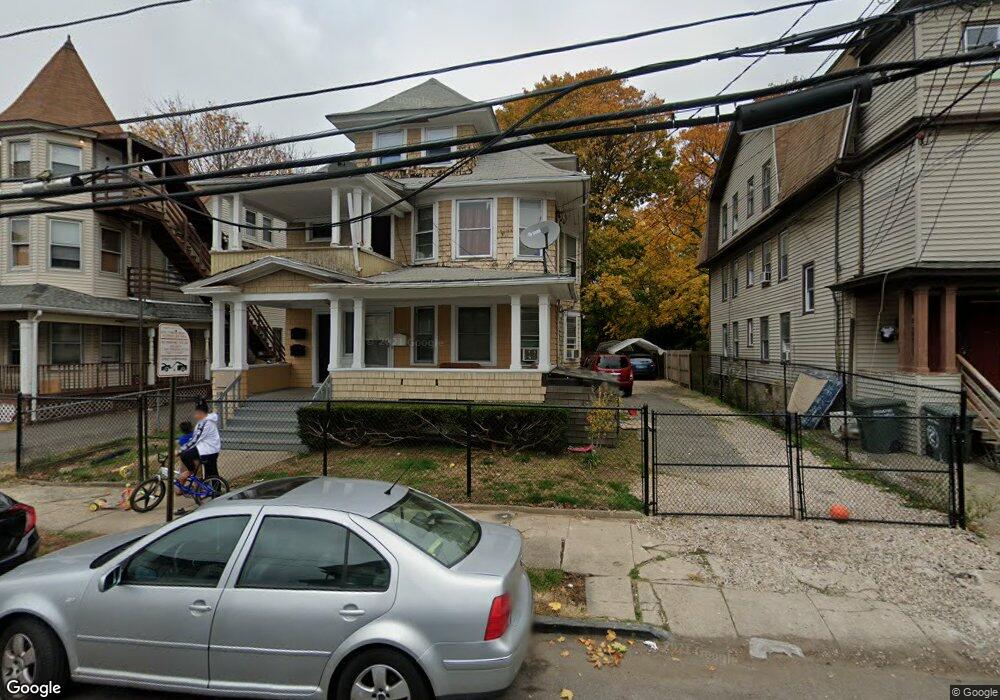
100 Whitney Ave Bridgeport, CT 06606
Brooklawn-Saint Vincent NeighborhoodEstimated Value: $375,793 - $802,000
6
Beds
3
Baths
3,275
Sq Ft
$191/Sq Ft
Est. Value
About This Home
This home is located at 100 Whitney Ave, Bridgeport, CT 06606 and is currently estimated at $625,198, approximately $190 per square foot. 100 Whitney Ave is a home located in Fairfield County with nearby schools including Read School, Central High School, and Catholic Academy of Bridgeport-St. Raphael Academy.
Ownership History
Date
Name
Owned For
Owner Type
Purchase Details
Closed on
Jul 18, 2002
Sold by
Teixeira Oscar F and Tiexeira Linda A
Bought by
Umanzor Rosalin
Current Estimated Value
Home Financials for this Owner
Home Financials are based on the most recent Mortgage that was taken out on this home.
Original Mortgage
$158,100
Interest Rate
6.73%
Create a Home Valuation Report for This Property
The Home Valuation Report is an in-depth analysis detailing your home's value as well as a comparison with similar homes in the area
Home Values in the Area
Average Home Value in this Area
Purchase History
| Date | Buyer | Sale Price | Title Company |
|---|---|---|---|
| Umanzor Rosalin | $186,000 | -- | |
| Umanzor Rosalin | $186,000 | -- |
Source: Public Records
Mortgage History
| Date | Status | Borrower | Loan Amount |
|---|---|---|---|
| Open | Umanzor Rosalin | $264,000 | |
| Closed | Umanzor Rosalin | $158,100 |
Source: Public Records
Tax History Compared to Growth
Tax History
| Year | Tax Paid | Tax Assessment Tax Assessment Total Assessment is a certain percentage of the fair market value that is determined by local assessors to be the total taxable value of land and additions on the property. | Land | Improvement |
|---|---|---|---|---|
| 2025 | $8,852 | $203,730 | $66,610 | $137,120 |
| 2024 | $8,852 | $203,730 | $66,610 | $137,120 |
| 2023 | $8,852 | $203,730 | $66,610 | $137,120 |
| 2022 | $8,852 | $203,730 | $66,610 | $137,120 |
| 2021 | $8,852 | $203,730 | $66,610 | $137,120 |
| 2020 | $7,820 | $144,840 | $40,360 | $104,480 |
| 2019 | $7,820 | $144,840 | $40,360 | $104,480 |
| 2018 | $7,875 | $144,840 | $40,360 | $104,480 |
| 2017 | $7,875 | $144,840 | $40,360 | $104,480 |
| 2016 | $7,875 | $144,840 | $40,360 | $104,480 |
| 2015 | $7,601 | $180,120 | $40,700 | $139,420 |
| 2014 | $7,601 | $180,120 | $40,700 | $139,420 |
Source: Public Records
Map
Nearby Homes
- 76 Porter St
- 2395 Main St Unit 2397
- 330 French St
- 90 Tom Thumb St
- 78 Fairmount Ave
- 724 Capitol Ave Unit 726
- 390 Charles St Unit 106
- 152 River St
- 178 Island Brook Ave
- 119 Madison Terrace
- 31 Taft Ave
- 936 Lindley St
- 508 Hawley Ave
- 957 William St Unit A
- 604 William St
- 106 Manhattan Ave Unit 108
- 318 Center St
- 1014 Noble Ave
- 191 Oak St
- 39 Jane St
- 114 Whitney Ave
- 114 Whitney Ave Unit 3 flr
- 114 Whitney Ave Unit 1 flr
- 114 Whitney Ave Unit 3
- 71 Whitney Ave
- 92 Whitney Ave
- 120 Whitney Ave
- 123 Whitney Ave
- 90 Whitney Ave
- 103 Whitney Ave
- 115 Whitney Ave
- 125 Whitney Ave Unit 2
- 132 Whitney Ave
- 91 Whitney Ave
- 103 Parrott Ave
- 93 Parrott Ave Unit 95
- 131 Whitney Ave Unit 133
- 131 Whitney Ave Unit 131
- 133 Whitney Ave Unit 2
- 133 Whitney Ave Unit 133