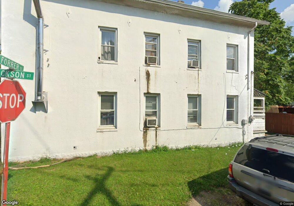
1000 Forrer St Middletown, OH 45044
Amanda-Oneida NeighborhoodEstimated Value: $146,000 - $195,000
3
Beds
2
Baths
1,824
Sq Ft
$93/Sq Ft
Est. Value
About This Home
This home is located at 1000 Forrer St, Middletown, OH 45044 and is currently estimated at $169,062, approximately $92 per square foot. 1000 Forrer St is a home located in Butler County with nearby schools including Amanda Elementary School, Highview 6th Grade Center, and Middletown Middle School.
Ownership History
Date
Name
Owned For
Owner Type
Purchase Details
Closed on
Oct 28, 2015
Sold by
The Ronald Mcglothin Living Trust
Bought by
Mcglothin Ronald
Current Estimated Value
Purchase Details
Closed on
Sep 27, 2007
Sold by
Deutsche Bank National Trust Co
Bought by
Mcglothin Ron
Purchase Details
Closed on
Jun 20, 2007
Sold by
Evans Dean L
Bought by
Deutsche Bank National Trust Co and Morgan Stanley Abs Capital Inc Trust 200
Create a Home Valuation Report for This Property
The Home Valuation Report is an in-depth analysis detailing your home's value as well as a comparison with similar homes in the area
Home Values in the Area
Average Home Value in this Area
Purchase History
| Date | Buyer | Sale Price | Title Company |
|---|---|---|---|
| Mcglothin Ronald | -- | Attorney | |
| Mcglothin Ron | $4,000 | Cornerstone Title Services | |
| Deutsche Bank National Trust Co | $19,800 | None Available |
Source: Public Records
Tax History Compared to Growth
Tax History
| Year | Tax Paid | Tax Assessment Tax Assessment Total Assessment is a certain percentage of the fair market value that is determined by local assessors to be the total taxable value of land and additions on the property. | Land | Improvement |
|---|---|---|---|---|
| 2024 | $1,797 | $34,670 | $8,090 | $26,580 |
| 2023 | $1,791 | $34,670 | $8,090 | $26,580 |
| 2022 | $1,652 | $27,860 | $8,090 | $19,770 |
| 2021 | $1,599 | $27,860 | $8,090 | $19,770 |
| 2020 | $1,665 | $27,860 | $8,090 | $19,770 |
| 2019 | $101 | $1,400 | $1,050 | $350 |
| 2018 | $103 | $1,400 | $1,050 | $350 |
| 2017 | $91 | $1,400 | $1,050 | $350 |
| 2016 | $108 | $1,400 | $1,050 | $350 |
| 2015 | $93 | $1,400 | $1,050 | $350 |
| 2014 | $99 | $11,320 | $8,510 | $2,810 |
| 2013 | $99 | $1,400 | $350 | $1,050 |
Source: Public Records
Map
Nearby Homes
- 1102 Forrer St
- 0 Jackson St Unit 895859
- 0 Jackson St Unit 1780028
- 720 Diamond Loop
- 3113 Rufus St
- 3107 Rufus St
- 3209 Rufus St
- 2900 Morgan St
- 3109 Locust St
- 3620 S Main St
- 1602 Oxford State Rd
- 712 Buena Ave
- 514 Granada Ave
- 1613 Sheridan Ave
- 1702 Glenwood Ave
- 1709 Oxford State Rd
- 1717 Pershing Ave
- 3221 Yankee Rd
- 1511 Meadow Ave
- 2004 Minnesota St
- 1006 Forrer St
- 1/2 Forrer St
- 1001 Jackson Ln
- 1019 Oxford State Rd
- 1005 Forrer St
- 1009 Oxford State Rd
- 1007 Forrer St
- 1015 Oxford State Rd
- 1008 Forrer St
- 1008 Forrer St
- 1009 Forrer St
- 920 Forrer St
- 921 Oxford State Rd
- 1004 Oxford State Rd
- 3202 Ben Harrison St
- 1002 Oxford State Rd
- 1002 Oxford St Rd
- 1027 Oxford State Rd
- 1015 Forrer St
- 918 Forrer St