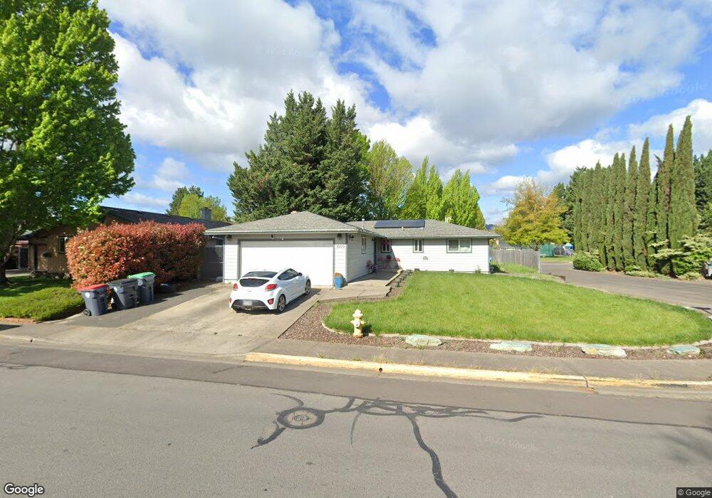
1000 Freeman Rd Central Point, OR 97502
Estimated Value: $323,000 - $389,000
3
Beds
2
Baths
1,251
Sq Ft
$284/Sq Ft
Est. Value
About This Home
This home is located at 1000 Freeman Rd, Central Point, OR 97502 and is currently estimated at $354,740, approximately $283 per square foot. 1000 Freeman Rd is a home located in Jackson County with nearby schools including Central Point Elementary School, Scenic Middle School, and Crater High School.
Ownership History
Date
Name
Owned For
Owner Type
Purchase Details
Closed on
Nov 29, 2018
Sold by
Carlton Mark
Bought by
Moser Chad Martin
Current Estimated Value
Home Financials for this Owner
Home Financials are based on the most recent Mortgage that was taken out on this home.
Original Mortgage
$172,712
Outstanding Balance
$150,966
Interest Rate
4.8%
Mortgage Type
Purchase Money Mortgage
Estimated Equity
$203,774
Purchase Details
Closed on
Apr 12, 2018
Sold by
Sandahl David P and Sandahl Joseph C
Bought by
Carlton Mark
Purchase Details
Closed on
Apr 11, 2018
Sold by
Sandahl David Paul and Sandahl Joseph Carl
Bought by
Carlton Mark
Create a Home Valuation Report for This Property
The Home Valuation Report is an in-depth analysis detailing your home's value as well as a comparison with similar homes in the area
Purchase History
| Date | Buyer | Sale Price | Title Company |
|---|---|---|---|
| Moser Chad Martin | $172,712 | Amerititle | |
| Carlton Mark | $165,000 | First American Title | |
| Carlton Mark | $165,000 | First American Title |
Source: Public Records
Mortgage History
| Date | Status | Borrower | Loan Amount |
|---|---|---|---|
| Open | Moser Chad Martin | $172,712 |
Source: Public Records
Tax History Compared to Growth
Tax History
| Year | Tax Paid | Tax Assessment Tax Assessment Total Assessment is a certain percentage of the fair market value that is determined by local assessors to be the total taxable value of land and additions on the property. | Land | Improvement |
|---|---|---|---|---|
| 2026 | $3,017 | $214,850 | -- | -- |
| 2025 | $2,943 | $208,600 | $59,130 | $149,470 |
| 2024 | $2,943 | $202,530 | $57,410 | $145,120 |
| 2023 | $2,849 | $196,640 | $55,740 | $140,900 |
| 2022 | $2,782 | $196,640 | $55,740 | $140,900 |
| 2021 | $2,703 | $190,920 | $54,120 | $136,800 |
| 2020 | $2,624 | $185,360 | $52,540 | $132,820 |
| 2019 | $3,016 | $174,730 | $49,530 | $125,200 |
| 2018 | $2,924 | $169,650 | $48,090 | $121,560 |
| 2017 | $2,850 | $169,650 | $48,090 | $121,560 |
| 2016 | $2,767 | $159,920 | $45,330 | $114,590 |
| 2015 | $2,651 | $159,920 | $45,330 | $114,590 |
| 2014 | $2,476 | $150,750 | $42,730 | $108,020 |
Source: Public Records
Map
Nearby Homes
- 1065 Edwina Ave
- 755 S 4th St
- 3364 Bursell Rd
- 887 Silver Fox Dr
- 3358 Bursell Rd
- 739 S Haskell St
- 851 Juanita Way
- 827 Isherwood Dr
- 571 Briarwood Dr
- 831 Isherwood Dr
- 834 Isherwood Dr
- 1426 Timothy St
- 555 Freeman Rd Unit 128
- 555 Freeman Rd Unit 254
- 555 Freeman Rd Unit 105
- 555 Freeman Rd Unit 204
- 555 Freeman Rd Unit 209
- 114 Cedar St
- 921 Pittview Ave
- 640 Malabar St
- 1020 Freeman Rd
- 930 Freeman Rd
- 549 Renee Cir
- 920 Freeman Rd
- 600 Edwina Ave
- 1025 Freeman Rd
- 545 Renee Cir
- 1035 Freeman Rd
- 927 Freeman Rd
- 910 Freeman Rd
- 1045 Freeman Rd
- 605 Edwina Ave
- 913 Freeman Rd Unit 1
- 606 Edwina Ave
- 1020 Edwina Ave
- 525 Renee Cir
- 1030 Edwina Ave
- 1101 Freeman Rd
- 607 Edwina Ave
- 900 Freeman Rd