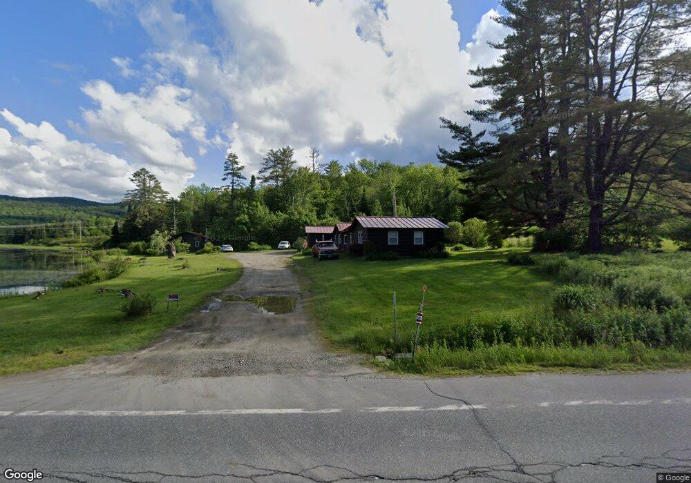
1000 Main St Bethlehem, NH 03574
Estimated Value: $335,000 - $448,000
2
Beds
1
Bath
700
Sq Ft
$577/Sq Ft
Est. Value
About This Home
This home is located at 1000 Main St, Bethlehem, NH 03574 and is currently estimated at $403,621, approximately $576 per square foot. 1000 Main St is a home located in Grafton County with nearby schools including Bethlehem Elementary School, Profile Junior High School, and Profile Senior High School.
Ownership History
Date
Name
Owned For
Owner Type
Purchase Details
Closed on
Jun 28, 2017
Sold by
Garitta Roula
Bought by
Roula Garitta Ret
Current Estimated Value
Purchase Details
Closed on
Dec 16, 2011
Sold by
Montanti John C and Montanti Angela
Bought by
Garitta Bruce and Garitta Roula
Home Financials for this Owner
Home Financials are based on the most recent Mortgage that was taken out on this home.
Original Mortgage
$82,000
Interest Rate
4.01%
Mortgage Type
Purchase Money Mortgage
Purchase Details
Closed on
Aug 8, 2008
Sold by
Tawhid Llc
Bought by
Montanti John C and Montanti Angela
Create a Home Valuation Report for This Property
The Home Valuation Report is an in-depth analysis detailing your home's value as well as a comparison with similar homes in the area
Home Values in the Area
Average Home Value in this Area
Purchase History
| Date | Buyer | Sale Price | Title Company |
|---|---|---|---|
| Roula Garitta Ret | -- | -- | |
| Garitta Bruce | $90,000 | -- | |
| Montanti John C | $150,000 | -- |
Source: Public Records
Mortgage History
| Date | Status | Borrower | Loan Amount |
|---|---|---|---|
| Previous Owner | Montanti John C | $82,000 |
Source: Public Records
Tax History
| Year | Tax Paid | Tax Assessment Tax Assessment Total Assessment is a certain percentage of the fair market value that is determined by local assessors to be the total taxable value of land and additions on the property. | Land | Improvement |
|---|---|---|---|---|
| 2024 | $5,609 | $326,500 | $89,900 | $236,600 |
| 2023 | $5,038 | $326,500 | $89,900 | $236,600 |
| 2022 | $3,603 | $150,800 | $21,100 | $129,700 |
| 2021 | $3,738 | $150,800 | $21,100 | $129,700 |
| 2020 | $3,800 | $150,800 | $21,100 | $129,700 |
| 2019 | $0 | $150,800 | $21,100 | $129,700 |
| 2018 | $2,857 | $150,800 | $21,100 | $129,700 |
| 2017 | $2,713 | $88,300 | $24,700 | $63,600 |
| 2016 | $2,425 | $88,300 | $24,700 | $63,600 |
| 2015 | $2,615 | $88,300 | $24,700 | $63,600 |
| 2013 | $2,510 | $87,900 | $24,300 | $63,600 |
Source: Public Records
Map
Nearby Homes
- 0 Rocks Edge Rd
- 4 Rocks Edge Rd
- 997 Main St
- 41 Millers Run
- 156 Rocks Edge Rd
- 70 Rocks Edge Rd
- 0 Main Brook St Unit 4647926
- 32 Millers Run
- 77 Millers Run
- 61 Millers Run
- 46 Millers Run
- 95 Millers Run
- 58 Millers Run
- 90 Rocks Edge Rd
- 72 Miller's Run
- 1071 Main St
- 72 Millers Run
- 90 Millers Run
- 100 Miller's Run
- 100 Millers Run
Your Personal Tour Guide
Ask me questions while you tour the home.