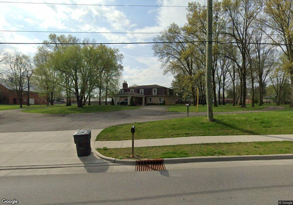
1000 Mount Tabor Rd New Albany, IN 47150
Estimated Value: $442,000 - $740,435
4
Beds
4
Baths
4,000
Sq Ft
$141/Sq Ft
Est. Value
About This Home
This home is located at 1000 Mount Tabor Rd, New Albany, IN 47150 and is currently estimated at $562,359, approximately $140 per square foot. 1000 Mount Tabor Rd is a home located in Floyd County with nearby schools including Hazelwood Middle School, New Albany Senior High School, and Community Montessori.
Ownership History
Date
Name
Owned For
Owner Type
Purchase Details
Closed on
Nov 28, 2016
Sold by
Mennemeyer Steven S and Granger Maria D
Bought by
New Albany City
Current Estimated Value
Purchase Details
Closed on
Jul 3, 2010
Sold by
Mennemeyer Steven
Bought by
Mennemeryer Steven S and Granger Maria D
Purchase Details
Closed on
Jun 8, 2010
Sold by
Wachovia Mortgage Fsb
Bought by
Mennemeyer Steven
Purchase Details
Closed on
Mar 4, 2010
Sold by
Brown Robert H and Brown Rhett C
Bought by
Wachovia Mortgage Fsb and World Savings Bank Fsb
Purchase Details
Closed on
Sep 5, 2006
Sold by
Brown Robert H and Brown Rhett C
Bought by
Brown Robert H
Create a Home Valuation Report for This Property
The Home Valuation Report is an in-depth analysis detailing your home's value as well as a comparison with similar homes in the area
Home Values in the Area
Average Home Value in this Area
Purchase History
| Date | Buyer | Sale Price | Title Company |
|---|---|---|---|
| New Albany City | $23,350 | -- | |
| Mennemeryer Steven S | -- | None Available | |
| Mennemeyer Steven | -- | None Available | |
| Wachovia Mortgage Fsb | $309,162 | None Available | |
| Brown Robert H | -- | None Available |
Source: Public Records
Tax History Compared to Growth
Tax History
| Year | Tax Paid | Tax Assessment Tax Assessment Total Assessment is a certain percentage of the fair market value that is determined by local assessors to be the total taxable value of land and additions on the property. | Land | Improvement |
|---|---|---|---|---|
| 2024 | $5,877 | $560,700 | $57,500 | $503,200 |
| 2023 | $5,086 | $493,600 | $57,500 | $436,100 |
| 2022 | $4,213 | $416,300 | $57,500 | $358,800 |
| 2021 | $3,766 | $370,500 | $57,500 | $313,000 |
| 2020 | $3,859 | $378,600 | $57,500 | $321,100 |
| 2019 | $3,589 | $352,900 | $57,500 | $295,400 |
| 2018 | $4,461 | $375,000 | $57,500 | $317,500 |
| 2017 | $3,946 | $324,800 | $60,000 | $264,800 |
| 2016 | $3,658 | $325,200 | $60,000 | $265,200 |
| 2014 | $3,492 | $300,400 | $60,000 | $240,400 |
| 2013 | -- | $313,200 | $60,000 | $253,200 |
Source: Public Records
Map
Nearby Homes
- 917 Brentwood Ct
- 30 Doebrook Ct
- 1130 Eastridge Dr
- 3903 Rainbow Dr
- 303 Colonial Club Dr
- 213 Colonial Club Dr
- 3105 Murr Ln
- 710 Victoria Ct
- 2705 Charlestown Rd
- 1709 Millerwood Dr
- 4105 Stone Place
- 3828 Payne Koehler Rd
- 1749 McDonald Ln
- 3207 Blackiston Blvd
- 3617 Doe Run Way
- 1672 Garretson Ln
- 3027 Grace Marie Way
- 3021 Grace Marie Way
- Elm Plan at Koehler Woods
- Downing Plan at Koehler Woods
- 1014 Mount Tabor Rd
- 1809 Cliffwood Ct
- 3428 Pennwood Dr
- 1807 Cliffwood Ct
- 3506 E Oakwood Dr
- 3426 Pennwood Dr
- 1811 Cliffwood Ct
- 3510 E Oakwood Dr
- 3430 Pennwood Dr
- 3424 Pennwood Dr
- 1813 Cliffwood Ct
- 1805 Cliffwood Ct
- 3422 Pennwood Dr
- 1808 Cliffwood Ct
- 1013 Mount Tabor Rd
- 3429 Pennwood Dr
- 1810 Cliffwood Ct
- 1815 Cliffwood Ct
- 3425 Pennwood Dr
- 3420 Pennwood Dr