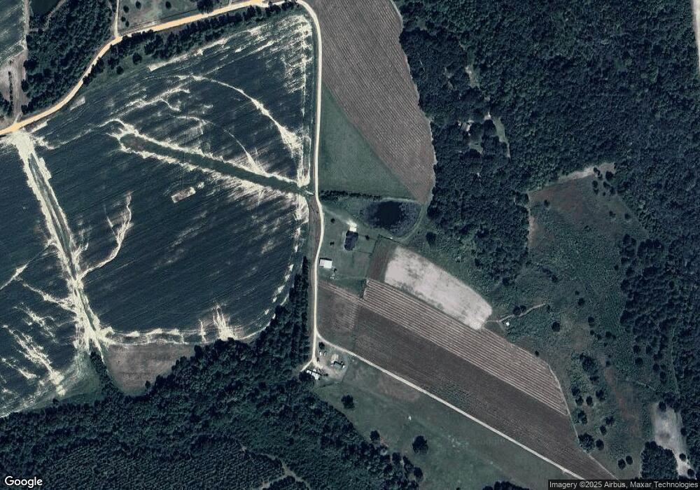
1000 Robert Davis Rd Sycamore, GA 31790
Estimated Value: $198,000 - $404,404
3
Beds
2
Baths
1,991
Sq Ft
$148/Sq Ft
Est. Value
About This Home
This home is located at 1000 Robert Davis Rd, Sycamore, GA 31790 and is currently estimated at $294,135, approximately $147 per square foot. 1000 Robert Davis Rd is a home with nearby schools including Turner County Elementary School, Turner County Middle School, and Turner County High School.
Ownership History
Date
Name
Owned For
Owner Type
Purchase Details
Closed on
Nov 20, 2020
Sold by
Lasseter Stacy
Bought by
Lasseter Stacy and Lasseter April Michelle
Current Estimated Value
Home Financials for this Owner
Home Financials are based on the most recent Mortgage that was taken out on this home.
Original Mortgage
$247,225
Outstanding Balance
$224,123
Interest Rate
3.9%
Mortgage Type
New Conventional
Estimated Equity
$70,012
Purchase Details
Closed on
May 10, 2002
Sold by
Lasseter Stacy
Bought by
Lasseter Kevin
Purchase Details
Closed on
Aug 13, 1999
Sold by
Ashburn Bank
Bought by
Lasseter Stacy
Purchase Details
Closed on
Dec 31, 1998
Sold by
Kendrick Thomas Rand
Bought by
Ashburn Bank
Purchase Details
Closed on
Nov 17, 1995
Bought by
Kendrick Thomas Rand
Create a Home Valuation Report for This Property
The Home Valuation Report is an in-depth analysis detailing your home's value as well as a comparison with similar homes in the area
Home Values in the Area
Average Home Value in this Area
Purchase History
| Date | Buyer | Sale Price | Title Company |
|---|---|---|---|
| Lasseter Stacy | -- | -- | |
| Lasseter Kevin | -- | -- | |
| Lasseter Roy | -- | -- | |
| Lasseter Stacy | -- | -- | |
| Lasseter Stacy | $65,000 | -- | |
| Marchant Michael | $30,000 | -- | |
| Ashburn Bank | -- | -- | |
| Kendrick Thomas Rand | $139,800 | -- |
Source: Public Records
Mortgage History
| Date | Status | Borrower | Loan Amount |
|---|---|---|---|
| Open | Lasseter Stacy | $247,225 |
Source: Public Records
Tax History Compared to Growth
Tax History
| Year | Tax Paid | Tax Assessment Tax Assessment Total Assessment is a certain percentage of the fair market value that is determined by local assessors to be the total taxable value of land and additions on the property. | Land | Improvement |
|---|---|---|---|---|
| 2024 | $3,201 | $133,597 | $23,116 | $110,481 |
| 2023 | $2,330 | $78,538 | $11,710 | $66,828 |
| 2022 | $2,257 | $76,737 | $9,909 | $66,828 |
| 2021 | $224 | $13,229 | $9,909 | $3,320 |
| 2020 | $316 | $15,472 | $10,552 | $4,920 |
| 2019 | $312 | $15,472 | $10,552 | $4,920 |
| 2018 | $1,145 | $35,795 | $10,552 | $25,243 |
| 2015 | -- | $35,795 | $659 | $25,243 |
| 2014 | -- | $35,795 | $659 | $25,243 |
Source: Public Records
Map
Nearby Homes
- 160 E Willis St
- 2633 Us Hwy 41
- 1511 Bussey Rd
- 196 N Mattie Ave
- 196 N Mattie Ave Unit 9-10-11
- 195 Mattie Ave
- 371 Lakeview Dr
- 0 Whiddon Mill Rd Unit 138931
- 0 Whiddon Mill Rd Unit 138434
- 5701 Ga Highway 32 E
- 883 N Railroad Ave
- 547 Joe Lawrence Rd
- 916 Randall H Whiddon Dr
- 500 Joe Lawrence Rd
- 220 E Williams Ave
- 727 Donna Ave
- 0 Story St
- 645 S Main St
- 411 Haley Ave
- 240 Whittle Cir
- 1080 Robert Davis Rd
- 415 Lumsden Ln
- 977 Robert Davis Rd
- 1966 Robert Davis Rd
- 885 Robert Davis Rd
- 1710 Robert Davis Rd
- 530 Irvin Rd
- 2280 Robert Davis Rd
- 2435 Russell Smith Rd
- 2435 Russell Smith Rd
- 351 Robert Davis Rd
- 1144 Irvin Rd
- 354 Leggett Rd
- 338 Leggett Rd
- 611 Gilley Rd
- 304 Leggett Rd
- 5681 Us Highway 41 S
- 5509 U S 41
- 5509 Us Highway 41 S
- 284 Leggett Rd
