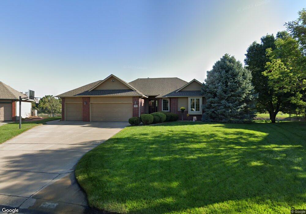
10002 W Greenspoint St Wichita, KS 67205
Aberdeen NeighborhoodEstimated Value: $324,000 - $344,622
3
Beds
3
Baths
1,416
Sq Ft
$236/Sq Ft
Est. Value
About This Home
This home is located at 10002 W Greenspoint St, Wichita, KS 67205 and is currently estimated at $334,311, approximately $236 per square foot. 10002 W Greenspoint St is a home located in Sedgwick County with nearby schools including Vermillion Elementary School, Maize South Elementary School, and Pray-Woodman Elementary.
Ownership History
Date
Name
Owned For
Owner Type
Purchase Details
Closed on
Aug 26, 2005
Sold by
Maxon Carl R and Maxon Kimberly M
Bought by
Mcclure Leslie J and Mcclure Kirk D
Current Estimated Value
Home Financials for this Owner
Home Financials are based on the most recent Mortgage that was taken out on this home.
Original Mortgage
$178,800
Outstanding Balance
$94,211
Interest Rate
5.61%
Mortgage Type
New Conventional
Estimated Equity
$240,100
Create a Home Valuation Report for This Property
The Home Valuation Report is an in-depth analysis detailing your home's value as well as a comparison with similar homes in the area
Home Values in the Area
Average Home Value in this Area
Purchase History
| Date | Buyer | Sale Price | Title Company |
|---|---|---|---|
| Mcclure Leslie J | -- | None Available |
Source: Public Records
Mortgage History
| Date | Status | Borrower | Loan Amount |
|---|---|---|---|
| Open | Mcclure Leslie J | $178,800 |
Source: Public Records
Tax History Compared to Growth
Tax History
| Year | Tax Paid | Tax Assessment Tax Assessment Total Assessment is a certain percentage of the fair market value that is determined by local assessors to be the total taxable value of land and additions on the property. | Land | Improvement |
|---|---|---|---|---|
| 2025 | $4,080 | $37,542 | $9,062 | $28,480 |
| 2023 | $4,080 | $31,522 | $6,210 | $25,312 |
| 2022 | $3,543 | $29,061 | $5,854 | $23,207 |
| 2021 | $3,316 | $27,164 | $4,014 | $23,150 |
| 2020 | $3,095 | $25,381 | $4,014 | $21,367 |
| 2019 | $2,974 | $24,404 | $4,014 | $20,390 |
| 2018 | $2,854 | $23,461 | $3,094 | $20,367 |
| 2017 | $2,676 | $0 | $0 | $0 |
| 2016 | $2,545 | $0 | $0 | $0 |
| 2015 | $2,494 | $0 | $0 | $0 |
| 2014 | $2,459 | $0 | $0 | $0 |
Source: Public Records
Map
Nearby Homes
- 2206 N Chadsworth St
- 9706 W Greenspoint St
- 10009 W Britton St
- 10109 W Sterling Ct
- 9330 W Britton Ct
- 9422 W Sterling St
- 2143 N Byron Rd
- 2410 N Watersedge Cir
- 9111 W 21st St N
- 2134 N Parkdale Ct
- 8811 W Britton Ct
- 10912 W Central Park St
- 9209 W Ryan St
- 3106 N Judith St
- 3141 N Judith St
- 10402 W Westport St
- 1949 N Stoney Point Ct
- 2121 N Rutgers St
- 11008 W Lantana Cir
- 2004 N Shefford St
- 2334 N Valleyview St
- 10006 W Greenspoint St
- 2330 N Valleyview St
- 10010 W Greenspoint St
- 10007 W Greenspoint St
- 10011 W Greenspoint St
- 10014 W Greenspoint St
- 2326 N Valleyview St
- 2409 N Chadsworth Ct
- 2327 N Valleyview St
- 2325 N Chadsworth Ct
- 2329 N Chadsworth Ct
- 2413 N Chadsworth Ct
- 2405 N Chadsworth Ct
- 10015 W Greenspoint St
- 2322 N Valleyview St
- 10018 W Greenspoint St
- 2323 N Valleyview St
- 2321 N Chadsworth Ct
- 2417 N Chadsworth St