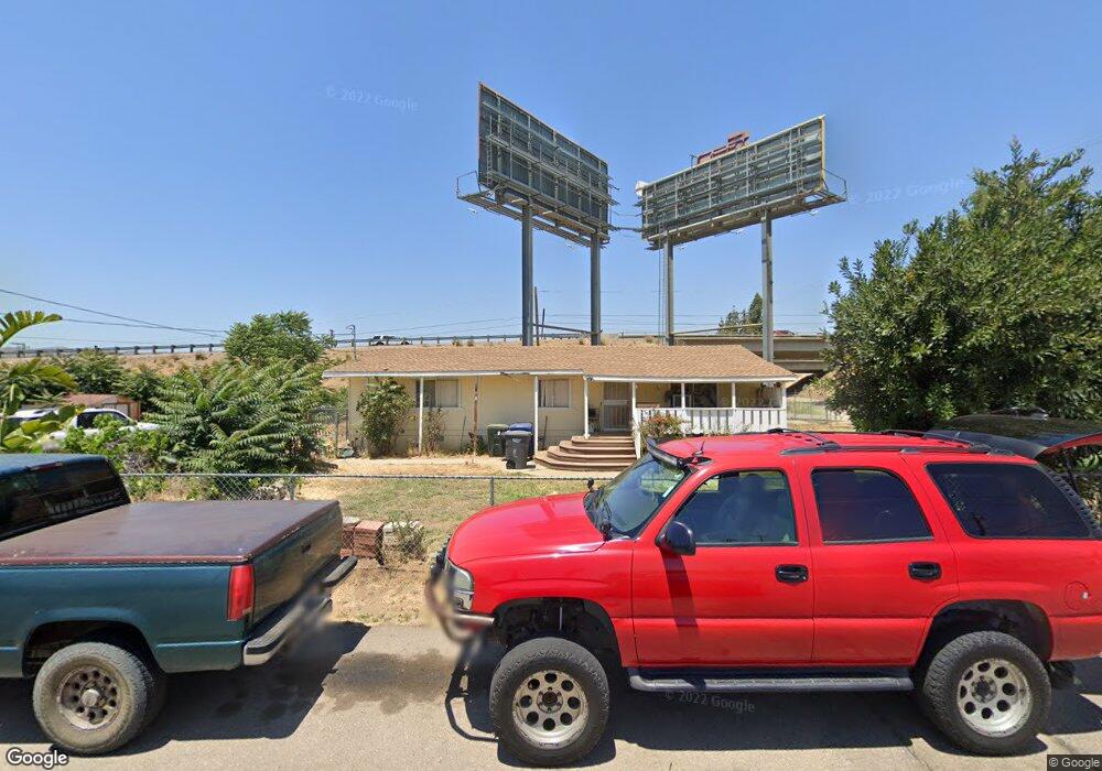
10004 Channel Rd Lakeside, CA 92040
Estimated Value: $636,585 - $709,000
2
Beds
2
Baths
1,152
Sq Ft
$581/Sq Ft
Est. Value
About This Home
This home is located at 10004 Channel Rd, Lakeside, CA 92040 and is currently estimated at $669,146, approximately $580 per square foot. 10004 Channel Rd is a home located in San Diego County with nearby schools including Lakeside Farms Elementary School, Lakeside Middle School, and El Capitan High School.
Ownership History
Date
Name
Owned For
Owner Type
Purchase Details
Closed on
Feb 24, 2020
Sold by
Smith Larry A
Bought by
Smith Larry A
Current Estimated Value
Purchase Details
Closed on
Mar 16, 2010
Sold by
Flagstar Bank Fsb
Bought by
Richard C Smith Family Trust
Purchase Details
Closed on
Dec 5, 2008
Sold by
Wasson Jack
Bought by
Flagstar Bank Fsb
Purchase Details
Closed on
Jan 25, 2007
Sold by
Wasson Jack
Bought by
Jacobs Properties Inc
Purchase Details
Closed on
Apr 29, 2005
Sold by
Wasson Constance N
Bought by
Wasson Jack
Home Financials for this Owner
Home Financials are based on the most recent Mortgage that was taken out on this home.
Original Mortgage
$308,000
Interest Rate
5.87%
Mortgage Type
Fannie Mae Freddie Mac
Purchase Details
Closed on
Apr 26, 2005
Sold by
Obannon Maurice E and Holloway Charles R
Bought by
Wasson Jack
Home Financials for this Owner
Home Financials are based on the most recent Mortgage that was taken out on this home.
Original Mortgage
$308,000
Interest Rate
5.87%
Mortgage Type
Fannie Mae Freddie Mac
Purchase Details
Closed on
Mar 16, 2005
Sold by
Obannon Dorothy Fleet
Bought by
Obannon Eric
Home Financials for this Owner
Home Financials are based on the most recent Mortgage that was taken out on this home.
Original Mortgage
$308,000
Interest Rate
5.87%
Mortgage Type
Fannie Mae Freddie Mac
Purchase Details
Closed on
Nov 17, 2003
Sold by
Peretti Dan and Peretti Carol L
Bought by
Obannon Dorothy Fleet
Home Financials for this Owner
Home Financials are based on the most recent Mortgage that was taken out on this home.
Original Mortgage
$213,120
Interest Rate
8.99%
Mortgage Type
Unknown
Purchase Details
Closed on
Sep 9, 1996
Sold by
Roberts Theoderic E and Roberts Patricia B
Bought by
Perretti Dan and Peretti Carol L
Home Financials for this Owner
Home Financials are based on the most recent Mortgage that was taken out on this home.
Original Mortgage
$35,850
Interest Rate
7.91%
Mortgage Type
Seller Take Back
Create a Home Valuation Report for This Property
The Home Valuation Report is an in-depth analysis detailing your home's value as well as a comparison with similar homes in the area
Home Values in the Area
Average Home Value in this Area
Purchase History
| Date | Buyer | Sale Price | Title Company |
|---|---|---|---|
| Smith Larry A | -- | None Available | |
| Richard C Smith Family Trust | $135,500 | North American Title Company | |
| Flagstar Bank Fsb | $323,106 | First American Title Ins Co | |
| Jacobs Properties Inc | -- | None Available | |
| Wasson Jack | -- | Commonwealth Title | |
| Wasson Jack | $385,000 | Commonwealth Title | |
| Obannon Eric | -- | -- | |
| Obannon Dorothy Fleet | $296,000 | California Title Company | |
| Perretti Dan | $40,000 | Old Republic Title Company |
Source: Public Records
Mortgage History
| Date | Status | Borrower | Loan Amount |
|---|---|---|---|
| Previous Owner | Wasson Jack | $308,000 | |
| Previous Owner | Obannon Dorothy Fleet | $213,120 | |
| Previous Owner | Perretti Dan | $35,850 |
Source: Public Records
Tax History
| Year | Tax Paid | Tax Assessment Tax Assessment Total Assessment is a certain percentage of the fair market value that is determined by local assessors to be the total taxable value of land and additions on the property. | Land | Improvement |
|---|---|---|---|---|
| 2025 | $2,775 | $174,890 | $90,349 | $84,541 |
| 2024 | $2,775 | $171,462 | $88,578 | $82,884 |
| 2023 | $2,666 | $168,101 | $86,842 | $81,259 |
| 2022 | $2,602 | $164,806 | $85,140 | $79,666 |
| 2021 | $2,575 | $161,575 | $83,471 | $78,104 |
| 2020 | $2,512 | $159,920 | $82,616 | $77,304 |
| 2019 | $2,465 | $156,786 | $80,997 | $75,789 |
| 2018 | $2,391 | $153,712 | $79,409 | $74,303 |
| 2017 | $2,320 | $150,699 | $77,852 | $72,847 |
| 2016 | $2,235 | $147,745 | $76,326 | $71,419 |
| 2015 | $2,219 | $145,527 | $75,180 | $70,347 |
| 2014 | $2,128 | $142,677 | $73,708 | $68,969 |
Source: Public Records
Map
Nearby Homes
- 9924 Vine St
- 0 Los Coches Rd Unit 397-060-86-00
- 12553 Mapleview St Unit 8
- 12553 Mapleview St Unit 28
- 9733 Winter Gardens Blvd Unit 36
- 9717 Winter Gardens Blvd Unit 180
- 9725 Winter Gardens Blvd Unit 110
- 9721 Winter Gardens Blvd Unit 151
- 9719 Winter Gardens Blvd Unit 163
- 12616 Lakeshore Dr Unit 3
- 12616 Lakeshore Dr Unit 1
- 12525 Julian Ave
- 12650 Lakeshore Dr
- 12650 Lakeshore Dr Unit 165
- 12158 Orange Crest Ct Unit 1
- 12750 Laurel St Unit 504
- 9620 Los Coches Rd
- 11949 Riverside Dr Unit 184
- 11949 Riverside Dr Unit 176
- 11949 Riverside Dr Unit 133
- 12254 Lakeshore Dr
- 12248 Lakeshore Dr
- 12306 Lakeshore Dr Unit 2
- 12306 Lakeshore Dr
- 9933 Channel Rd
- 12316 Lakeshore Dr
- 12236 Lakeshore Dr
- 12325 Lakeshore Dr
- 12324 Lakeshore Dr
- 9911 Channel Rd Unit 34
- 9911 Channel Rd
- 12330 Lakeshore Dr
- 12312 Parkside St
- 12338 Lakeshore Dr
- 12320 Parkside St Unit 24
- 12345 Lakeshore Dr
- 12326 Parkside St
- 12346 Lakeshore Dr
- 12332 Parkside St
- 0 California 67 Unit SW23214623
Your Personal Tour Guide
Ask me questions while you tour the home.