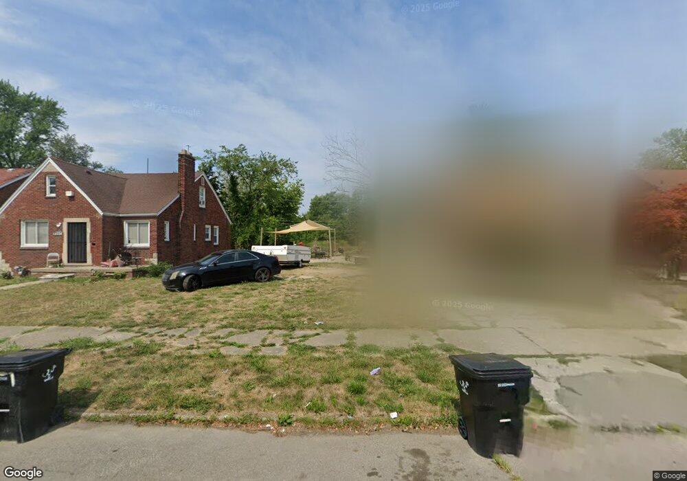
10005 Somerset Ave Detroit, MI 48224
Outer Drive-Hayes NeighborhoodEstimated Value: $21,460 - $115,000
3
Beds
1
Bath
1,298
Sq Ft
$49/Sq Ft
Est. Value
About This Home
This home is located at 10005 Somerset Ave, Detroit, MI 48224 and is currently estimated at $64,153, approximately $49 per square foot. 10005 Somerset Ave is a home located in Wayne County with nearby schools including Wayne Elementary School, Edward 'Duke' Ellington Conservatory of Music and Art, and Charles L. Spain Elementary-Middle School.
Ownership History
Date
Name
Owned For
Owner Type
Purchase Details
Closed on
Jan 6, 2015
Sold by
Treasurer Of The Charter County Of Wayne
Bought by
Detroit Land Bank Authority
Current Estimated Value
Purchase Details
Closed on
Mar 16, 2010
Sold by
Donovan Shaun
Bought by
Underwood Signora J
Purchase Details
Closed on
Oct 2, 2009
Sold by
Wells Fargo Bank Na
Bought by
The Secretary Of Housing & Urban Develop
Purchase Details
Closed on
Apr 1, 2009
Sold by
Green Edna D
Bought by
Wells Fargo Bank Na
Purchase Details
Closed on
Nov 14, 2003
Sold by
Wilder Tommie and Wilder Felecia V
Bought by
Green Edna
Create a Home Valuation Report for This Property
The Home Valuation Report is an in-depth analysis detailing your home's value as well as a comparison with similar homes in the area
Home Values in the Area
Average Home Value in this Area
Purchase History
| Date | Buyer | Sale Price | Title Company |
|---|---|---|---|
| Detroit Land Bank Authority | -- | None Available | |
| Underwood Signora J | $9,505 | None Available | |
| The Secretary Of Housing & Urban Develop | -- | None Available | |
| Wells Fargo Bank Na | $92,963 | None Available | |
| Green Edna | $95,500 | -- |
Source: Public Records
Tax History Compared to Growth
Tax History
| Year | Tax Paid | Tax Assessment Tax Assessment Total Assessment is a certain percentage of the fair market value that is determined by local assessors to be the total taxable value of land and additions on the property. | Land | Improvement |
|---|---|---|---|---|
| 2025 | -- | $0 | $0 | $0 |
| 2024 | -- | $0 | $0 | $0 |
| 2023 | $0 | $0 | $0 | $0 |
| 2022 | -- | $0 | $0 | $0 |
| 2021 | $0 | $0 | $0 | $0 |
| 2020 | $2,488 | $0 | $0 | $0 |
| 2019 | $2,488 | $0 | $0 | $0 |
| 2018 | $0 | $0 | $0 | $0 |
| 2017 | $130 | $0 | $0 | $0 |
| 2016 | $130 | $1,300 | $0 | $0 |
| 2015 | $130 | $1,300 | $0 | $0 |
| 2013 | $2,295 | $22,954 | $0 | $0 |
| 2010 | -- | $33,653 | $1,301 | $32,352 |
Source: Public Records
Map
Nearby Homes
- 9899 Balfour Rd
- 9910 Somerset Ave
- 10326 Beaconsfield St
- 10345 Greensboro St
- 10029 Balfour Rd
- 10366 Roxbury St
- 10336 Roxbury St
- 10172 Somerset Ave
- 10415 Roxbury St
- 9803 Nottingham Rd
- 10303 Roxbury St
- 9316 Mckinney St
- 9300 Mckinney St
- 10468 Lakepointe St
- 10521 Roxbury St
- 10420 Lakepointe St
- 9265 Bedford St
- 10346 Lakepointe St
- 9205 Mckinney St
- 9833 Berkshire St
- 10015 Somerset Ave
- 9997 Somerset Ave
- 10023 Somerset Ave
- 9989 Somerset Ave
- 10096 Nottingham Rd
- 10031 Somerset Ave
- 9981 Somerset Ave
- 9975 Somerset Ave
- 10010 Somerset Ave
- 10080 Nottingham Rd
- 10108 Nottingham Rd
- 10100 Nottingham Rd
- 10016 Somerset Ave
- 10037 Somerset Ave
- 10114 Nottingham Rd
- 10086 Nottingham Rd
- 10000 Somerset Ave
- 10076 Nottingham Rd
- 9996 Somerset Ave
- 10122 Nottingham Rd