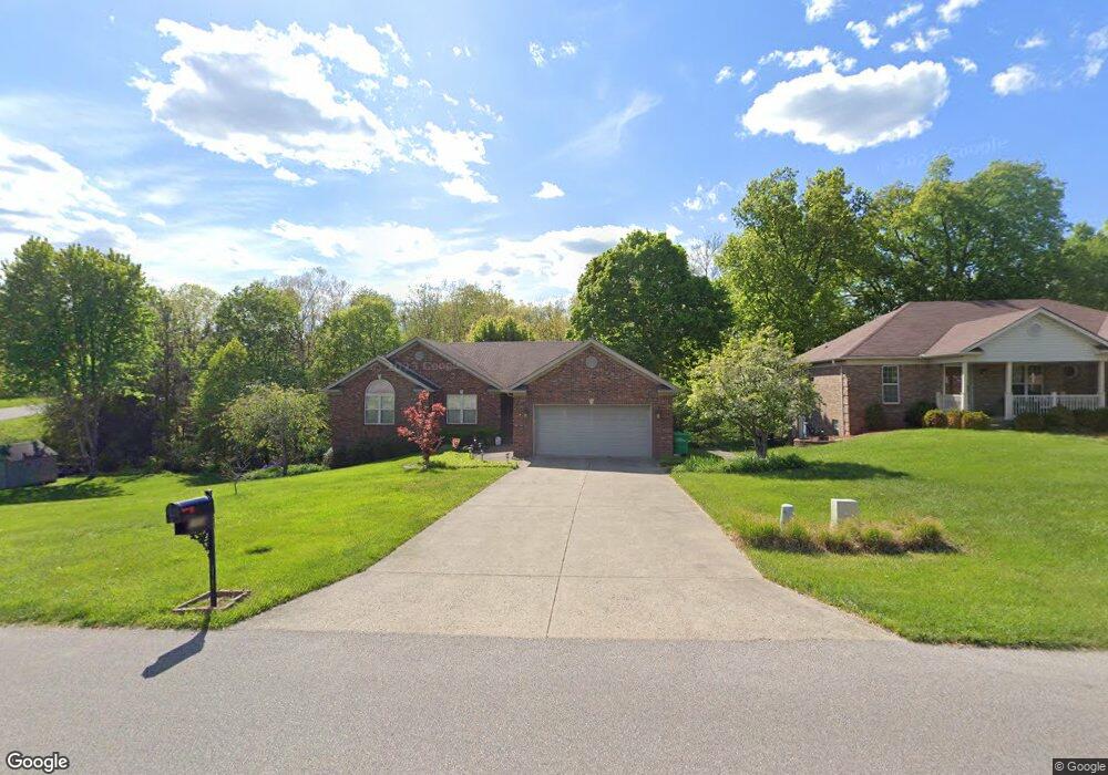
1001 Brookstone Ct Georgetown, IN 47122
Estimated Value: $396,000 - $443,000
5
Beds
3
Baths
1,628
Sq Ft
$259/Sq Ft
Est. Value
About This Home
This home is located at 1001 Brookstone Ct, Georgetown, IN 47122 and is currently estimated at $421,202, approximately $258 per square foot. 1001 Brookstone Ct is a home located in Floyd County with nearby schools including Georgetown Elementary School, Highland Hills Middle School, and Floyd Central High School.
Ownership History
Date
Name
Owned For
Owner Type
Purchase Details
Closed on
May 31, 2006
Sold by
Moore Brian K and Moore Kelly M
Bought by
Lauder David F and Lauder Kristina L
Current Estimated Value
Home Financials for this Owner
Home Financials are based on the most recent Mortgage that was taken out on this home.
Original Mortgage
$167,920
Outstanding Balance
$99,330
Interest Rate
6.68%
Mortgage Type
New Conventional
Estimated Equity
$321,872
Create a Home Valuation Report for This Property
The Home Valuation Report is an in-depth analysis detailing your home's value as well as a comparison with similar homes in the area
Home Values in the Area
Average Home Value in this Area
Purchase History
| Date | Buyer | Sale Price | Title Company |
|---|---|---|---|
| Lauder David F | -- | Us Title |
Source: Public Records
Mortgage History
| Date | Status | Borrower | Loan Amount |
|---|---|---|---|
| Open | Lauder David F | $167,920 |
Source: Public Records
Tax History Compared to Growth
Tax History
| Year | Tax Paid | Tax Assessment Tax Assessment Total Assessment is a certain percentage of the fair market value that is determined by local assessors to be the total taxable value of land and additions on the property. | Land | Improvement |
|---|---|---|---|---|
| 2024 | $3,926 | $400,300 | $53,700 | $346,600 |
| 2023 | $3,383 | $360,600 | $53,700 | $306,900 |
| 2022 | $3,231 | $324,700 | $53,700 | $271,000 |
| 2021 | $2,962 | $301,700 | $53,700 | $248,000 |
| 2020 | $2,914 | $304,800 | $53,700 | $251,100 |
| 2019 | $2,720 | $293,900 | $53,700 | $240,200 |
| 2018 | $2,555 | $277,000 | $53,700 | $223,300 |
| 2017 | $2,422 | $252,100 | $53,700 | $198,400 |
| 2016 | $2,035 | $231,500 | $53,700 | $177,800 |
| 2014 | $2,238 | $223,200 | $53,800 | $169,400 |
| 2013 | -- | $219,500 | $53,700 | $165,800 |
Source: Public Records
Map
Nearby Homes
- 3006 Zachary Trail
- 1027 Brookstone Ct
- 1026 Brookstone Ct
- 1034 Brookstone Ct
- 1036 Brookstone Ct
- 7014 Dylan Cir
- 1236 Walts Rd
- 1232 Walts Rd
- 1004 Carter Dr
- 1115 Marci Ln
- 8058 Hudson Ln
- 8048 Hudson Ln
- Finch Bonus Plan at Knob Hill
- Haylyn 48' Plan at Knob Hill
- Model A Plan at Knob Hill
- Anniston Plan at Knob Hill
- Haylyn Plan at Knob Hill
- Maria Plan at Knob Hill
- Samantha Bonus Plan at Knob Hill
- Juliana Plan at Knob Hill
- 1003 Brookstone Ct
- 1002 Brookstone Ct
- 1005 Brookstone Ct
- 2003 Brookstone Way
- 1004 Brookstone Ct
- 1007 Brookstone Ct
- 2005 Brookstone Way
- 3000 Brookhill Ct
- 1006 Brookstone Ct
- 1009 Brookstone Ct
- 2007 Brookstone Way
- 3002 Brookhill Ct
- 1008 Brookstone Ct
- 3004 Brookhill Ct
- 2009 Brookstone Way
- 1034 Baylor Wissman Rd
- 1010 Brookstone Ct
- 3006 Brookhill Ct
- 2010 Brookstone Way
- 1013 Brookstone Ct