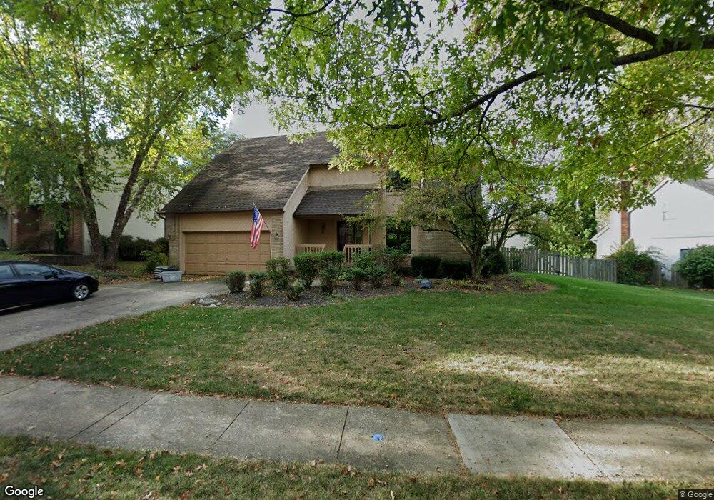
1001 Farrington Dr Westerville, OH 43081
Estimated Value: $463,121 - $560,000
4
Beds
3
Baths
2,148
Sq Ft
$235/Sq Ft
Est. Value
About This Home
This home is located at 1001 Farrington Dr, Westerville, OH 43081 and is currently estimated at $505,030, approximately $235 per square foot. 1001 Farrington Dr is a home located in Franklin County with nearby schools including Mcvay Elementary School, Walnut Springs Middle School, and Westerville-North High School.
Ownership History
Date
Name
Owned For
Owner Type
Purchase Details
Closed on
Dec 23, 2002
Sold by
Mager Robert
Bought by
Mager Robert and Mager Barbara J
Current Estimated Value
Home Financials for this Owner
Home Financials are based on the most recent Mortgage that was taken out on this home.
Original Mortgage
$141,000
Interest Rate
6.23%
Purchase Details
Closed on
Jun 24, 1986
Bought by
Mager Robert
Create a Home Valuation Report for This Property
The Home Valuation Report is an in-depth analysis detailing your home's value as well as a comparison with similar homes in the area
Home Values in the Area
Average Home Value in this Area
Purchase History
| Date | Buyer | Sale Price | Title Company |
|---|---|---|---|
| Mager Robert | -- | Chelsea Title Agency | |
| Mager Robert | $129,500 | -- |
Source: Public Records
Mortgage History
| Date | Status | Borrower | Loan Amount |
|---|---|---|---|
| Open | Mager Robert | $210,000 | |
| Closed | Mager Robert | $125,000 | |
| Closed | Mager Robert | $99,999 | |
| Closed | Mager Robert | $121,900 | |
| Closed | Mager Robert | $122,300 | |
| Closed | Mager Robert | $20,000 | |
| Closed | Mager Robert | $141,000 |
Source: Public Records
Tax History Compared to Growth
Tax History
| Year | Tax Paid | Tax Assessment Tax Assessment Total Assessment is a certain percentage of the fair market value that is determined by local assessors to be the total taxable value of land and additions on the property. | Land | Improvement |
|---|---|---|---|---|
| 2024 | $8,396 | $147,740 | $33,250 | $114,490 |
| 2023 | $8,218 | $147,735 | $33,250 | $114,485 |
| 2022 | $7,882 | $108,190 | $21,000 | $87,190 |
| 2021 | $7,948 | $108,190 | $21,000 | $87,190 |
| 2020 | $7,926 | $108,190 | $21,000 | $87,190 |
| 2019 | $7,000 | $90,200 | $17,500 | $72,700 |
| 2018 | $6,694 | $90,200 | $17,500 | $72,700 |
| 2017 | $6,811 | $90,200 | $17,500 | $72,700 |
| 2016 | $6,737 | $80,360 | $16,940 | $63,420 |
| 2015 | $6,525 | $80,360 | $16,940 | $63,420 |
| 2014 | $6,530 | $80,360 | $16,940 | $63,420 |
| 2013 | $3,106 | $76,545 | $16,135 | $60,410 |
Source: Public Records
Map
Nearby Homes
- 969 Farrington Dr
- 858 Knebworth Ct
- 613 Valley Wood Ct
- 857 E Walnut St
- 1368 Nutmeg Ct
- 1003 Autumn Meadows Dr
- 283 Apache Cir
- 539 Cherrington Rd
- 1015 Autumn Woods Dr
- 994 Autumn Lake Ct
- 192 Buckeye Ct
- 187 Bernadine Ct
- 1203 Autumn Creek Cir
- 768 Collingwood Dr
- 615 Vancouver Dr
- 430 Electric Ave
- 437 Potawatomi Dr
- 393 Sentry Ln
- 974 Timberbank Dr
- 150 Matthew Ave
- 993 Farrington Dr
- 350 Cornhill Ct
- 346 Cornhill Ct
- 312 Hartfordshire Ln
- 1017 Farrington Dr
- 329 Chertsey Ct
- 354 Cornhill Ct
- 330 Cornhill Ct
- 309 Hartfordshire Ln
- 294 Hartfordshire Ln
- 1027 Farrington Dr
- 323 Chertsey Ct
- 358 Cornhill Ct
- 326 Chertsey Ct
- 297 Hartfordshire Ln
- 286 Hartfordshire Ln
- 351 Cornhill Ct
- 357 Cornhill Ct
- 325 Cornhill Ct
- 345 Cornhill Ct