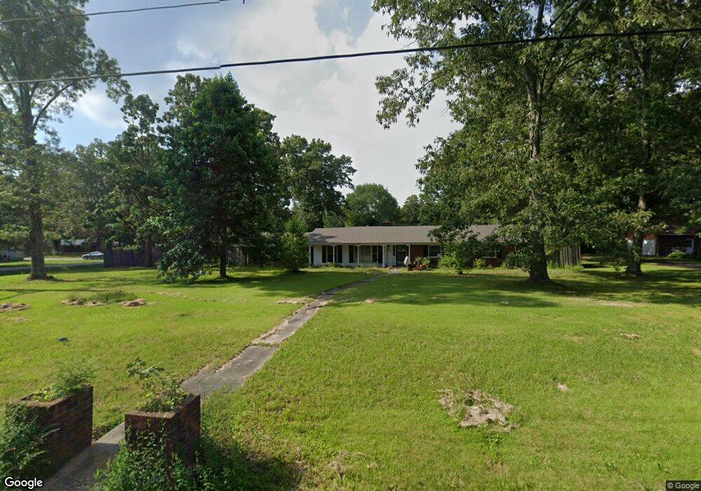
1001 Lincoln St Manchester, TN 37355
Estimated Value: $253,000 - $316,000
--
Bed
2
Baths
1,821
Sq Ft
$158/Sq Ft
Est. Value
About This Home
This home is located at 1001 Lincoln St, Manchester, TN 37355 and is currently estimated at $287,561, approximately $157 per square foot. 1001 Lincoln St is a home located in Coffee County with nearby schools including Westwood Middle School and Temple Baptist Christian School.
Ownership History
Date
Name
Owned For
Owner Type
Purchase Details
Closed on
Jul 26, 2022
Sold by
Alan Welch Bryan
Bought by
Aguilera Aaron and Aguilera Ericka
Current Estimated Value
Purchase Details
Closed on
Oct 26, 2015
Sold by
Welch Blake Michael
Bought by
Welch Bryan Alan and Welch Brett Sheldon
Purchase Details
Closed on
Jul 29, 2015
Sold by
Welch Blake Michael
Bought by
Welch Blake Michael
Purchase Details
Closed on
Oct 24, 2002
Sold by
Welch Barbara Ann
Bought by
Welch Blake Michael
Purchase Details
Closed on
May 11, 1998
Sold by
Blevins Barbara Kennedy
Bought by
Mansfield Joel and Mansfield Benda
Purchase Details
Closed on
Jan 31, 1994
Bought by
Welch Barbara Ann
Create a Home Valuation Report for This Property
The Home Valuation Report is an in-depth analysis detailing your home's value as well as a comparison with similar homes in the area
Home Values in the Area
Average Home Value in this Area
Purchase History
| Date | Buyer | Sale Price | Title Company |
|---|---|---|---|
| Aguilera Aaron | $110,000 | Bell & Alexander Title Service | |
| Welch Bryan Alan | -- | -- | |
| Welch Blake Michael | -- | -- | |
| Welch Bryan Alan | -- | -- | |
| Welch Blake Michael | -- | -- | |
| Mansfield Joel | $25,500 | -- | |
| Welch Barbara Ann | $54,000 | -- |
Source: Public Records
Tax History Compared to Growth
Tax History
| Year | Tax Paid | Tax Assessment Tax Assessment Total Assessment is a certain percentage of the fair market value that is determined by local assessors to be the total taxable value of land and additions on the property. | Land | Improvement |
|---|---|---|---|---|
| 2024 | $1,830 | $43,425 | $5,500 | $37,925 |
| 2023 | $1,830 | $43,425 | $0 | $0 |
| 2022 | $1,576 | $43,425 | $5,500 | $37,925 |
| 2021 | $1,518 | $33,150 | $3,500 | $29,650 |
| 2020 | $1,518 | $33,150 | $3,500 | $29,650 |
| 2019 | $1,518 | $33,150 | $3,500 | $29,650 |
| 2018 | $1,518 | $33,150 | $3,500 | $29,650 |
| 2017 | $1,537 | $29,300 | $3,500 | $25,800 |
| 2016 | $1,537 | $29,300 | $3,500 | $25,800 |
| 2015 | $1,537 | $29,300 | $3,500 | $25,800 |
| 2014 | $1,537 | $29,307 | $0 | $0 |
Source: Public Records
Map
Nearby Homes
- 905 Royal Trail
- 1203 Edgewood Dr
- 112 Reynard St
- 1306 Mcmahan St
- 1003 Kennedy Dr
- 142 Heritage Cir
- 422 Heritage Cir
- 355 W Doak Rd
- 1550 S Spring St
- 121 Regalwood Dr
- 0 Forrestwood Dr
- 195 Hamilton Ct
- 2674 New Tullahoma Hwy
- 23 Regalwood Dr
- 1841 Hills Chapel Rd
- Lot 51 Philips
- 1619 Hills Chapel Rd
- 1212 Woodcrest Dr
- 12 Fox Creek Ct
- 1221 Hillcrest Dr
- 254 Blanford Cir
- 314 Blanford Cir
- 138 Blanford Cir
- 1005 Lincoln St
- 1000 Royal Trail
- 1002 Royal Trail
- 921 Lincoln St
- 1900 2nd Ave
- 1000 Lincoln St
- 1002 Lincoln St
- 914 Royal Trail
- 1006 Royal Trail
- 2000 2nd Ave
- 2004 2nd Ave
- 1004 Lincoln St
- 0 2nd Ave
- 2008 2nd Ave
- 1007 Lincoln St
- 912 Royal Trail
- 1006 Lincoln St